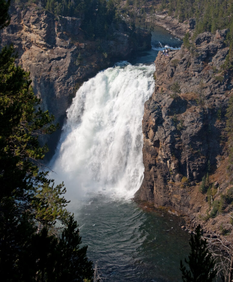
Upper Yellowstone Falls is a 109-foot plunge waterfall on the Yellowstone River in Yellowstone National Park, Wyoming, upstream of the Lower Falls. It marks the start of the Grand Canyon of the Yellowstone, and a short paved walk leads to a platform at its brink.
The falls
The river drops over a sheer, vertical ledge about 90 feet wide. The height is 109 feet. Because the river is squeezed hard over the lip, the water lands nearly 100 feet out from the crest in a large basin. The falls run all year: the volume is about 63,500 gallons per second at spring peak runoff and about 5,000 in autumn. A marker at the brink notes that the rock here belongs to the Canyon Rhyolite, a lava flow about 484,000 years old.
Getting there
There are two viewing areas. The Brink of the Upper Falls sits just off the Grand Loop Road south of Canyon Junction, between North and South Rim drives; a paved walk of about 0.3 mile with roughly 39 feet of gain leads from the parking lot, with stairs down to the main platform at the lip. On the other side of the canyon, the Upper Falls Viewpoints are reached from South Rim Drive by taking the first left into their parking area.
Yellowstone admission is $35 per vehicle for seven days, plus $100 per person for non-US residents aged 16 and older unless they hold an Annual or America the Beautiful Pass.
When to go
Flow is highest with spring runoff and much lower by autumn, though the river never stops. On sunny days a rainbow can form in the spray: Photo Journeys saw one from the South Rim on an early June morning, and World of Waterfalls photographed a double rainbow from the upstream South Rim overlook around 10 a.m. in early August.
On site
An accessible route runs from the parking lot to viewpoints of the Upper Falls; the stairs lead to the platform right at the brink, while a gentler path reaches an alternative viewpoint. Signs ask visitors to stay on the trails and overlooks. Pets are not allowed on Yellowstone's trails and boardwalks. Park rules require staying at least 100 yards from bears and wolves and 25 yards from other wildlife.
History and name
The marker at the brink reproduces prospector Bart Henderson's 1867 account of standing at the edge of the falls.
Nearby
Crystal Falls, on Cascade Creek, is about 0.3 mile away, Lower Yellowstone Falls, downstream on the same river, about 0.4 mile and Red Rock Cascade about 0.8 mile.
Distances are straight-line.
Sources
- worldwaterfalldatabase.com
- home.nps.gov
- nps.gov
- home.nps.gov
- nps.gov
- hmdb.org
- justinfague.com
- photojourneys.ca
- world-of-waterfalls.com