Waterfalls in Missouri
11 waterfalls in Missouri across 11 counties, from the USGS dataset; 9 with a measured height. The tallest is Mina Sauk Falls at 95 ft. All US waterfalls.
State: Missouri 47
- Alabama 97
- Arizona 66
- Arkansas 280
- California 1,039
- Colorado 345
- Connecticut 79
- Florida 3
- Georgia 298
- Idaho 249
- Illinois 20
- Indiana 24
- Iowa 8
- Kansas 24
- Kentucky 65
- Louisiana 6
- Maine 175
- Maryland 13
- Massachusetts 37
- Michigan 294
- Minnesota 43
- Mississippi 8
- Missouri 11
- Montana 252
- Nebraska 14
- Nevada 25
- New Hampshire 264
- New Jersey 5
- New Mexico 20
- New York 879
- North Carolina 495
- North Dakota 1
- Ohio 26
- Oklahoma 30
- Oregon 1,342
- Pennsylvania 274
- Rhode Island 5
- South Carolina 22
- South Dakota 10
- Tennessee 427
- Texas 71
- Utah 76
- Vermont 229
- Virginia 127
- Washington 2,596
- West Virginia 13
- Wisconsin 83
- Wyoming 267
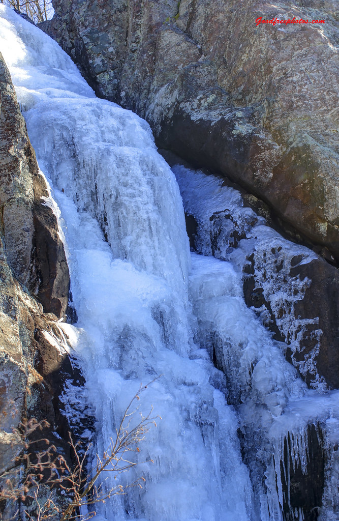
- 3 drops
- On tributary of Taum Sauk Creek
- 7 mi from Ironton

- On Hickory Creek
- 9 mi from Farmington
- On Rocky Creek
- 9 mi from Winona
- On Falling Springs
- 10 mi from Winona
- On Falls Branch
- 7 mi from Perryville
- On East Fork Black River
- 12 mi from Ironton
- On Williams Creek
- 4 mi from Excelsior Springs
- On Little Finley Creek
- 4 mi from Seymour
- 2 drops
- On Platte River
- 8 mi from Savannah
- On Indian Creek
- 2 mi from Leawood
Missouri's waterfalls, from volcanic mountains to a Joplin chert ledge
The St. Francois Mountains in the southeast are Precambrian volcanic rock, older than the Appalachians, and they produce Missouri's two best-known waterfalls; elsewhere, spring-fed creeks over dolomite and chert account for the rest of the state's 11 named falls, one to a county from the Ozarks to the Kansas City suburbs.
Where the waterfalls are
Iron County and Reynolds County, both in the St. Francois Mountains, hold Mina Sauk Falls and Johnson's Shut-ins. To the southwest, Newton County has Grand Falls on Shoal Creek in Joplin. Shannon, Oregon, Ste. Genevieve, Perry and Webster counties each add one more Ozark waterfall, and Andrew, Clay and Jackson counties, in the state's northwest corner and Kansas City area, hold the rest.
Waterfalls worth the trip
- Mina Sauk Falls, 95 feet, is Missouri's tallest waterfall, on a 2.9-mile loop trail in Taum Sauk Mountain State Park that climbs past the state's highest point; the park's own trail sheet still describes it as dropping 132 feet over a series of ledges. It runs only in wet weather and thins to a trickle otherwise.
- Johnsons Shut-ins, 12 feet on the East Fork Black River, cuts chutes and potholes through rhyolite rock in Johnson's Shut-Ins State Park.
- Shoal Creek Falls, better known as Grand Falls, drops 8 feet over a 163-foot-wide chert ledge in Joplin, a short walk from Wildcat Park; it has no visitor facilities, and swimming is allowed.
Access
Missouri state parks, including Taum Sauk Mountain and Johnson's Shut-ins, charge no entrance or parking fee and are open sunrise to sunset year-round. Grand Falls, likewise free to visit, has no restrooms or other facilities on site.
Safety
A reservoir above Johnson's Shut-ins failed on December 14, 2005, sending a flood through the park that destroyed the campground; only the superintendent's family was on site, and they survived with injuries. The park reopened for limited day use in 2006, regained full water access in 2009, and got a new campground in 2010. At Mina Sauk Falls, the trail runs along the top of the drop past bluffs, slippery rock and grades over 10 percent, with water crossings that can be unbridged after rain.
Waterfalls in Missouri on the map
Numbers show how many sit in that area; zoom in or click to split them, click a marker for details.
Tallest waterfalls in Missouri
- Mina Sauk Falls95 ftIron County
- Hickory Canyon Falls40 ftSte. Genevieve County
- Rocky Falls30 ftShannon County
- Falling Springs Falls20 ftOregon County
- Falls Branch Falls12 ftPerry County
- Johnsons Shut-ins12 ftReynolds County
- Shoal Creek Falls8 ftNewton County
- Tryst Falls6 ftClay County
- Finley Falls4 ftWebster County
Waterfalls by county
Missouri has named waterfalls in 11 counties. The most are in Oregon County (1), Perry County (1), Webster County (1), Ste. Genevieve County (1), Reynolds County (1), Iron County (1). Every county has its own page with a map and the tallest falls:
- Andrew County 1
- Clay County 1
- Iron County 1
- Jackson County 1
- Newton County 1
- Oregon County 1
- Perry County 1
- Reynolds County 1
- Shannon County 1
- Ste. Genevieve County 1
- Webster County 1
Types of waterfalls in Missouri
block (3), horsetail (2), cascade (2), tiered (2), plunge (1). What the types mean is explained in the guide to waterfall types.
About the data
Of the 11 waterfalls in Missouri, 9 have a measured height, 7 have coordinates verified against aerial imagery and 1 have photos. Heights are the total drop as recorded by the source; falls without a measurement are listed without one. Every page has the stream, the nearest town and distance, a map with directions and a review form for photos and notes.