Waterfalls in Alabama
97 waterfalls in Alabama across 24 counties, from the USGS dataset; 88 with a measured height. The tallest is Thompson Falls at 150 ft. All US waterfalls.
State: Alabama 47
- Alabama 97
- Arizona 66
- Arkansas 280
- California 1,039
- Colorado 345
- Connecticut 79
- Florida 3
- Georgia 298
- Idaho 249
- Illinois 20
- Indiana 24
- Iowa 8
- Kansas 24
- Kentucky 65
- Louisiana 6
- Maine 175
- Maryland 13
- Massachusetts 37
- Michigan 294
- Minnesota 43
- Mississippi 8
- Missouri 11
- Montana 252
- Nebraska 14
- Nevada 25
- New Hampshire 264
- New Jersey 5
- New Mexico 20
- New York 879
- North Carolina 495
- North Dakota 1
- Ohio 26
- Oklahoma 30
- Oregon 1,342
- Pennsylvania 274
- Rhode Island 5
- South Carolina 22
- South Dakota 10
- Tennessee 427
- Texas 71
- Utah 76
- Vermont 229
- Virginia 127
- Washington 2,596
- West Virginia 13
- Wisconsin 83
- Wyoming 267
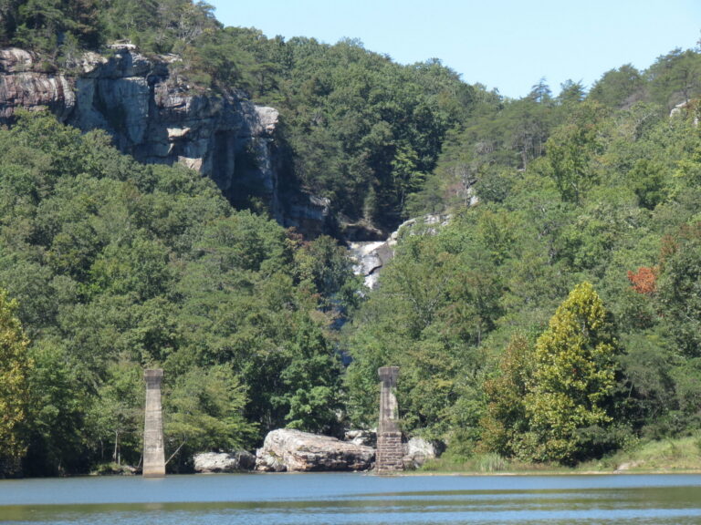
- Tallest drop 85 ft · 2 drops
- On Yellow Creek
- 4 mi from Leesburg
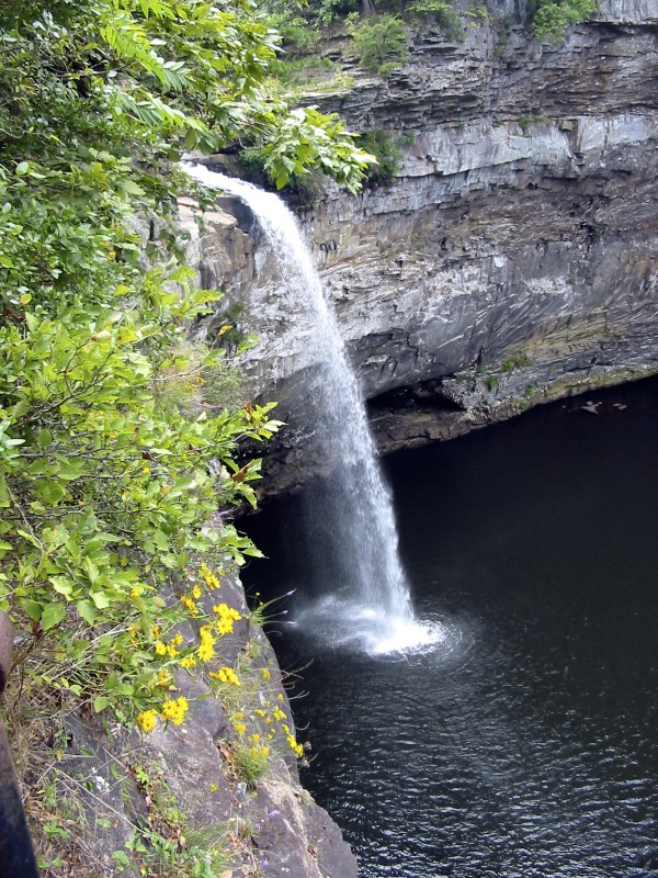
- Tallest drop 71 ft · 2 drops
- On West Fork Little River
- 10 mi from Fort Payne
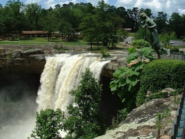
- On Black Creek
- 2 mi from Gadsden
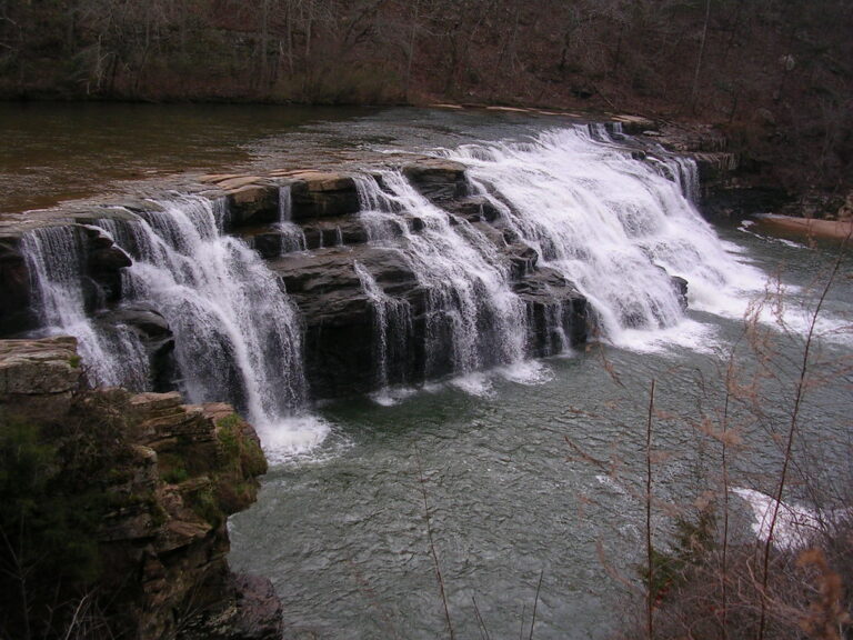
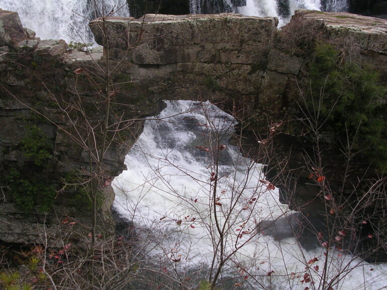
- On Town Creek
- 9 mi from Crossville
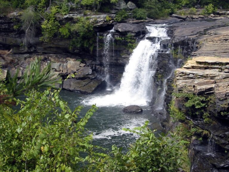
- On Little River
- 6 mi from Fort Payne
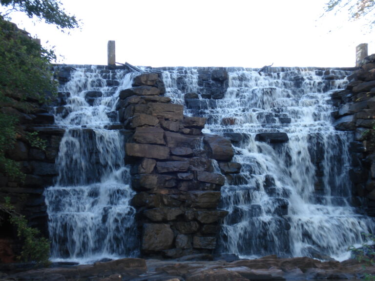
- On Chewacla Creek
- 4 mi from Auburn
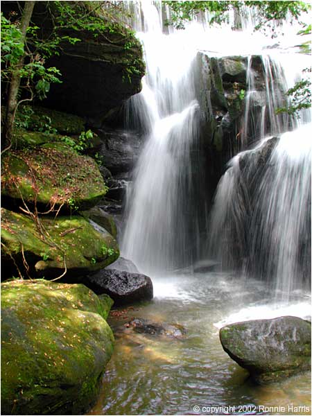
- On Turkeyfoot Creek
- 10 mi from Double Springs

- 2 drops
- On Mink Creek
- 4 mi from Arab
- On Piney Branch
- 9 mi from New Hope
- On Eddings Creek
- 6 mi from Montevallo
- On Miller Creek
- 8 mi from Trenton
- On Ricketts Gap Creek
- 7 mi from New Hope
- On Beech Creek
- 5 mi from Arab
- On Brindley Creek
- 5 mi from Cullman
- 2 drops
- On White Creek
- 11 mi from Haleyville
- On trib of Thompson Creek
- 12 mi from Haleyville
Alabama's waterfalls, from Little River Canyon to the Sipsey Wilderness
Where the Cumberland Plateau reaches its southern end in northeastern Alabama, sandstone caprock over softer shale drops Little River and its side creeks off sheer canyon walls, producing the state's tallest falls. A separate arm of the plateau, cut by the Sipsey Fork in the northwest, holds far more falls but shorter ones, and the Talladega Mountains and scattered Piedmont and coastal-plain shoals fill out the rest. In all, 97 named waterfalls are recorded across 24 counties.
Where the waterfalls are
DeKalb County holds 14 listings around Fort Payne and Mentone, where Little River Canyon National Preserve and DeSoto State Park sit on Lookout Mountain. Cherokee County and Etowah County add falls along the same plateau edge, from Little River Falls to Noccalula Falls in Gadsden, while Marshall County and Jackson County hold smaller Sand Mountain drops toward Lake Guntersville.
Northwest, Winston County and Lawrence County together hold 27 listings, the state's densest cluster, inside the Bankhead National Forest's Sipsey Wilderness. Franklin County, Marion County, Cullman County, Morgan County and Blount County surround that cluster, including the privately preserved Dismals Canyon in Franklin County.
South and east, Clay County and Talladega County hold falls in the Talladega National Forest around Cheaha Mountain, the state's highest point. Piedmont shoals continue through Shelby County, Lee County, Tuscaloosa County, Randolph County, Tallapoosa County and Jefferson County, with isolated coastal-plain drops in Bullock County, Covington County, Houston County and Mobile County.
Waterfalls worth the trip
- Graces High Falls, 133 feet, is seen from a platform on the Little River Canyon Rim Parkway; it runs only after rain and can dry up between storms.
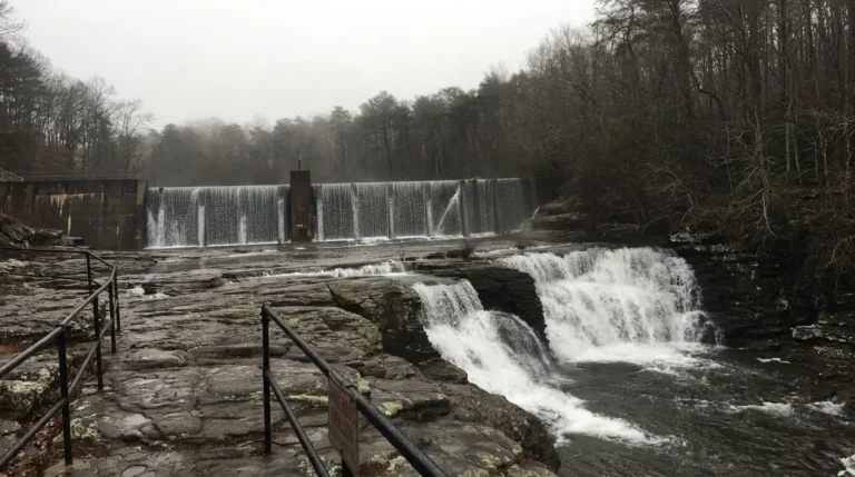
- De Soto Falls, 88 feet on the West Fork Little River (Wikipedia and the park's own map give 104 to 107), drops beside a former hydroelectric dam near Mentone, down about 50 concrete steps to a paved overlook.
- Little River Falls, 30 feet at the head of Little River Canyon, is a short boardwalk from a 100-car lot off Highway 35, free to visit.
- Noccalula Falls, 79 feet (park materials still say 90), drops into a Black Creek gorge in a Gadsden city park; a paid trail leads behind the falling water.
- Yellow Creek Falls, 95 feet in two tiers, is reached only by paddling about 0.75 mile up Weiss Lake's Yellow Creek arm, then a short unmarked path across private land; follow posted rules.
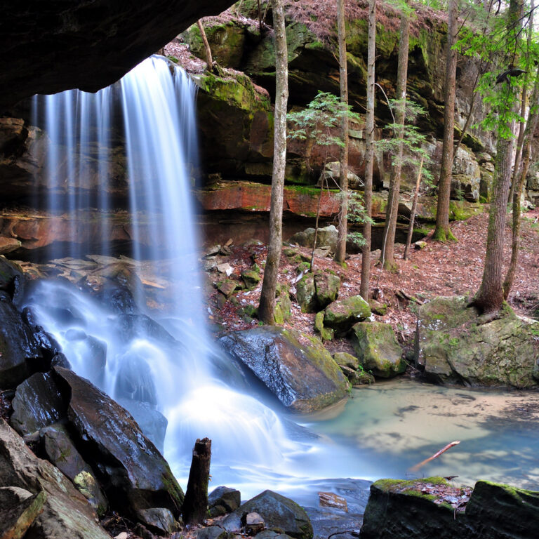
- Turkeyfoot Falls, 20 feet, sits in the Sipsey Wilderness, a 1.2-mile out-and-back where a washed-out creek crossing makes footing uncertain.
- High Falls, 50 feet in two tiered steps, drops in the Talladega National Forest near Cheaha State Park, a half-mile out-and-back with wood-and-steel stairs.
- Chewacla Falls, 20 feet, is a short, steep walk down the Deer Rub Trail's gneiss boulders near Auburn.
When to go
Winter and early spring bring the strongest flow across the plateau and Bankhead forest falls; De Soto Falls, Noccalula Falls and Turkeyfoot Falls all run lower by summer and fall. Weekend parking at Little River Falls often fills by late morning.
Fees and access
Little River Canyon National Preserve charges no fee at Little River Falls or the Graces High Falls overlook, though its separate Canyon Mouth Park site charges $15 in 2026. De Soto Falls charges $5 per vehicle in 2026, with a $50 local annual pass good only at that falls area. Noccalula Falls Park in Gadsden charges $10 for adults and $8 for children and seniors through October 31, 2026, and Chewacla State Park charges $5 for ages 12 to 61 and $3 for ages 4 to 11 and 62 and over. Rainbow Falls, inside privately owned Dismals Canyon, charges $20 on weekdays and $26 on weekends in its fall 2026 season, by registration only.
Safety
A 40-year-old man drowned at De Soto Falls after jumping from the falls on Memorial Day 2019, despite posted barriers and warning signs. An 18-year-old drowned after being swept over Little River Falls while floating upstream in June 2020; rangers ask visitors to stay 50 feet back from the edge, since rain can change the current quickly. A man suffered a head injury falling at Yellow Creek Falls in 2021 and had to be carried out to an ambulance. At the Talladega National Forest's High Falls, the creek crossing below the drop can run too swift after heavy rain, above a steep, slippery ravine.
Waterfalls in Alabama on the map
Numbers show how many sit in that area; zoom in or click to split them, click a marker for details.
Tallest waterfalls in Alabama
- Thompson Falls150 ftMarshall County
- Graces High Falls133 ftDeKalb County
- Griffin Falls115 ftDeKalb County
- Piney Branch Falls100 ftMarshall County
- Yellow Creek Falls95 ftCherokee County
- De Soto Falls88 ftDeKalb County
- Noccalula Falls79 ftEtowah County
- Falling Rock Falls75 ftShelby County
- Larkwood Falls75 ftCullman County
- Falls Branch Falls65 ftDeKalb County
Waterfalls by county
Alabama has named waterfalls in 24 counties. The most are in Winston County (15), DeKalb County (14), Lawrence County (12), Marshall County (7), Cherokee County (5), Clay County (5). Every county has its own page with a map and the tallest falls:
- Blount County 3
- Bullock County 1
- Cherokee County 5
- Clay County 5
- Covington County 1
- Cullman County 2
- DeKalb County 14
- Etowah County 1
- Franklin County 3
- Houston County 1
- Jackson County 2
- Jefferson County 1
- Lawrence County 12
- Lee County 3
- Marion County 1
- Marshall County 7
- Mobile County 1
- Morgan County 4
- Randolph County 2
- Shelby County 5
- Talladega County 4
- Tallapoosa County 2
- Tuscaloosa County 2
- Winston County 15
Types of waterfalls in Alabama
dam (2), historical (2). What the types mean is explained in the guide to waterfall types.
About the data
Of the 97 waterfalls in Alabama, 88 have a measured height, 24 have coordinates verified against aerial imagery and 11 have photos. Heights are the total drop as recorded by the source; falls without a measurement are listed without one. Every page has the stream, the nearest town and distance, a map with directions and a review form for photos and notes.
Find waterfalls near me · All US waterfalls
Sources
- en.wikipedia.org
- en.wikipedia.org
- nps.gov
- nps.gov
- nps.gov
- worldwaterfalldatabase.com
- alapark.com
- ajc.com
- worldwaterfalldatabase.com
- noccalulafallspark.com
- worldwaterfalldatabase.com
- weisradio.com
- worldwaterfalldatabase.com
- en.wikipedia.org
- en.wikipedia.org
- worldwaterfalldatabase.com
- travelawaits.com
- worldwaterfalldatabase.com
- alapark.com
- dismalscanyon.com
- en.wikipedia.org