Waterfalls in Arizona
66 waterfalls in Arizona across 12 counties, from the USGS dataset; 35 with a measured height. The tallest is Cheyava Falls at 800 ft. All US waterfalls.
State: Arizona 47
- Alabama 97
- Arizona 66
- Arkansas 280
- California 1,039
- Colorado 345
- Connecticut 79
- Florida 3
- Georgia 298
- Idaho 249
- Illinois 20
- Indiana 24
- Iowa 8
- Kansas 24
- Kentucky 65
- Louisiana 6
- Maine 175
- Maryland 13
- Massachusetts 37
- Michigan 294
- Minnesota 43
- Mississippi 8
- Missouri 11
- Montana 252
- Nebraska 14
- Nevada 25
- New Hampshire 264
- New Jersey 5
- New Mexico 20
- New York 879
- North Carolina 495
- North Dakota 1
- Ohio 26
- Oklahoma 30
- Oregon 1,342
- Pennsylvania 274
- Rhode Island 5
- South Carolina 22
- South Dakota 10
- Tennessee 427
- Texas 71
- Utah 76
- Vermont 229
- Virginia 127
- Washington 2,596
- West Virginia 13
- Wisconsin 83
- Wyoming 267
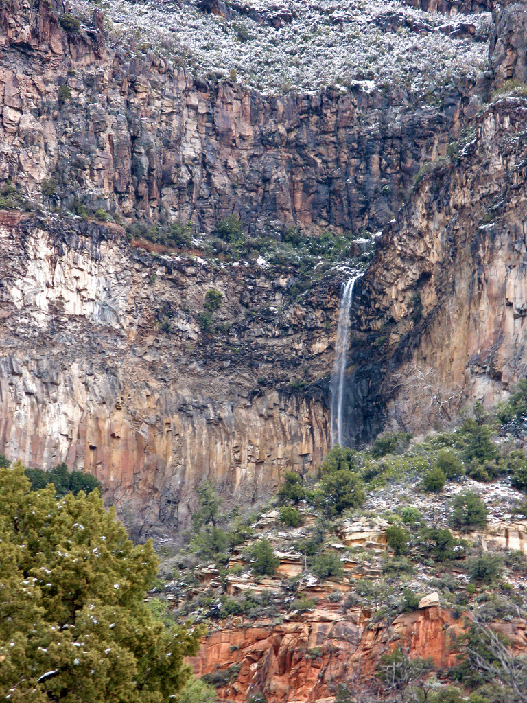
- Tallest drop 280 ft
- 5 mi from Sedona
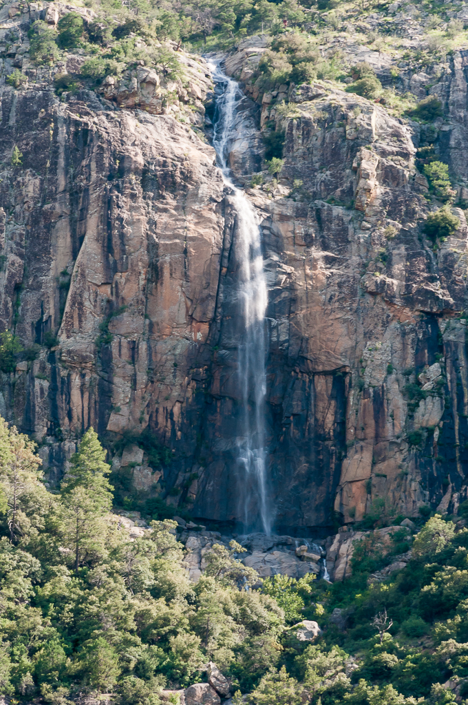
- On tributary of Carr Creek
- 4 mi from Sierra Vista Southeast
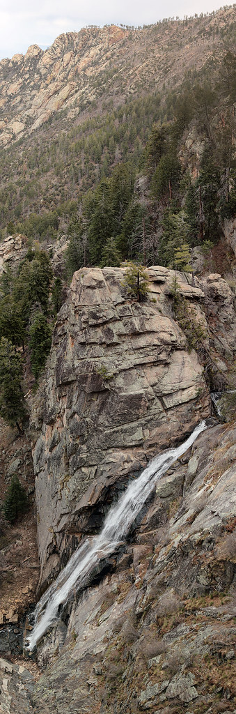
- 2 drops
- On Ash Creek
- 11 mi from Swift Trail Junction

- Tallest drop 110 ft · 2 drops
- On Little Colorado River
- 30 mi from Flagstaff
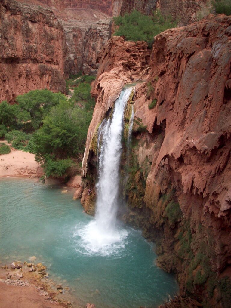
- On Havasu Creek
- 34 mi from Grand Canyon Village
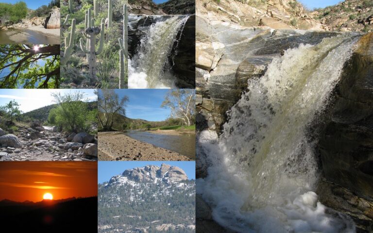
- On Tanque Verde Creek
- 5 mi from Tanque Verde
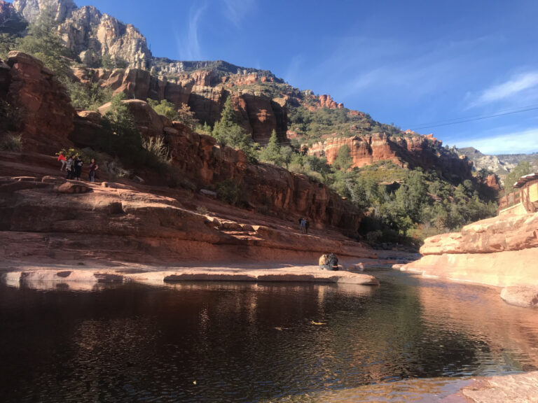
- On Oak Creek
- 5 mi from Sedona
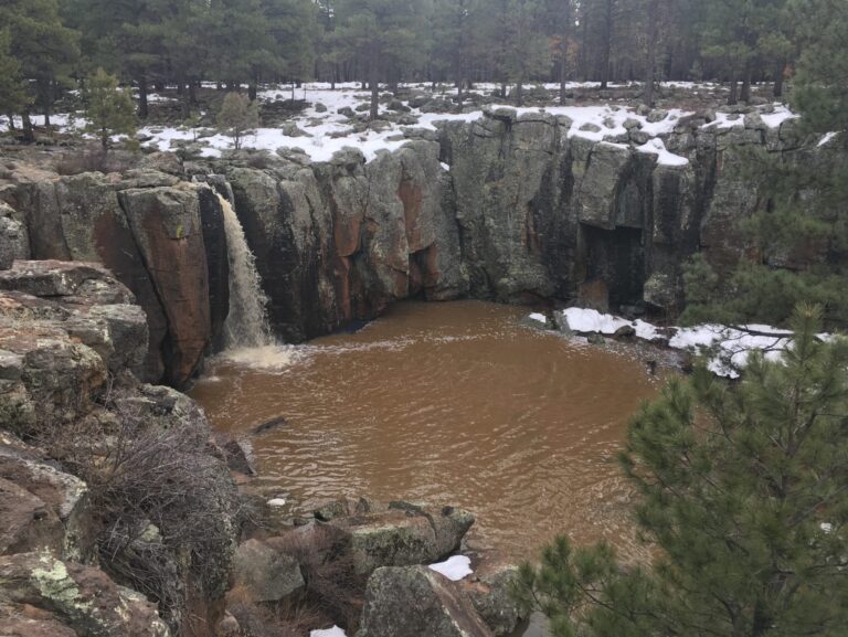
- Tallest drop 6 ft · 2 drops
- 3 mi from Mountainaire
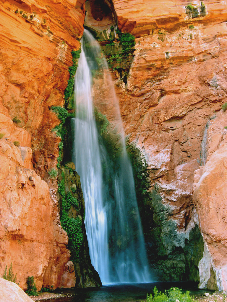
- 2 drops
- On Deer Creek
- 31 mi from Grand Canyon Village

- Tallest drop 245 ft · 4 drops
- 11 mi from Grand Canyon
- Tallest drop 320 ft · 2 drops
- 3 mi from Sedona
- 7 drops
- On Bear Creek
- 6 mi from Tanque Verde
- On tributary of Carr Creek
- 4 mi from Sierra Vista Southeast
- On Havasu Creek
- 34 mi from Grand Canyon Village
- On Reevis Creek
- 17 mi from Superior
- On Workman Creek
- 21 mi from Tonto Basin
- 34 mi from LeChee
The Grand Canyon, the Rim and the reservations — Arizona's waterfalls
Water works through three landscapes here: the mile-deep layers of the Grand Canyon, the travertine and basalt of the Mogollon Rim's edge, and the granite "sky island" ranges off the southern desert floor. Sixty-six named falls are recorded, and nearly half sit in Coconino County, home to the Grand Canyon, the Havasupai Reservation and the Navajo Nation's stretch of the Little Colorado.
Where the waterfalls are
The Grand Canyon and its side canyons hold most of Coconino County's listings: river-corridor falls reachable only by permitted boat or backcountry hike, the Havasu Creek drainage on the Havasupai Reservation, the lava-dammed Little Colorado on the Navajo Nation, and Oak Creek Canyon near Sedona. On the Rim, Gila County has a state park built around a travertine natural bridge, a fall in the Sierra Ancha, and another on the Fort Apache Reservation.
Farther south, desert ranges carry the rest: the Santa Catalina Mountains in Pima County, the Huachuca Mountains in Cochise County, and the Pinaleño Mountains in Graham County, home to Ash Creek Falls. Maricopa and Pinal counties hold the Superstition Wilderness's Reevis Falls; Apache, Mohave, Yavapai and Yuma counties scatter the rest across reservation land, the canyon's west end and the low desert.
Waterfalls worth the trip
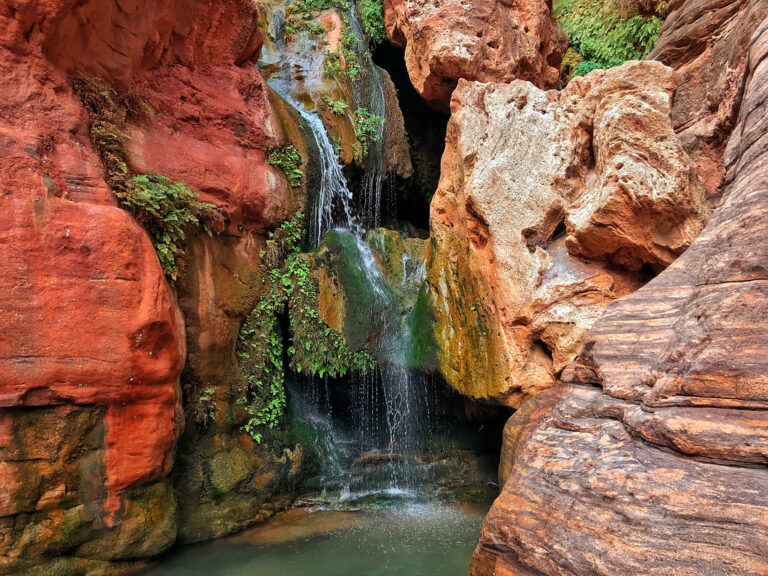
- Havasu Falls, 100 feet on travertine-blue Havasu Creek, requires an overnight tribal reservation on the Havasupai Reservation.
- Grand Falls, 185 feet on the Little Colorado River, formed when lava from Merriam Crater dammed the channel about 20,000 years ago; the water runs chocolate-brown, and the Navajo Nation's Leupp Chapter has closed the site since 2023.
- Cheyava Falls, Arizona's tallest documented waterfall at 800 feet, drops in two roughly 400-foot cascades in trail-less Grand Canyon backcountry; its Hopi name means "intermittent waters," and it needs a wet winter to flow.
- Tanque Verde Falls, 70 feet in the Santa Catalina foothills, is reached by a 2-mile Rim Loop off Redington Road or a steeper half-mile trail to the creek.
- Carr Falls, 370 feet and ephemeral, is seen from an overlook at the end of Carr Canyon Road: 1.4 paved miles then 6.3 miles of steep dirt, high clearance recommended.
- Slide Rock, a 14-foot natural waterslide on Oak Creek, sits in a state park reached by vehicle only; no walk-in or bicycle entry.
- Tonto Natural Bridge Falls pours over a travertine bridge billed as the largest of its kind in the world; the trails down to it are under half a mile but steep.
- Cibecue Falls, 80 feet on Cibecue Creek on the Fort Apache Indian Reservation, needs a one-day White Mountain Apache access permit from every visitor.
When to go
Havasu Creek runs close to 70 degrees year-round, but the tribe flags monsoon risk from June through September, and the park service closes the trail into the canyon above 115 degrees. Grand Falls peaks in March and April on snowmelt and thins by summer; Cheyava Falls needs a wet winter to flow at all, and Carr Falls runs only after rain.
Permits, fees and closures
Grand Canyon National Park charges $35 a vehicle, with no timed-entry reservation in 2026. A backcountry permit costs $10 plus $15 per person per night, and the noncommercial river permit needed to reach canyon falls by boat runs $110 per participant. Havasupai Reservation 2026 pricing runs $455 per person for three nights of camping or $2,277 per lodge room, plus $400 for a round-trip pack mule; there is no day-hiking option. Grand Falls allows no visitors under the Leupp Chapter's closure, except other tribal members visiting for cultural preservation. Cibecue Falls needs a $45 White Mountain Apache permit per person, sold online or at the Carrizo Service Station. Slide Rock charges $30 a vehicle from May through August 21, 2026, then $20 through the following April, and Tonto Natural Bridge charges $10 for adults and $5 for ages 7 to 13.
Safety
A flash flood killed eight people at Tanque Verde Falls in July 1981, and the Forest Service warns against entering that canyon when storms threaten or jumping into its pools. On the Havasupai Reservation, jumping or diving from Havasu Falls draws a fine and a ten-year ban, and flooding forced an evacuation in September 2025. Slide Rock's swimming area has no lifeguard and bans glass containers. Remote falls such as Carr Falls and Cheyava Falls lack cell service and marked trails; approach them cautiously after rain.
Waterfalls in Arizona on the map
Numbers show how many sit in that area; zoom in or click to split them, click a marker for details.
Tallest waterfalls in Arizona
- Cheyava Falls800 ftCoconino County
- Angel Falls600 ftCoconino County
- Encinoso Falls400 ftCoconino County
- Carr Falls370 ftCochise County
- Winn Falls365 ftCochise County
- Seven Cataracts330 ftPima County
- Ash Creek Falls265 ftGraham County
- Seneca Falls250 ftGila County
- Seven Falls225 ftPima County
- Upper Carr Falls225 ftCochise County
Waterfalls by county
Arizona has named waterfalls in 12 counties. The most are in Coconino County (31), Gila County (8), Pima County (6), Apache County (3), Cochise County (3), Mohave County (3). Every county has its own page with a map and the tallest falls:
- Apache County 3
- Cochise County 3
- Coconino County 31
- Gila County 8
- Graham County 2
- Greenlee County 2
- Maricopa County 2
- Mohave County 3
- Pima County 6
- Pinal County 1
- Yavapai County 3
- Yuma County 2
Types of waterfalls in Arizona
tiered (19), horsetail (13), plunge (10), cascade (6), block (4), fan (3). What the types mean is explained in the guide to waterfall types.
About the data
Of the 66 waterfalls in Arizona, 35 have a measured height, 19 have coordinates verified against aerial imagery and 11 have photos. Heights are the total drop as recorded by the source; falls without a measurement are listed without one. Every page has the stream, the nearest town and distance, a map with directions and a review form for photos and notes.