Waterfalls in Kansas
24 waterfalls in Kansas across 16 counties, from the USGS dataset; 20 with a measured height. The tallest is Lake Kahola Falls at 35 ft. All US waterfalls.
State: Kansas 47
- Alabama 97
- Arizona 66
- Arkansas 280
- California 1,039
- Colorado 345
- Connecticut 79
- Florida 3
- Georgia 298
- Idaho 249
- Illinois 20
- Indiana 24
- Iowa 8
- Kansas 24
- Kentucky 65
- Louisiana 6
- Maine 175
- Maryland 13
- Massachusetts 37
- Michigan 294
- Minnesota 43
- Mississippi 8
- Missouri 11
- Montana 252
- Nebraska 14
- Nevada 25
- New Hampshire 264
- New Jersey 5
- New Mexico 20
- New York 879
- North Carolina 495
- North Dakota 1
- Ohio 26
- Oklahoma 30
- Oregon 1,342
- Pennsylvania 274
- Rhode Island 5
- South Carolina 22
- South Dakota 10
- Tennessee 427
- Texas 71
- Utah 76
- Vermont 229
- Virginia 127
- Washington 2,596
- West Virginia 13
- Wisconsin 83
- Wyoming 267
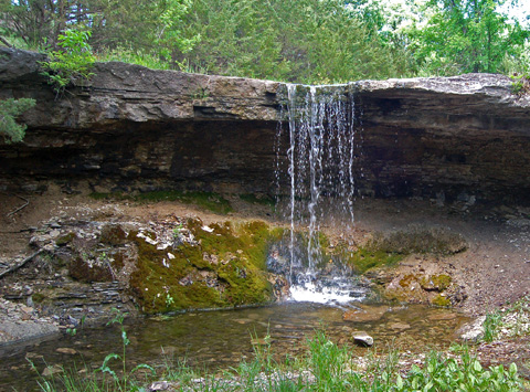

- 2 drops
- On Kahola Falls
- 10 mi from Council Grove
- On Wolfpen Creek
- 19 mi from Erie
- 2 drops
- 11 mi from Marysville
- Tallest drop 5 ft · 2 drops
- On Rock Creek
- 3 mi from Fort Scott
- On Rock Creek
- 5 mi from Sedan
- On Hitchen Creek
- 19 mi from Fredonia
- Tallest drop 2 ft · 2 drops
- On Wildcat Creek
- 18 mi from Sedan
- On Caney River
- 15 mi from Sedan
Kansas's waterfalls, small drops on the Flint Hills' limestone
Kansas has almost no relief to speak of, but where a stream crosses resistant limestone or an old dam spillway in the eastern third of the state, it still drops a few feet at a time. The state counts 24 named waterfalls, none of them topping 40 feet, most on the Flint Hills' chert-capped limestone or the sandstone hills of the southeast corner.
Where the waterfalls are
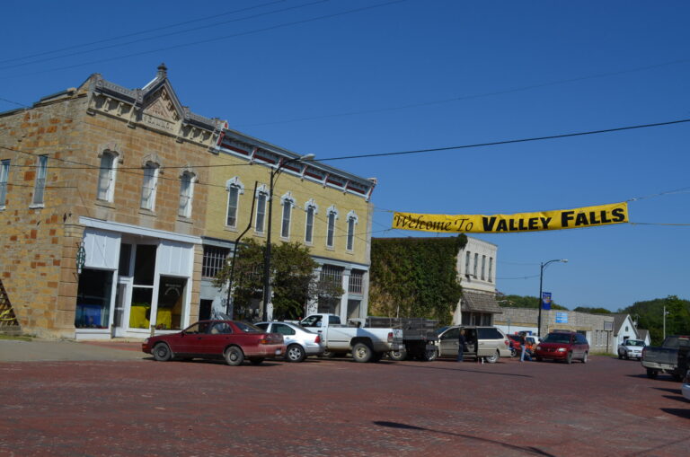
The Flint Hills run from Marshall County in the north to Cowley County in the south, where streams crossing its chert-banded limestone cut narrow, boxlike channels; Marshall County holds Alcove Spring Falls and Idlewild Falls, and Cowley County has Cowley Lake Falls. In the southeast corner, Chautauqua County, with 4 listings, and Elk County, with 3, sit on sandstone laid down some 300 million years ago, the same rock exposed at Elk Falls. Bourbon County and Johnson County each add 2 listings, both dam spillways; Johnson County's pair sit at suburban lakes in Merriam and Olathe, closer to Kansas City than any other listing. Jefferson County's single listing, Valley Falls, once powered a mill and gave the town, first named Grasshopper Falls, its name, but the falls themselves are dammed over today. Butler, Chase, Cherokee, Doniphan, Geary, Greenwood, Morris, Riley and Wabaunsee counties each hold one.
Waterfalls worth the trip
- Alcove Spring Falls, 5 feet, is a quarter-mile walk from parking on East River Road; the Donner-Reed Party camped and named the spring here in 1846, and one of its members, Sarah Keyes, died and was buried nearby.
- Elk Falls, 5 feet, drops over a sandstone ledge at the town that took its name from the falls; a mill once used its power, and an 1893 truss bridge downstream now gives a pedestrian view.
- Chase Falls drops 35 feet on Prather Creek in Chase County.
- Cowley Lake Falls, 20 feet, is a dam spillway at Arkansas City.
- Rock Creek Lake Falls drops 10 feet near Fort Scott.
- Pillsbury Crossing Falls, 5 feet, crosses Deep Creek near Manhattan.
When to go
Alcove Spring Falls flows mainly in spring and is usually dry by summer. Most of the rest are dam spillways whose flow tracks lake levels and releases rather than a fixed season, so a wet spring or a rainy week is generally a better bet than a dry summer stretch.
Fees and access
Most of these are dam spillways on county, city or wildlife-area lakes rather than fee-charging state parks; Alcove Spring Falls sits on land held by a private preservation association rather than a park agency. A Kansas fishing license is required to fish at any of them, separate from the vehicle permit the state charges only at its own state parks; none of these falls sits in one.
Safety
At Elk Falls, high water can form a retaining hydraulic at the ledge, a stretch rated Class III by paddling guides.
Waterfalls in Kansas on the map
Numbers show how many sit in that area; zoom in or click to split them, click a marker for details.
Tallest waterfalls in Kansas
- Chase Falls35 ftChase County
- Geary Lake Falls35 ftGeary County
- Lake Kahola Falls35 ftMorris County
- Bourbon Lake Falls30 ftBourbon County
- Eureka Lake Falls26 ftGreenwood County
- Cowley Lake Falls20 ftCowley County
- Chautauqua Falls10 ftChautauqua County
- Idlewild Falls10 ftMarshall County
- Rock Creek Lake Falls10 ftBourbon County
- Cedar Lake Falls6 ftJohnson County
Waterfalls by county
Kansas has named waterfalls in 16 counties. The most are in Chautauqua County (4), Elk County (3), Marshall County (2), Bourbon County (2), Johnson County (2), Butler County (1). Every county has its own page with a map and the tallest falls:
- Bourbon County 2
- Butler County 1
- Chase County 1
- Chautauqua County 4
- Cherokee County 1
- Cowley County 1
- Doniphan County 1
- Elk County 3
- Geary County 1
- Greenwood County 1
- Jefferson County 1
- Johnson County 2
- Marshall County 2
- Morris County 1
- Riley County 1
- Wabaunsee County 1
Types of waterfalls in Kansas
dam (8). What the types mean is explained in the guide to waterfall types.
About the data
Of the 24 waterfalls in Kansas, 20 have a measured height, 7 have coordinates verified against aerial imagery and 3 have photos. Heights are the total drop as recorded by the source; falls without a measurement are listed without one. Every page has the stream, the nearest town and distance, a map with directions and a review form for photos and notes.