Waterfalls in Texas
71 waterfalls in Texas across 30 counties, from the USGS dataset; 57 with a measured height. The tallest is Bryans Falls at 407 ft. All US waterfalls.
State: Texas 47
- Alabama 97
- Arizona 66
- Arkansas 280
- California 1,039
- Colorado 345
- Connecticut 79
- Florida 3
- Georgia 298
- Idaho 249
- Illinois 20
- Indiana 24
- Iowa 8
- Kansas 24
- Kentucky 65
- Louisiana 6
- Maine 175
- Maryland 13
- Massachusetts 37
- Michigan 294
- Minnesota 43
- Mississippi 8
- Missouri 11
- Montana 252
- Nebraska 14
- Nevada 25
- New Hampshire 264
- New Jersey 5
- New Mexico 20
- New York 879
- North Carolina 495
- North Dakota 1
- Ohio 26
- Oklahoma 30
- Oregon 1,342
- Pennsylvania 274
- Rhode Island 5
- South Carolina 22
- South Dakota 10
- Tennessee 427
- Texas 71
- Utah 76
- Vermont 229
- Virginia 127
- Washington 2,596
- West Virginia 13
- Wisconsin 83
- Wyoming 267

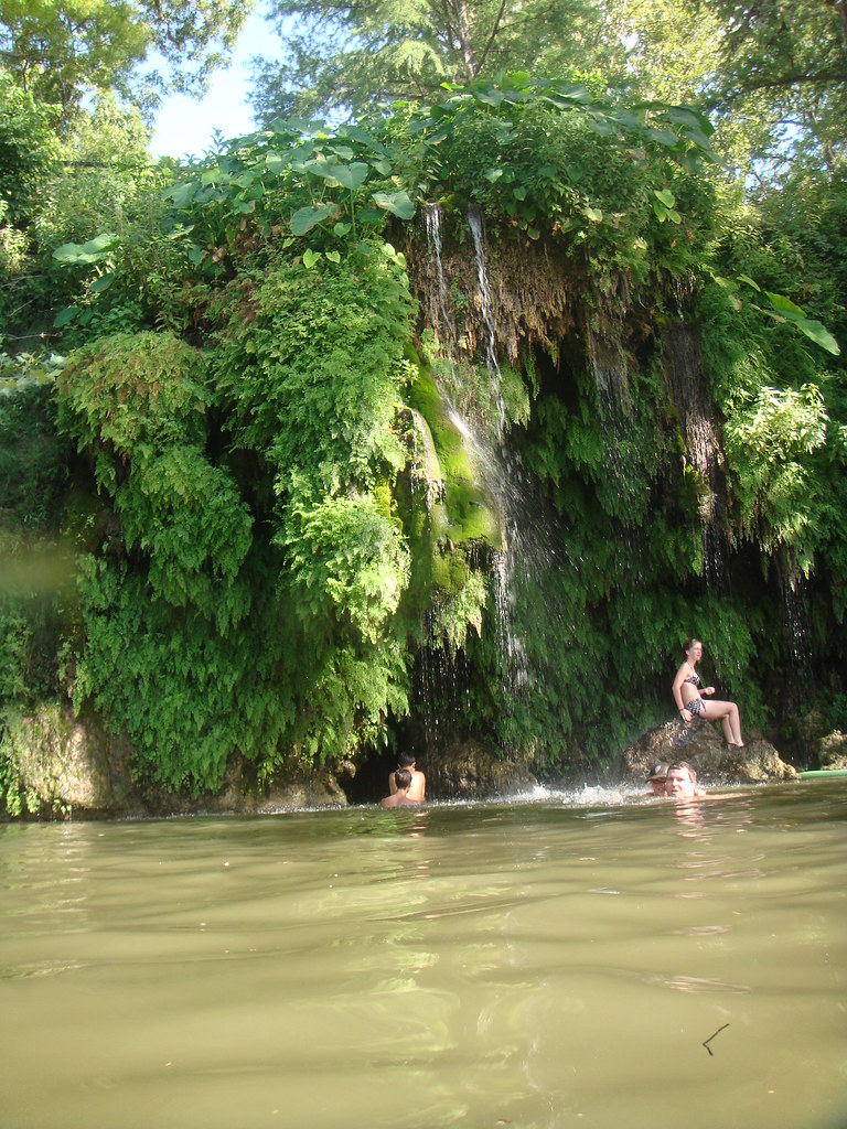
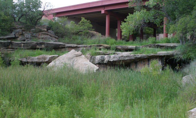
- Tallest drop 100 ft · 3 drops
- On Cattail Creek
- 66 mi from Presidio
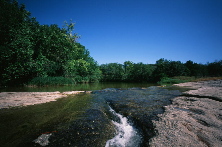

- On Devils River
- 36 mi from Cienegas Terrace

- On Cattail Creek
- 66 mi from Presidio
- Tallest drop 250 ft
- On Laguna Creek
- 66 mi from Presidio
- Tallest drop 100 ft
- On Post Oak Creek
- 17 mi from Lampasas
- Tallest drop 105 ft · 2 drops
- On Capote Creek
- 33 mi from Marfa
- On Deer Creek
- 15 mi from Buchanan Dam
- On Ojito Adentro Spring
- 19 mi from Presidio
Texas waterfalls, from Hill Country springs to Big Bend canyons
Waterfalls in Texas form where a river crosses a fault line, the edge of a limestone plateau or old volcanic rock. The state carries 71 named falls across 30 counties, clustered mainly in the spring-fed Hill Country, the desert Trans-Pecos around Big Bend, and the Panhandle's river canyons.
Where the waterfalls are
The Balcones Escarpment, where the Edwards Plateau steps down toward the plains, feeds most of the state's falls with limestone springs. Around Austin, Travis County has falls on Barton, Onion and Hamilton creeks; Burnet County has Krause Springs and the site of the original Marble Falls, submerged behind a dam since 1951. San Saba County holds Gorman Falls, and Blanco County has Pedernales Falls; Comal County and Kerr County have several low falls on the Guadalupe River.
The volcanic Trans-Pecos holds the state's biggest, most remote falls. Brewster County has Cattail Falls in Big Bend National Park; Presidio County has Madrid Falls in Big Bend Ranch State Park and, on the private Sierra Vieja ranchland, Capote Falls, closed to the public. Val Verde County has Dolan Falls on the Devils River.
The rest are scattered: Panhandle canyon falls in Randall and Crosby counties, and small creek and dam falls in Parker and Karnes counties.
Waterfalls worth the trip
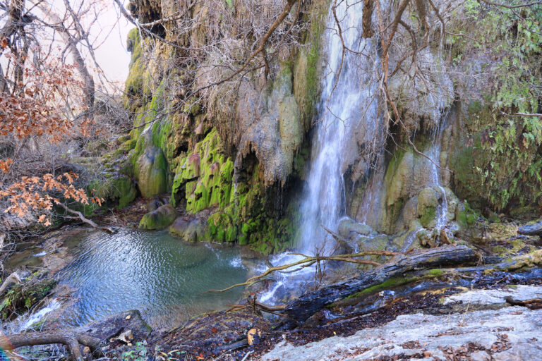
- Gorman Falls, 78 feet over a travertine terrace in Colorado Bend State Park, is a rocky 3-mile round trip ending in a steep, slippery descent.
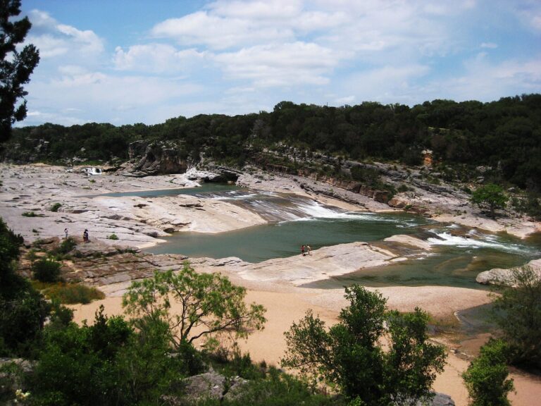
- Pedernales Falls, 30 feet of limestone steps, is an easy walk from the parking lot; swimming at the falls themselves is not allowed.
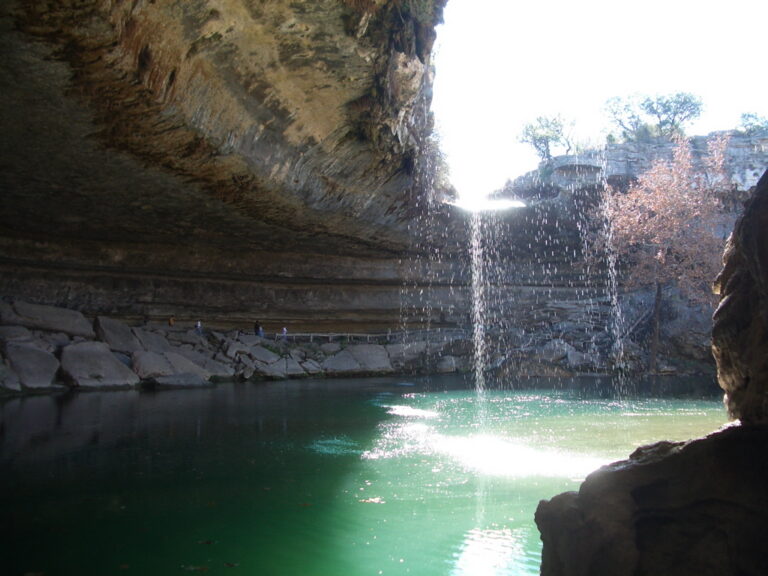
- Hamilton Pool Falls drops 46 feet into a collapsed limestone grotto; the trail down is a steep 0.25 mile, and a reservation plus vehicle fee are required.
- Upper and Lower McKinney Falls, both about 8 feet on Onion Creek, sit along a paved 2.8-mile trail where swimming is allowed.
- Krause Springs Falls, a 20-foot spring-fed cascade on private grounds, feeds a swimming pool and charges its own admission.
- Dolan Falls, a 7-foot ledge on the Devils River, is reached only by canoe or kayak, 16.4 miles below Baker's Crossing through a Class IV drop most paddlers portage.
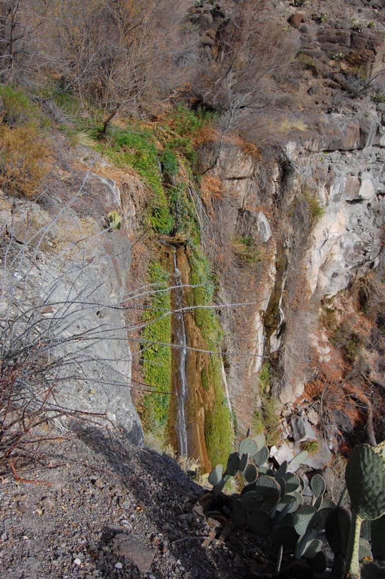
- Cattail Falls in Big Bend National Park drops 195 feet in three tiers on a creek that usually runs as a trickle; the hike is 1.6 miles one way over boulders and slabs.
- Madrid Falls, 100 feet down a lava-rock canyon in Big Bend Ranch State Park, sits on the Chorro Vista Loop, 4.6 miles round trip on a route needing a high-clearance vehicle.
When to go
Spring-fed falls — Gorman, Hamilton Pool and Krause Springs among them — run most of the year but thin out in drought, while rain-fed creeks like Barton and Onion Creek flood fast after a storm and dry to a trickle within weeks. Cattail and Madrid Falls usually trickle and surge after storms; summer temperatures at Big Bend Ranch can pass 100°F by late morning, so spring and fall suit the hike better. The Devils River is best floated in spring and fall, when flow suits the paddling trip to Dolan Falls.
Fees, permits and closures
State parks charge $5 a person at Colorado Bend, Big Bend Ranch and Devils River, and $6 at Pedernales Falls and McKinney Falls; children 12 and under are free, and a Texas State Parks Pass covers entry. Big Bend National Park charges $30 a vehicle for seven days. Hamilton Pool Preserve takes a reservation and a $12 vehicle fee on top of admission; only limited beach-area swimming is allowed as of September 2026, and the cliffside trail stays closed for rockfall. Dolan Falls also needs a $10 permit for the last stretch of state land, and its gates open only Friday through Monday. Colorado Bend's Gorman Springs Trail has been closed for tree work since September 2026, and Pedernales Falls' campground is closed for construction through October.
Safety
Flash flooding is the state's biggest hazard. In July 2025, a flood on the Guadalupe River killed at least 136 people in the Hill Country, most in Kerr County, where several low falls sit; the river flooded again in July 2026. At Pedernales Falls, rising or muddy water means leaving the riverbed right away. A teenager drowned at Hamilton Pool in 2016 after being pulled unresponsive from the water, and Dolan Falls, rated Class IV, is one paddlers are told to portage rather than run.
Waterfalls in Texas on the map
Numbers show how many sit in that area; zoom in or click to split them, click a marker for details.
Tallest waterfalls in Texas
- Bryans Falls407 ftBrewster County
- Laguna Falls295 ftBrewster County
- Pine Canyon Falls240 ftBrewster County
- Cattail Falls195 ftBrewster County
- Post Oak Falls160 ftSan Saba County
- Window Falls150 ftBrewster County
- Copper Plaque Falls140 ftBrewster County
- Mexicano Falls135 ftPresidio County
- Capote Falls128 ftPresidio County
- Madrid Falls100 ftPresidio County
Waterfalls by county
Texas has named waterfalls in 30 counties. The most are in Travis County (9), Brewster County (6), Comal County (5), Randall County (5), Presidio County (5), San Saba County (5). Every county has its own page with a map and the tallest falls:
- Bandera County 1
- Bell County 1
- Blanco County 1
- Bosque County 1
- Brewster County 6
- Briscoe County 1
- Burnet County 4
- Comal County 5
- Crosby County 2
- Falls County 1
- Floyd County 1
- Gillespie County 1
- Guadalupe County 1
- Hays County 1
- Hood County 1
- Jasper County 2
- Karnes County 2
- Kendall County 3
- Kerr County 2
- Kimble County 1
- McLennan County 1
- Medina County 1
- Parker County 4
- Presidio County 5
- Randall County 5
- San Saba County 5
- Stonewall County 1
- Taylor County 1
- Travis County 9
- Val Verde County 1
Types of waterfalls in Texas
dam (2). What the types mean is explained in the guide to waterfall types.
About the data
Of the 71 waterfalls in Texas, 57 have a measured height, 23 have coordinates verified against aerial imagery and 10 have photos. Heights are the total drop as recorded by the source; falls without a measurement are listed without one. Every page has the stream, the nearest town and distance, a map with directions and a review form for photos and notes.
Find waterfalls near me · All US waterfalls
Sources
- tpwd.texas.gov
- tpwd.texas.gov
- tpwd.texas.gov
- tpwd.texas.gov
- tpwd.texas.gov
- tpwd.texas.gov
- parks.traviscountytx.gov
- spectrumlocalnews.com
- tpwd.texas.gov
- krausesprings.net
- hotspringsguides.com
- tpwd.texas.gov
- tpwd.texas.gov
- tpwd.texas.gov
- tpwd.texas.gov
- hikingwalking.com
- nps.gov
- tpwd.texas.gov
- tpwd.texas.gov
- tpwd.texas.gov
- lcra.org
- en.wikipedia.org
- en.wikipedia.org
- worldwaterfalldatabase.com