Waterfalls in Utah
76 waterfalls in Utah across 19 counties, from the USGS dataset; 58 with a measured height. The tallest is Sinawava Falls at 750 ft. All US waterfalls.
State: Utah 47
- Alabama 97
- Arizona 66
- Arkansas 280
- California 1,039
- Colorado 345
- Connecticut 79
- Florida 3
- Georgia 298
- Idaho 249
- Illinois 20
- Indiana 24
- Iowa 8
- Kansas 24
- Kentucky 65
- Louisiana 6
- Maine 175
- Maryland 13
- Massachusetts 37
- Michigan 294
- Minnesota 43
- Mississippi 8
- Missouri 11
- Montana 252
- Nebraska 14
- Nevada 25
- New Hampshire 264
- New Jersey 5
- New Mexico 20
- New York 879
- North Carolina 495
- North Dakota 1
- Ohio 26
- Oklahoma 30
- Oregon 1,342
- Pennsylvania 274
- Rhode Island 5
- South Carolina 22
- South Dakota 10
- Tennessee 427
- Texas 71
- Utah 76
- Vermont 229
- Virginia 127
- Washington 2,596
- West Virginia 13
- Wisconsin 83
- Wyoming 267
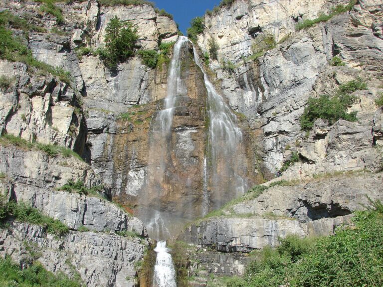
- Tallest drop 200 ft · 5 drops
- 7 mi from Lindon
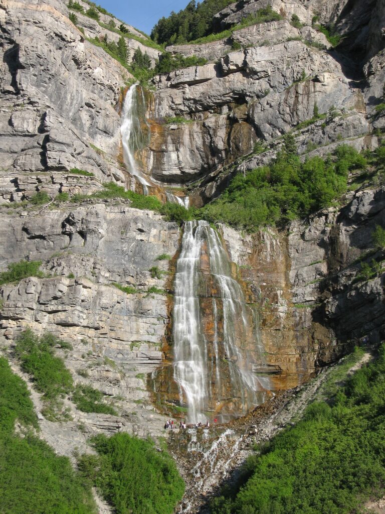
- Tallest drop 175 ft · 3 drops
- 6 mi from Orem
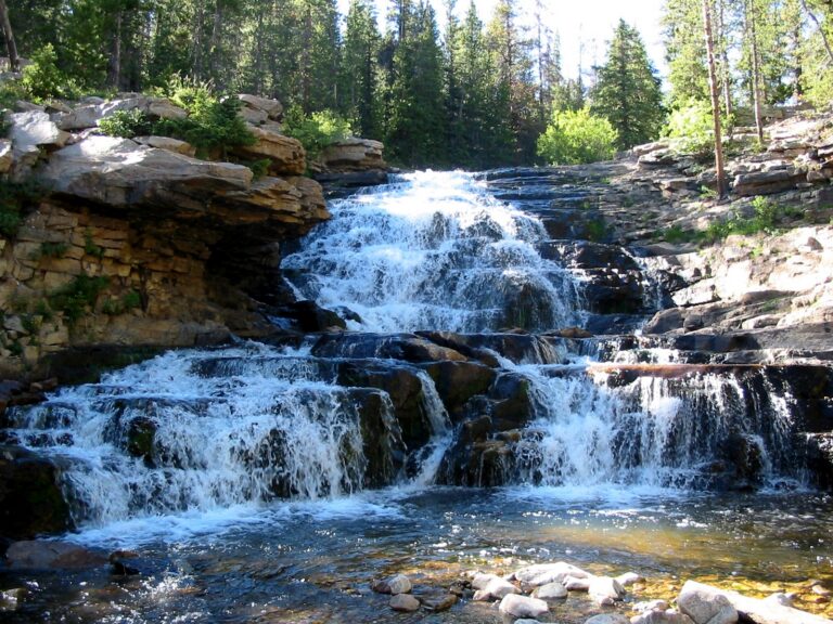
- Tallest drop 15 ft · 7 drops
- On Provo River
- 18 mi from Kamas
- On South Fork American Fork Canyon Creek
- 6 mi from Cedar Hills
- Tallest drop 35 ft · 2 drops
- On Gordon Creek
- 7 mi from Spring Glen
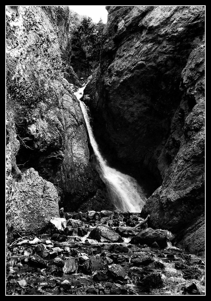
- On Mill B North Fork
- 5 mi from Cottonwood Heights
- Tallest drop 10 ft · 3 drops
- On Fremont River
- 56 mi from Ferron
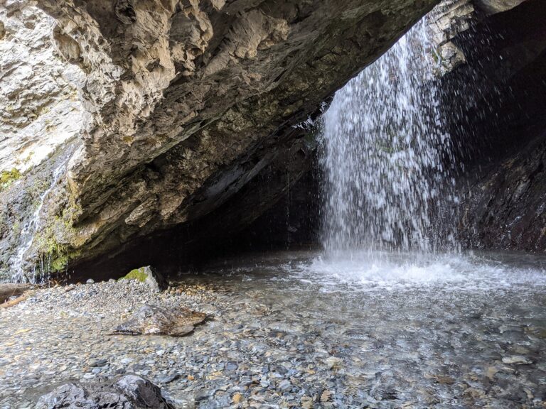

- On Waterfall Canyon Creek
- 3 mi from South Ogden
- On Bells Canyon Creek
- 3 mi from Granite
- On Little Deer Creek
- 20 mi from Francis
- On Mill B South Fork
- 6 mi from Cottonwood Heights
- On Dry Creek
- 4 mi from Alpine
Utah's waterfalls, from Wasatch ice climbs to Zion's sandstone drops
Two kinds of rock give Utah its waterfalls. Snowmelt off the Wasatch Front and the glaciated Uinta Mountains drives creeks over ledges that peak by early summer and freeze by midwinter, while farther south Navajo Sandstone cliffs in Zion, Grand Staircase-Escalante and Canyonlands hold spring-fed falls that never stop and desert pour-offs that run only after a storm. In all, 76 named waterfalls are recorded across 19 counties.
Where the waterfalls are
The Wasatch Front carries the most listings. Salt Lake County has 13, mostly short hikes into Big and Little Cottonwood Canyons, and Utah County has 12 more around Provo Canyon and American Fork Canyon; Davis County and Weber County add foothill canyons above Farmington and Ogden.
East of the Wasatch, the glaciated Uinta Mountains hold falls in Summit County, Duchesne County and Wasatch County, strung along the Mirror Lake Highway.
South, Washington County — 13 listings — sits almost entirely inside Zion National Park. Kane County and Garfield County cover Grand Staircase-Escalante, Wayne County holds Capitol Reef, and San Juan County has mostly ephemeral pour-offs. Carbon County, on Bureau of Land Management ground, has a smaller pair near Price.
Waterfalls worth the trip
- Birch Creek Falls, 600 feet, drops from a hanging side canyon on the west wall of Zion Canyon. There is no trail to the base, but the seasonal falls often show after rain, visible from the Court of the Patriarchs shuttle stop.
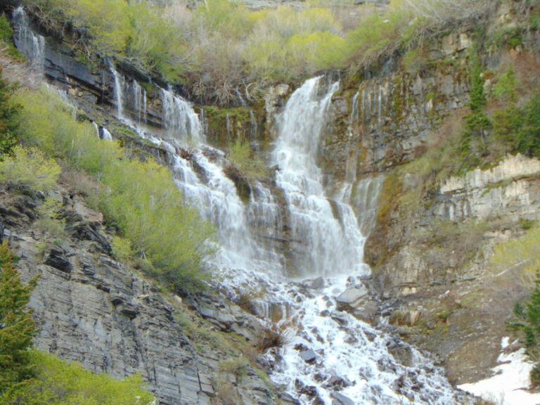
- Bridal Veil Falls, 430 feet in three tiers beside US-189 in Provo Canyon, is spring-fed and flows all year. A paved path normally reaches the viewing area, though the base trail closes for reconstruction from July 2026 into 2027.
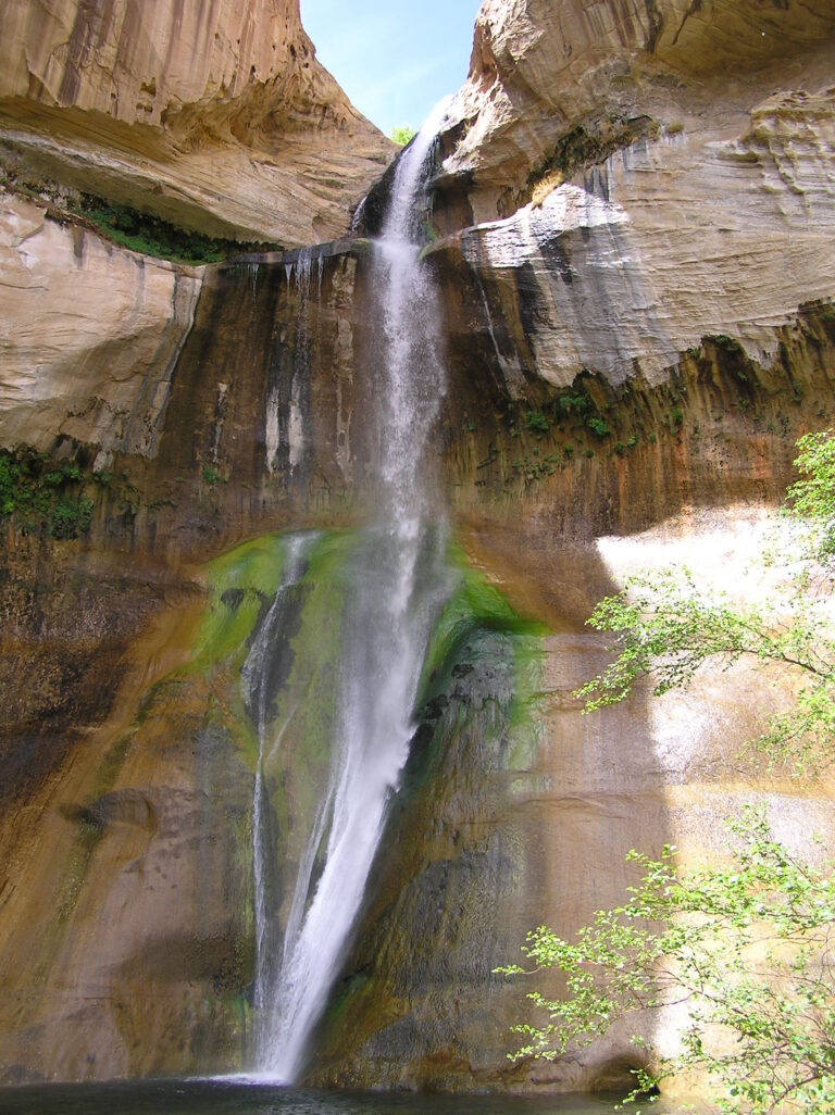
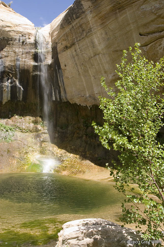
- Lower Calf Creek Falls, about 150 feet, is a spring-fed plunge in Grand Staircase-Escalante, at the end of a sandy 6-mile round trip from Calf Creek Campground.
- Provo River Falls, about 100 feet over at least seven steps, sits right beside the Mirror Lake Highway in the Uinta Mountains, a short walk from the milepost 23.9 parking area.
- Malan Falls, 320 feet at the head of Waterfall Canyon above Ogden, is a strenuous 2.4-mile round trip with a rocky scramble near the top and private land bordering the trail.
- Battle Creek Falls, a 55-foot plunge above Pleasant Grove, is an easy mile-and-a-half round trip that freezes into a climbable ice column most winters.
- Doughnut Falls, 20 feet, pours through a hole in the rock into a small cave, a short walk from the Mill D trailhead in Big Cottonwood Canyon.
When to go
Wasatch Front and Uinta creeks run on snowmelt, peaking in late May and June and thinning by late summer; Bridal Veil Falls' upper tiers freeze into a route called Stairway to Heaven most winters. Lower Calf Creek Falls flows all year, best visited in spring or fall to dodge summer heat on its sandy trail. The Mirror Lake Highway, which passes Provo River Falls, closes every winter and reopened for the season on May 22, 2026. Zion's shuttle, the only way to reach the Court of the Patriarchs stop in season, runs daily from mid-spring through late fall.
Fees, permits and closures
Zion National Park charges $35 per vehicle or $20 per person for a week in 2026; once the shuttle is running, private cars cannot use the Zion Canyon Scenic Drive without a medical permit. Grand Staircase-Escalante charges $5 per vehicle at the Calf Creek trailhead. Doughnut Falls' Big Cottonwood Canyon trailhead has charged a Forest Service parking fee since June 2026 — $10 for three days, $20 for a week or $60 a year — and the canyon's watershed rules ban dogs, swimming and wading outright. Bridal Veil Falls and Battle Creek Falls are both free, though each has construction under way in 2026. Fremont River Falls, beside the highway in Capitol Reef, stays closed to entry under the park's current rules.
Safety
At Lower Calf Creek Falls, rock has fallen from the overhanging cliff into the pool without warning since at least 2024, when a struck visitor needed a helicopter evacuation. Hikers have died falling from the rocks around Malan Falls, and visitors are asked not to climb its cliffs. Fremont River Falls' recirculating current has caused repeated near-drownings, and its plunge pool now sits inside a closed, no-entry zone.
Waterfalls in Utah on the map
Numbers show how many sit in that area; zoom in or click to split them, click a marker for details.
Tallest waterfalls in Utah
- Sinawava Falls750 ftWashington County
- Hidden Canyon Falls630 ftWashington County
- Birch Creek Falls600 ftWashington County
- Upper Emerald Pools Falls485 ftWashington County
- Stewarts Cascades475 ftUtah County
- Bridal Veil Falls430 ftUtah County
- Ogden Canyon Falls325 ftWeber County
- Malan Falls320 ftWeber County
- Upper Bells Canyon Falls210 ftSalt Lake County
- Spencer Falls180 ftDuchesne County
Waterfalls by county
Utah has named waterfalls in 19 counties. The most are in Washington County (13), Salt Lake County (13), Utah County (12), Summit County (6), San Juan County (6), Garfield County (4). Every county has its own page with a map and the tallest falls:
- Carbon County 2
- Davis County 3
- Duchesne County 2
- Garfield County 4
- Grand County 2
- Iron County 1
- Kane County 3
- Piute County 1
- Salt Lake County 13
- San Juan County 6
- Sanpete County 1
- Sevier County 1
- Summit County 6
- Uintah County 1
- Utah County 12
- Wasatch County 1
- Washington County 13
- Wayne County 2
- Weber County 2
Types of waterfalls in Utah
horsetail (2), tiered (1), ephemeral (1). What the types mean is explained in the guide to waterfall types.
About the data
Of the 76 waterfalls in Utah, 58 have a measured height, 26 have coordinates verified against aerial imagery and 11 have photos. Heights are the total drop as recorded by the source; falls without a measurement are listed without one. Every page has the stream, the nearest town and distance, a map with directions and a review form for photos and notes.