Waterfalls in Nebraska
14 waterfalls in Nebraska across 5 counties, from the USGS dataset; 6 with a measured height. The tallest is Smith Falls at 63 ft. All US waterfalls.
State: Nebraska 47
- Alabama 97
- Arizona 66
- Arkansas 280
- California 1,039
- Colorado 345
- Connecticut 79
- Florida 3
- Georgia 298
- Idaho 249
- Illinois 20
- Indiana 24
- Iowa 8
- Kansas 24
- Kentucky 65
- Louisiana 6
- Maine 175
- Maryland 13
- Massachusetts 37
- Michigan 294
- Minnesota 43
- Mississippi 8
- Missouri 11
- Montana 252
- Nebraska 14
- Nevada 25
- New Hampshire 264
- New Jersey 5
- New Mexico 20
- New York 879
- North Carolina 495
- North Dakota 1
- Ohio 26
- Oklahoma 30
- Oregon 1,342
- Pennsylvania 274
- Rhode Island 5
- South Carolina 22
- South Dakota 10
- Tennessee 427
- Texas 71
- Utah 76
- Vermont 229
- Virginia 127
- Washington 2,596
- West Virginia 13
- Wisconsin 83
- Wyoming 267

- 2 drops
- 12 mi from Valentine
- On Snake River
- 21 mi from Valentine
- On North Branch Dismal River
- 49 mi from Sutherland
Nebraska's waterfalls: springs breaking from the Niobrara's canyon walls
Fourteen named waterfalls turn up in Nebraska, nearly all of them short drops off the canyon walls that line the Niobrara River in the state's north-central Sandhills. Springs seeping from the bluffs above the Niobrara feed dozens of small falls into the valley, most of them unnamed.
Where the waterfalls are
Cherry County holds 10 of the 14, strung along the Niobrara near Valentine — Smith Falls, Fort Falls, Berry Falls, Arrowhead Falls and others, plus Big Falls and Horseshoe Falls on the North Loup River to the south. Brown County adds Norden Falls, also on the Niobrara, near Ainsworth. Away from that valley, Chase County holds Wauneta Falls on Frenchman Creek in the state's southwest corner, Holt County has Rock Falls on North Branch Eagle Creek near Atkinson, and Hooker County has North Branch Dismal River Falls out in the Sandhills.
Waterfalls worth the trip
- Smith Falls, 63 feet down a spring-fed side canyon into the Niobrara, is Nebraska's tallest by Wikipedia's account. A footbridge — a relocated 1996 iron truss originally built at Verdigre — carries visitors across the river from Smith Falls State Park's north side to reach it.
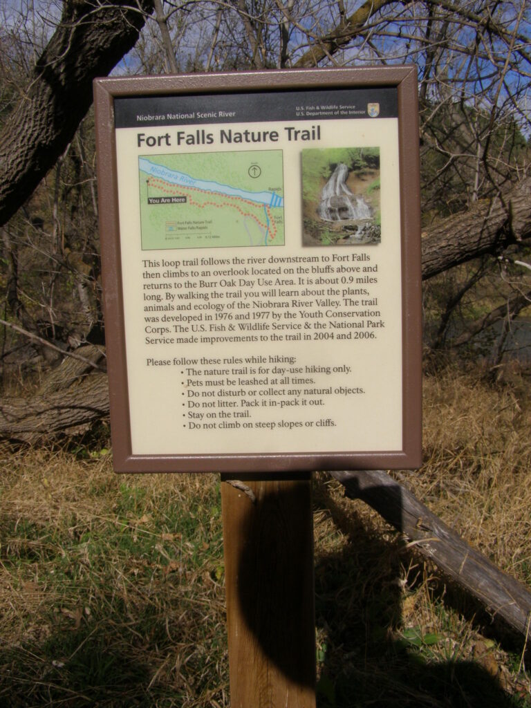
- Fort Falls, 42 feet, sits on the Fort Falls Hiking Trail inside Fort Niobrara National Wildlife Refuge, reached on foot from the refuge's gravel roads east of Valentine.
- Berry Falls, also in Cherry County, is one of more than 200 small waterfalls the National Park Service counts along the Niobrara's bluffs, best seen from the river itself.
When to go and getting in
Niobrara National Scenic River charges no entrance fee, though it doesn't own the land along the river, so private landings and outfitters may charge their own rates for canoe, kayak or tube access. Fort Niobrara refuge is also free, open sunrise to sunset for foot travel only; its visitor center keeps weekday hours, 9 a.m. to 4 p.m.
Safety
Fort Niobrara refuge bans camping, climbing and rappelling and limits visitors to foot travel on designated routes in daylight; stay on marked paths near the canyon falls.
Waterfalls in Nebraska on the map
Numbers show how many sit in that area; zoom in or click to split them, click a marker for details.
Tallest waterfalls in Nebraska
- Smith Falls63 ftCherry County
- Tyler Falls50 ftCherry County
- Fort Falls42 ftCherry County
- Snake River Falls20 ftCherry County
- Berry Falls10 ftCherry County
- Big Falls10 ftCherry County
Waterfalls by county
Nebraska has named waterfalls in 5 counties. The most are in Cherry County (10), Brown County (1), Hooker County (1), Holt County (1), Chase County (1). Every county has its own page with a map and the tallest falls:
Types of waterfalls in Nebraska
block (4), tiered (2), horsetail (1), plunge (1), fan (1). What the types mean is explained in the guide to waterfall types.
About the data
Of the 14 waterfalls in Nebraska, 6 have a measured height, 5 have coordinates verified against aerial imagery and 1 have photos. Heights are the total drop as recorded by the source; falls without a measurement are listed without one. Every page has the stream, the nearest town and distance, a map with directions and a review form for photos and notes.