Waterfalls in Oklahoma
30 waterfalls in Oklahoma across 12 counties, from the USGS dataset; 20 with a measured height. The tallest is Turner Falls at 60 ft. All US waterfalls.
State: Oklahoma 47
- Alabama 97
- Arizona 66
- Arkansas 280
- California 1,039
- Colorado 345
- Connecticut 79
- Florida 3
- Georgia 298
- Idaho 249
- Illinois 20
- Indiana 24
- Iowa 8
- Kansas 24
- Kentucky 65
- Louisiana 6
- Maine 175
- Maryland 13
- Massachusetts 37
- Michigan 294
- Minnesota 43
- Mississippi 8
- Missouri 11
- Montana 252
- Nebraska 14
- Nevada 25
- New Hampshire 264
- New Jersey 5
- New Mexico 20
- New York 879
- North Carolina 495
- North Dakota 1
- Ohio 26
- Oklahoma 30
- Oregon 1,342
- Pennsylvania 274
- Rhode Island 5
- South Carolina 22
- South Dakota 10
- Tennessee 427
- Texas 71
- Utah 76
- Vermont 229
- Virginia 127
- Washington 2,596
- West Virginia 13
- Wisconsin 83
- Wyoming 267
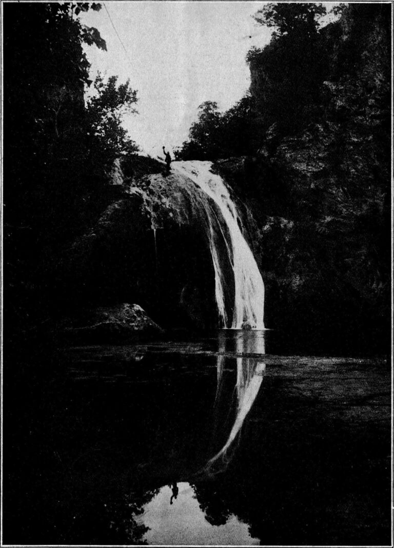
- Tallest drop 45 ft · 2 drops
- On Honey Creek
- 6 mi from Davis
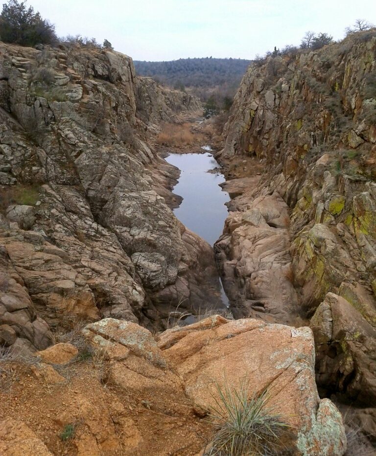
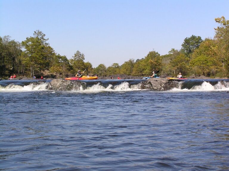
- Tallest drop 3 ft · 3 drops
- On Mountain Fork
- 7 mi from Broken Bow

- On Pennington Creek
- 5 mi from Tishomingo

- 2 drops
- On Travertine Creek
- 1 mi from Sulphur

- On Dripping Springs Branch
- 7 mi from Siloam Springs
- On Lick Creek
- 5 mi from Davis
- On Henry House Creek
- 12 mi from Lone Grove
- Tallest drop 2 ft
- On Travertine Creek
- Under 1 mi from Sulphur
- On Blue River
- 8 mi from Tishomingo
- On Travertine Creek
- Under 1 mi from Sulphur
Oklahoma's waterfalls: spring-fed drops in the Arbuckles and beyond
Thirty-one named waterfalls turn up across Oklahoma, most of them short, spring-fed drops rather than tall plunges. The densest cluster sits in the Arbuckle Mountains, where an aquifer in ancient granite and limestone surfaces as travertine-lined creeks; a few more break from harder rock in the Wichita and Ouachita ranges, and scattered prairie-stream falls fill out the map.
Where the waterfalls are
Murray County holds 14 of the state's 31 listings, in the Arbuckle foothills. Chickasaw National Recreation Area's Travertine Creek drops in a chain of small falls near Sulphur — Little Niagara, Cave Island, Sycamore, Bear and Garfield among them — while Turner Falls tumbles over Honey Creek a few miles away near Davis. The same range extends into Carter County, near Lone Grove and Dickson, and Johnston County, where Pennington Creek and the Blue River carry falls near Tishomingo.
Delaware County, in the far northeastern corner, sits on the Ozark Highlands edge rather than the Arbuckles; Natural Falls State Park there, near the Arkansas line, holds Dripping Springs Falls.
The folded Ouachita Mountains reach into McCurtain County, where the Mountain Fork carries Presbyterian Falls below Beavers Bend State Park, and Le Flore County, where the Poteau River holds Hontubby Falls. The granite Wichita Mountains give Comanche County its lone listing, Forty Foot Hole. Atoka, Cherokee, Lincoln, Muskogee and Wagoner counties each add one, on plains streams beyond these ranges.
Waterfalls worth the trip
- Dripping Springs Falls, 50 feet, sits in Natural Falls State Park; the lot sits about 150 feet from the platform, and "Where the Red Fern Grows" was filmed here in 1974.
- Turner Falls, 60 feet in two tiers on Honey Creek, is a short walk into a wide swimming pool at city-run Turner Falls Park near Davis; the park's own materials still give 77 feet.
- Little Niagara Falls, 3 feet on Travertine Creek in Chickasaw National Recreation Area, is a short walk from parking, alongside Cave Island, Sycamore, Bear and Garfield falls, all within 0.4 mile.
- Forty Foot Hole, about 12 feet despite the name, sits at the end of the moderate, 1.1-mile Kite Trail in the Wichita Mountains Wildlife Refuge.
- Presbyterian Falls, an 8-foot run of ledges on the Mountain Fork below Beavers Bend State Park, is better known to paddlers than hikers, with parking and a portage path close by.
- Bridal Veil Falls, 7 feet, drops on Honey Creek about 0.1 mile from Turner Falls, close enough for the same visit.
When to go
Turner Falls and the Chickasaw creeks run fullest in spring and after rain. Turner keeps a summer season from May 1 through September 30, with lifeguards and higher admission; 2026's lifeguard shifts ended September 21, and winter rates and hours run through April 30. Little Niagara can stop flowing in a dry spell. The Mountain Fork below Beavers Bend floats and fishes best from spring through fall, with afternoon dam releases common on hot days; the Kite Trail and Natural Falls State Park stay open all year.
Fees, permits and closures
Chickasaw National Recreation Area charges no entrance fee. Turner Falls Park, run by the City of Davis, charges per person, not per vehicle: summer admission runs $16 weekdays and $20 weekends for adults, with lower winter rates. Natural Falls State Park charges $10 a vehicle for out-of-state visitors, $8 for an Oklahoma plate; swimming is not allowed inside the park. The Wichita Mountains refuge is free to enter, though camping and backcountry permits cost extra. Slippery Falls sits on private Scout-camp land with no public access documented.
Safety
Chickasaw National Recreation Area bans swimming and wading in Travertine Creek past Little Niagara, east of the NE Perimeter Road bridge, and keeps pets out of the water there. At Turner Falls, children 12 and under must wear a Coast Guard-certified flotation device, and swimming after lifeguard season is at the visitor's own risk. A keeper hydraulic forms at Presbyterian Falls around 2,000 to 4,000 cfs; a kayaker drowned there in October 2009 after his boat was caught in it at high water.
Waterfalls in Oklahoma on the map
Numbers show how many sit in that area; zoom in or click to split them, click a marker for details.
Tallest waterfalls in Oklahoma
- Turner Falls60 ftMurray County
- Dripping Springs Falls50 ftDelaware County
- Lick Creek Falls45 ftMurray County
- Cedar Falls15 ftCarter County
- Classen Falls15 ftMurray County
- Henry House Falls15 ftCarter County
- Price Falls15 ftMurray County
- Forty Foot Hole12 ftComanche County
- Hickory Falls12 ftCarter County
- McSpadden Falls10 ftCherokee County
Waterfalls by county
Oklahoma has named waterfalls in 12 counties. The most are in Murray County (13), Johnston County (4), Carter County (3), Delaware County (2), Comanche County (1), Le Flore County (1). Every county has its own page with a map and the tallest falls:
- Atoka County 1
- Carter County 3
- Cherokee County 1
- Comanche County 1
- Delaware County 2
- Johnston County 4
- Le Flore County 1
- Lincoln County 1
- McCurtain County 1
- Murray County 13
- Muskogee County 1
- Wagoner County 1
Types of waterfalls in Oklahoma
historical (2), dam (1). What the types mean is explained in the guide to waterfall types.
About the data
Of the 30 waterfalls in Oklahoma, 20 have a measured height, 9 have coordinates verified against aerial imagery and 6 have photos. Heights are the total drop as recorded by the source; falls without a measurement are listed without one. Every page has the stream, the nearest town and distance, a map with directions and a review form for photos and notes.
Find waterfalls near me · All US waterfalls
Sources
- worldwaterfalldatabase.com
- turnerfallspark.com
- turnerfallspark.com
- turnerfallspark.squarespace.com
- turnerfallspark.com
- en.wikipedia.org
- travelok.com
- worldwaterfalldatabase.com
- nps.gov
- nps.gov
- nps.gov
- en.wikipedia.org
- en.wikipedia.org
- worldwaterfalldatabase.com
- fws.gov
- worldwaterfalldatabase.com
- americanwhitewater.org
- americanwhitewater.org
- web2.travelok.com
- scoutingevent.com