Waterfalls in Kentucky
65 waterfalls in Kentucky across 29 counties, from the USGS dataset; 43 with a measured height. The tallest is Torrent Falls at 145 ft. All US waterfalls.
State: Kentucky 47
- Alabama 97
- Arizona 66
- Arkansas 280
- California 1,039
- Colorado 345
- Connecticut 79
- Florida 3
- Georgia 298
- Idaho 249
- Illinois 20
- Indiana 24
- Iowa 8
- Kansas 24
- Kentucky 65
- Louisiana 6
- Maine 175
- Maryland 13
- Massachusetts 37
- Michigan 294
- Minnesota 43
- Mississippi 8
- Missouri 11
- Montana 252
- Nebraska 14
- Nevada 25
- New Hampshire 264
- New Jersey 5
- New Mexico 20
- New York 879
- North Carolina 495
- North Dakota 1
- Ohio 26
- Oklahoma 30
- Oregon 1,342
- Pennsylvania 274
- Rhode Island 5
- South Carolina 22
- South Dakota 10
- Tennessee 427
- Texas 71
- Utah 76
- Vermont 229
- Virginia 127
- Washington 2,596
- West Virginia 13
- Wisconsin 83
- Wyoming 267
- Tallest drop 45 ft · 3 drops
- On Tioga Creek
- 5 mi from Fort Knox
- On Cumberland River
- 11 mi from Whitley City
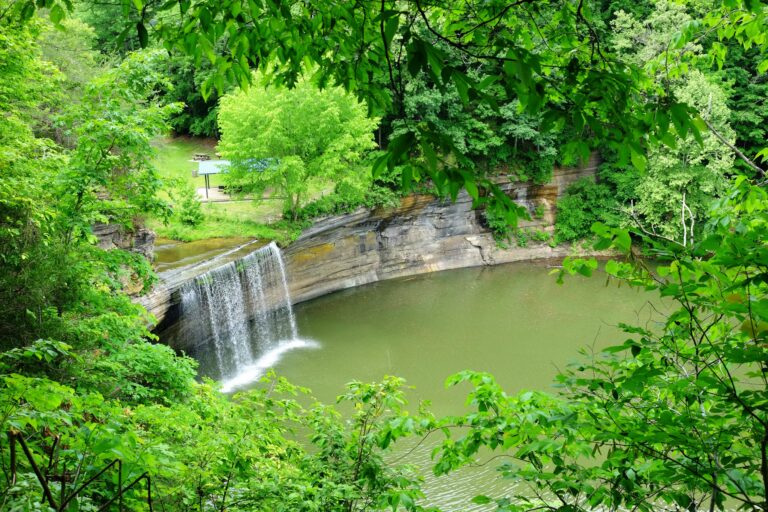
- On Indian Creek
- 6 mi from Albany
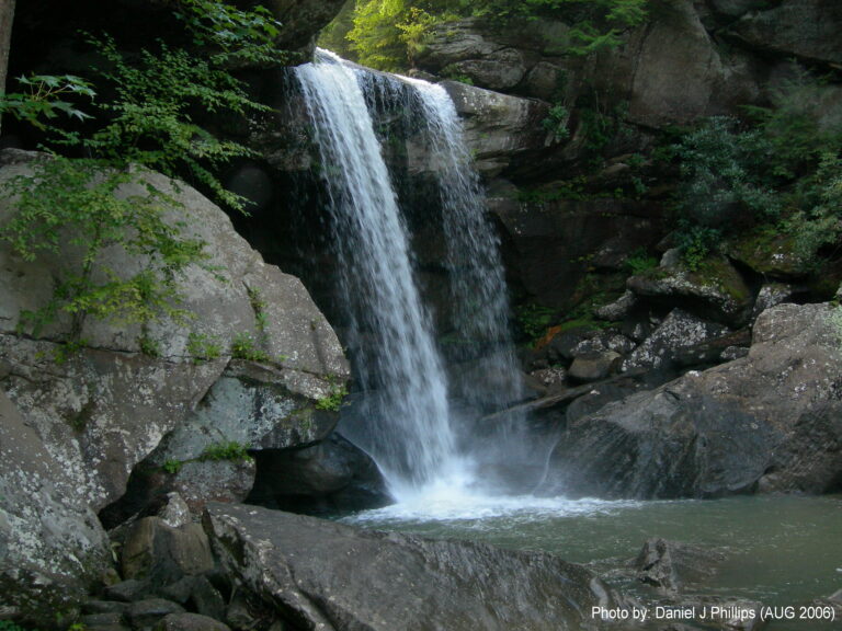
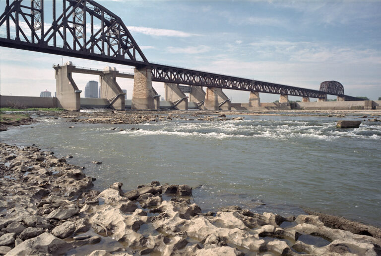

- On Tarkiln Branch
- 8 mi from West Liberty
- On Sam Carroll Branch
- 9 mi from Olive Hill
- On Broke Leg Creek
- 13 mi from West Liberty
- On Robbins Branch
- 15 mi from Leitchfield
- On Flat Lick Creek
- 4 mi from Annville
- On Vanhook Branch
- 11 mi from North Corbin
Kentucky waterfalls: from the Cumberland Plateau to the Bluegrass
A sandstone cap over softer shale runs across the eastern third of Kentucky, and wherever a creek cuts through it, the water drops in a clean ledge rather than wearing the hillside into a slope. That's where most of the state's 65 named waterfalls sit, inside the Daniel Boone National Forest, the Red River Gorge and the Big South Fork river country, with a smaller, older set cut into the limestone of the Bluegrass around Lexington and Frankfort.
Where the waterfalls are
McCreary County holds the densest cluster, where Big South Fork National River and Recreation Area meets the Daniel Boone National Forest at the Tennessee line. Whitley County and Clinton County add falls along the Sheltowee Trace Trail and Lake Cumberland, and Wayne County, Rockcastle County, Jackson County and Casey County round out the plateau's southern and western edge.
Northeast, Menifee County, Morgan County, Wolfe County, Powell County and Elliott County sit in and around the Red River Gorge, with Carter County and Lawrence County nearby toward the West Virginia line, and Harlan County, Letcher County, Bell County and Owsley County deep in the mountains toward Pine and Black Mountain.
The Bluegrass has smaller falls cut into limestone, in Jessamine County, Mercer County, Woodford County, Franklin County, Fayette County and Henry County. Near Fort Knox, Hardin County, Meade County and Edmonson County sit toward the Western Coal Field, and Jefferson County, at Louisville, holds the Falls of the Ohio, a stretch of fossil-bearing river rock rather than a plunge.
Waterfalls worth the trip
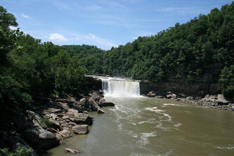
- Cumberland Falls, 68 feet on the Cumberland River, is the state's best-known drop: wide enough to throw a mist that produces a moonbow on clear nights near the full moon. The main overlook is a short walk from the parking lot.
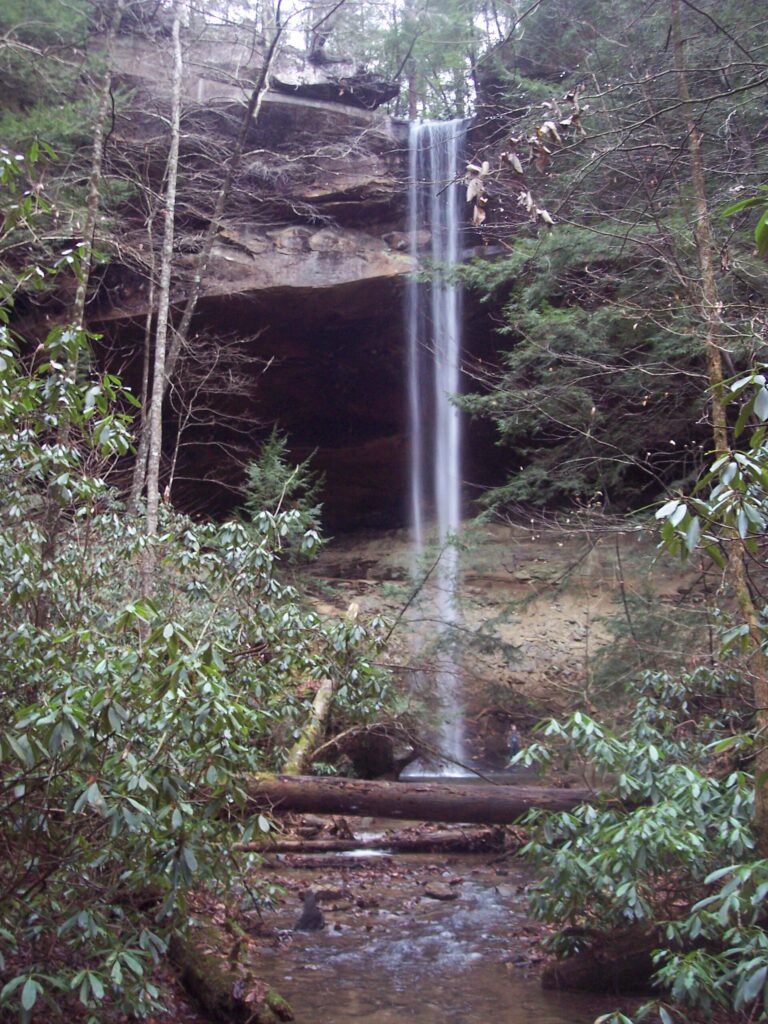
- Yahoo Falls, 108 feet, sits inside Big South Fork National River and Recreation Area. A one-mile loop off KY 700 near Whitley City passes behind the falls through a rock shelter and climbs to overlooks above it.
- Eagle Falls drops 36 feet a short distance across the river from Cumberland Falls, at the end of a roughly two-mile round trip along cliffs above Eagle Creek.
- Seventy Six Falls pours into Lake Cumberland; the exposed drop changes with the reservoir level, and the Army Corps of Engineers keeps a parking area, footbridges and a picnic ground there, reachable by land or boat.
- Bad Branch Falls, 60 feet, plunges off a sandstone cliff on Pine Mountain inside a state nature preserve, a roughly two-mile out-and-back walk from the lot.
- Dog Slaughter Falls is a short, broad drop on the Sheltowee Trace Trail in the Daniel Boone National Forest, downstream from the Cumberland Falls area.
When to go
Plateau creeks are rain-fed and run strongest through winter and spring; Bad Branch Falls roars after heavy rain, ices over in winter and thins to a lighter cascade by midsummer. High water can submerge the lower trail beside Eagle Creek. The Cumberland Falls moonbow needs a clear night near the full moon, and winter moonbows can show up brighter against a darker sky.
Fees, permits and closures
Kentucky State Parks, including Cumberland Falls, charge no general admission fee. Big South Fork National River and Recreation Area is free to enter, though backcountry camping needs an online permit. Bad Branch State Nature Preserve is open sunrise to sunset only, with no overnight parking and no pets, bikes or camping. Torrent Falls, in Wolfe County, is private property inside a commercial via ferrata course, reached only on a booked guided climb. Tioga Falls sits on the Fort Knox Army post, free and daylight-only, subject to closure for military training or hunting. An access road to Yahoo Falls was closed for wildfire operations in spring 2026; check current Big South Fork conditions first.
Safety
Yahoo Falls' rock shelter and stairs get slick with mud; a man died there in March 2024 after apparently falling while chasing his dog. Swimming in the river at Cumberland Falls is banned because of dangerous currents. At Bad Branch, a climber fell from the top of the falls and needed an airlift in 2016, and the ground above the drop is off-limits to hikers. The Army reports repeated rescues at Tioga Falls and asks visitors to stay off the falls themselves.
Waterfalls in Kentucky on the map
Numbers show how many sit in that area; zoom in or click to split them, click a marker for details.
Tallest waterfalls in Kentucky
- Torrent Falls145 ftWolfe County
- Yahoo Falls108 ftMcCreary County
- Kellacey Falls106 ftMorgan County
- Dog Falls90 ftElliott County
- Little Broke Leg Falls90 ftMenifee County
- Tioga Falls90 ftHardin County
- Shaker Landing Falls80 ftMercer County
- Anglin Falls75 ftRockcastle County
- Cumberland Falls68 ftMcCreary County
- Sam Carroll Falls65 ftCarter County
Waterfalls by county
Kentucky has named waterfalls in 29 counties. The most are in McCreary County (7), Menifee County (5), Morgan County (5), Laurel County (4), Whitley County (3), Elliott County (3). Every county has its own page with a map and the tallest falls:
- Bell County 1
- Carter County 3
- Casey County 1
- Clinton County 2
- Edmonson County 3
- Elliott County 3
- Fayette County 1
- Franklin County 2
- Hardin County 1
- Harlan County 2
- Henry County 1
- Jackson County 1
- Jefferson County 2
- Jessamine County 2
- Laurel County 4
- Lawrence County 1
- Letcher County 1
- McCreary County 7
- Meade County 2
- Menifee County 5
- Mercer County 2
- Morgan County 5
- Owsley County 1
- Powell County 1
- Rockcastle County 2
- Wayne County 2
- Whitley County 3
- Wolfe County 3
- Woodford County 1
Types of waterfalls in Kentucky
plunge (29), horsetail (2), dam (1), cascade (1), slide (1). What the types mean is explained in the guide to waterfall types.
About the data
Of the 65 waterfalls in Kentucky, 43 have a measured height, 6 have coordinates verified against aerial imagery and 7 have photos. Heights are the total drop as recorded by the source; falls without a measurement are listed without one. Every page has the stream, the nearest town and distance, a map with directions and a review form for photos and notes.
Find waterfalls near me · All US waterfalls