Waterfalls in South Dakota
10 waterfalls in South Dakota across 5 counties, from the USGS dataset; 8 with a measured height. The tallest is Bridal Veil Falls at 75 ft. All US waterfalls.
State: South Dakota 47
- Alabama 97
- Arizona 66
- Arkansas 280
- California 1,039
- Colorado 345
- Connecticut 79
- Florida 3
- Georgia 298
- Idaho 249
- Illinois 20
- Indiana 24
- Iowa 8
- Kansas 24
- Kentucky 65
- Louisiana 6
- Maine 175
- Maryland 13
- Massachusetts 37
- Michigan 294
- Minnesota 43
- Mississippi 8
- Missouri 11
- Montana 252
- Nebraska 14
- Nevada 25
- New Hampshire 264
- New Jersey 5
- New Mexico 20
- New York 879
- North Carolina 495
- North Dakota 1
- Ohio 26
- Oklahoma 30
- Oregon 1,342
- Pennsylvania 274
- Rhode Island 5
- South Carolina 22
- South Dakota 10
- Tennessee 427
- Texas 71
- Utah 76
- Vermont 229
- Virginia 127
- Washington 2,596
- West Virginia 13
- Wisconsin 83
- Wyoming 267
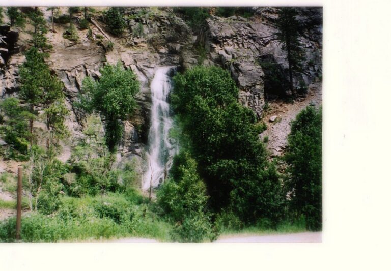
- On Rubicon Gulch
- 5 mi from Spearfish
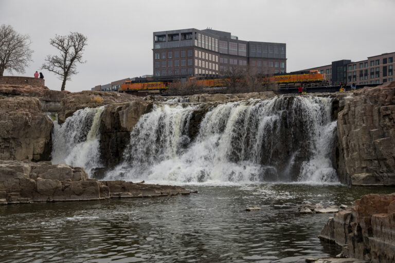
- Tallest drop 15 ft · 4 drops
- On Big Sioux River
- 1 mi from Sioux Falls
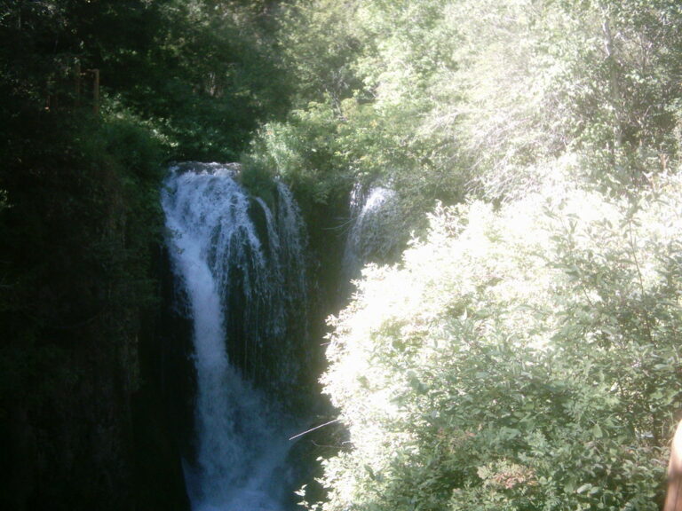
- 3 drops
- On Little Spearfish Creek
- 9 mi from Lead
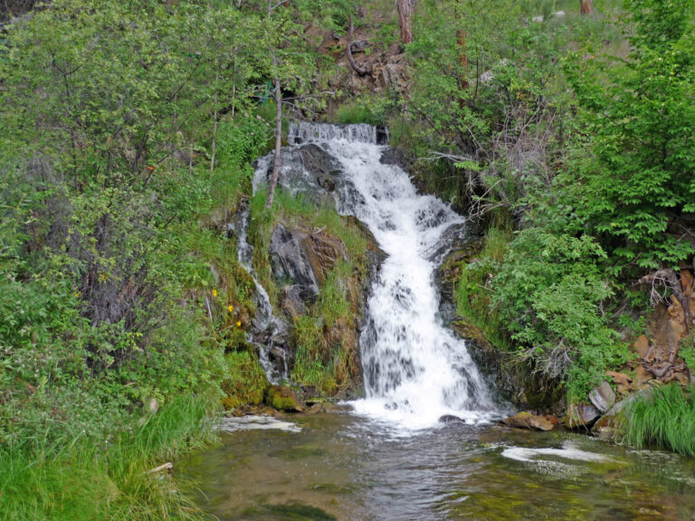
- 2 drops
- On Rapid Creek
- 6 mi from Colonial Pine Hills

- On Spearfish Creek
- 8 mi from Lead
- On Fall River
- 4 mi from Hot Springs
- 9 mi from Hot Springs
South Dakota's waterfalls: Black Hills canyons and one prairie river
Two very different landscapes carry South Dakota's eleven named waterfalls. In the northern Black Hills, Spearfish Canyon cuts through banded limestone and shale, and creeks off its rim drop in a short string of falls; more than a hundred miles east, the Big Sioux River crosses a single outcrop of ancient quartzite in the middle of Sioux Falls.
Where the waterfalls are
Lawrence County holds three falls in Spearfish Canyon — Bridal Veil, Roughlock and Spearfish Falls — cut through brown Deadwood Shale, pink Englewood Limestone and thick gray Pahasapa Limestone on top. To the south, granite country around Custer gives Custer County two listings, and Pennington County two more, including the long-closed Thunderhead Falls. Fall River County, near Hot Springs at the Black Hills' southern edge, holds Cascade Falls and Fall River Falls. Away from the Black Hills entirely, Minnehaha County on the eastern prairie holds Sioux Falls in the city itself and Devils Falls near Garretson.
Waterfalls worth the trip
- Bridal Veil Falls, 75 feet over resistant rock in Spearfish Canyon, is a roadside pull-off view with an observation platform; hiking into the immediate area isn't allowed. A tourism page gives it closer to 60 feet.
- Roughlock Falls, 42 feet in tiers on Little Spearfish Creek, is an easy, mostly level 1-mile walk from Spearfish Canyon Nature Area — the name recalls wagon drivers who once locked their wheels to descend the steep grade nearby.
- Spearfish Falls, 47 feet by lidar survey (often given as 60), sits at the end of a steep, roughly 3/4-mile trail; a hydroelectric plant serving the Homestake Gold Mine diverted the creek away from the falls from 1917 until 2003, when the flow returned.
- Sioux Falls, 50 feet where the Big Sioux River crosses four main steps of 1.5-billion-year-old quartzite, is a short walk from parking in the city's Falls Park.
Fees and access
Custer State Park charges $25 per vehicle (or $20 per motorcycle) for a 2026 pass covering one to seven days; an annual pass runs $40 for residents and $60 for nonresidents, and vehicles passing straight through on US 16A need no pass. Spearfish Canyon Nature Area, home to Roughlock Falls, charges nothing to enter. Falls Park in Sioux Falls is also free, open 5 a.m. to nearly midnight daily. Thunderhead Falls, a mine-tunnel attraction near Rapid City, has been closed to visitors for years with no reopening announced.
Safety
Falls Park bans swimming in the river between Falls Park Drive and Sixth Street; two people drowned there on March 14, 2013 trying to rescue a six-year-old boy who had gone into the foam-covered water below the falls, and the boy survived. At Bridal Veil Falls, visitors are kept to the platform rather than the streambank itself.
Waterfalls in South Dakota on the map
Numbers show how many sit in that area; zoom in or click to split them, click a marker for details.
Tallest waterfalls in South Dakota
- Bridal Veil Falls75 ftLawrence County
- Sioux Falls50 ftMinnehaha County
- Spearfish Falls47 ftLawrence County
- Roughlock Falls42 ftLawrence County
- Fall River Falls35 ftFall River County
- Thunderhead Falls30 ftPennington County
- Devils Falls15 ftMinnehaha County
- Cascade Falls5 ftFall River County
Waterfalls by county
South Dakota has named waterfalls in 5 counties. The most are in Lawrence County (3), Fall River County (2), Minnehaha County (2), Pennington County (2), Custer County (1). Every county has its own page with a map and the tallest falls:
Types of waterfalls in South Dakota
cascade (3), tiered (3), horsetail (2), segmented (1). What the types mean is explained in the guide to waterfall types.
About the data
Of the 10 waterfalls in South Dakota, 8 have a measured height, 5 have coordinates verified against aerial imagery and 4 have photos. Heights are the total drop as recorded by the source; falls without a measurement are listed without one. Every page has the stream, the nearest town and distance, a map with directions and a review form for photos and notes.