Waterfalls in Idaho
249 waterfalls in Idaho across 25 counties, from the USGS dataset; 165 with a measured height. The tallest is Goat Falls at 615 ft. All US waterfalls.
State: Idaho 47
- Alabama 97
- Arizona 66
- Arkansas 280
- California 1,039
- Colorado 345
- Connecticut 79
- Florida 3
- Georgia 298
- Idaho 249
- Illinois 20
- Indiana 24
- Iowa 8
- Kansas 24
- Kentucky 65
- Louisiana 6
- Maine 175
- Maryland 13
- Massachusetts 37
- Michigan 294
- Minnesota 43
- Mississippi 8
- Missouri 11
- Montana 252
- Nebraska 14
- Nevada 25
- New Hampshire 264
- New Jersey 5
- New Mexico 20
- New York 879
- North Carolina 495
- North Dakota 1
- Ohio 26
- Oklahoma 30
- Oregon 1,342
- Pennsylvania 274
- Rhode Island 5
- South Carolina 22
- South Dakota 10
- Tennessee 427
- Texas 71
- Utah 76
- Vermont 229
- Virginia 127
- Washington 2,596
- West Virginia 13
- Wisconsin 83
- Wyoming 267
- Tallest drop 165 ft · 2 drops
- On Snake River
- 4 mi from Twin Falls
![[IDAHO-B-0127] Perrine Coulee Creek - Perrine Coulee Falls](https://fallsdiscovery.com/wp-content/uploads/2026/09/7356501068_afa1f117a6_b-768x480.jpg "[IDAHO-B-0127] Perrine Coulee Creek - Perrine Coulee Falls")
- On Perrine Coulee Creek
- 2 mi from Twin Falls

- On Snake River
- 4 mi from Kimberly
- Tallest drop 85 ft · 2 drops
- On Henrys Fork Snake River
- 10 mi from Ashton
![[IDAHO-B-0102] Moyie River - Moyie Falls](https://fallsdiscovery.com/wp-content/uploads/2026/09/IDAHO-B-0102-Moyie-River-Moyie-Falls.jpg "[IDAHO-B-0102] Moyie River - Moyie Falls")
- Tallest drop 61 ft · 2 drops
- On Moyie River
- 7 mi from Bonners Ferry
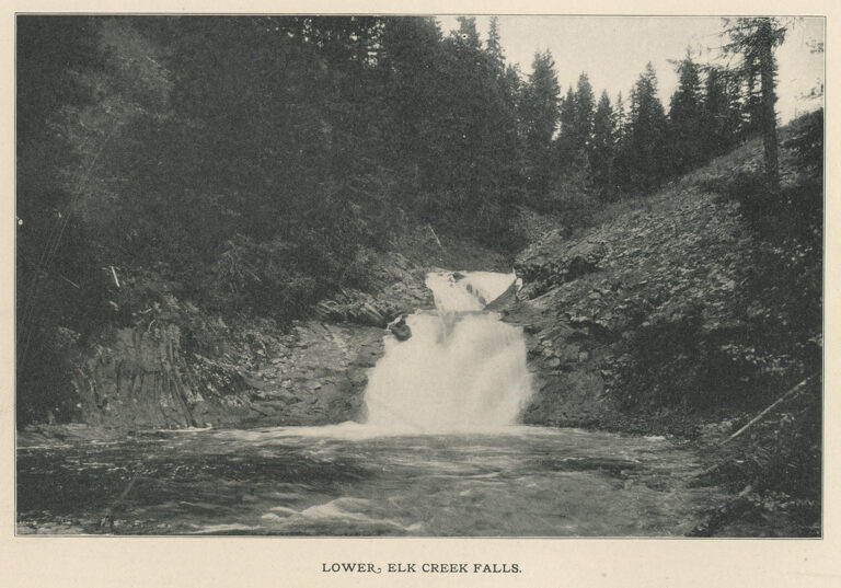
- On Elk Creek
- 18 mi from Orofino
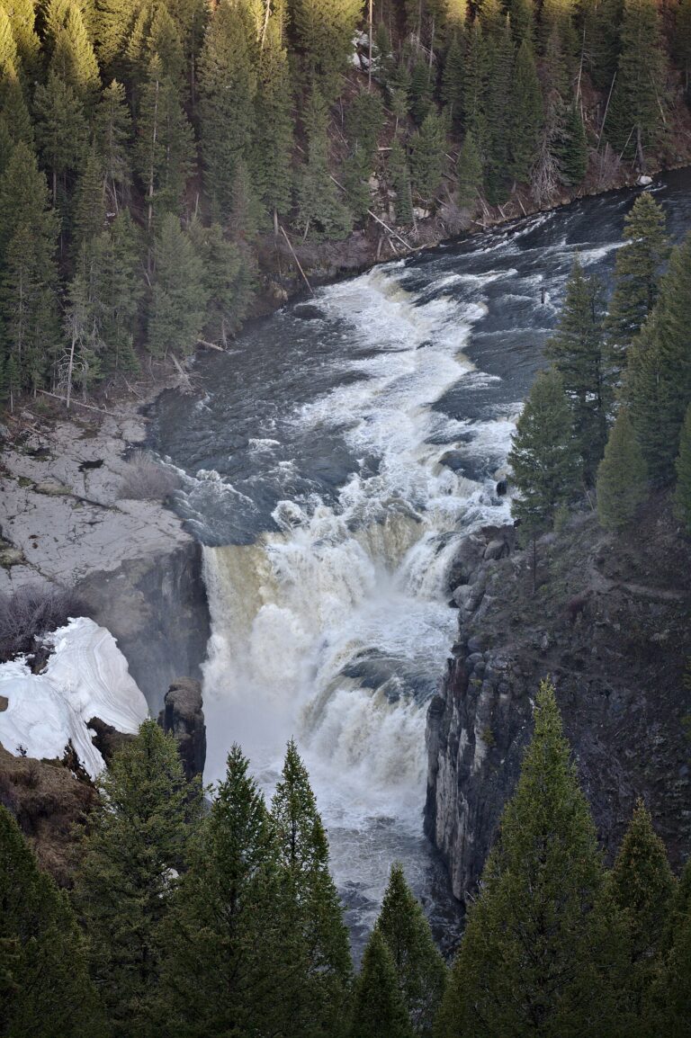
- 3 drops
- On Henrys Fork Snake River
- 10 mi from Ashton
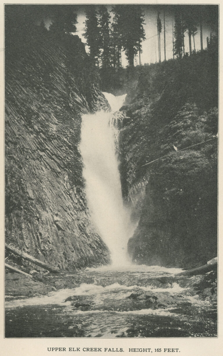
- 2 drops
- On Elk Creek
- 18 mi from Orofino
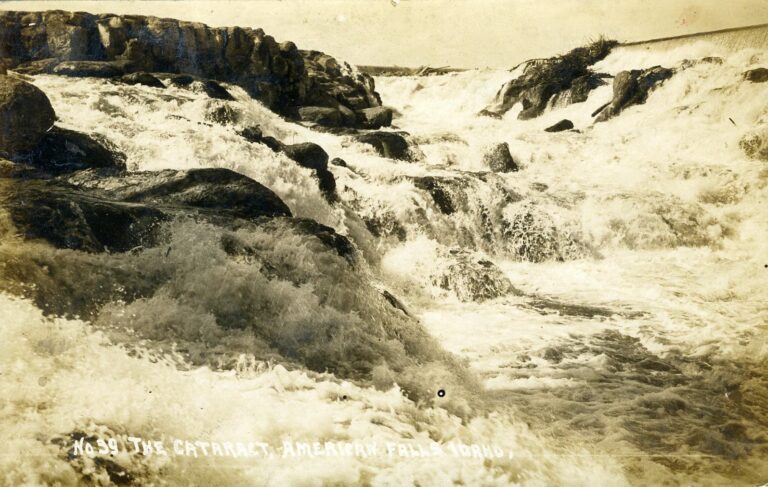
![[IDAHO-C-0037] Stanley Lake - Lady Face Falls](https://fallsdiscovery.com/wp-content/uploads/2026/09/49691108227_3f90414a4d_b.jpg "[IDAHO-C-0037] Stanley Lake - Lady Face Falls")
![[IDAHO-B-0070] Snake River - Lower Salmon Falls](https://fallsdiscovery.com/wp-content/uploads/2026/09/5569429109_8b880ebddb_b-768x482.jpg "[IDAHO-B-0070] Snake River - Lower Salmon Falls")
- On Snake River
- 11 mi from Wendell

- On Snake River
- 3 mi from Twin Falls
![[IDAHO-B-0171] Pend Oreille River - Albeni Falls](https://fallsdiscovery.com/wp-content/uploads/2026/09/28374647225_8fbbe32428_b-768x492.jpg "[IDAHO-B-0171] Pend Oreille River - Albeni Falls")
![[IDAHO-B-0110] Little Salmon River - Little Salmon Falls](https://fallsdiscovery.com/wp-content/uploads/2026/09/6534802347_1d811a409f_b.jpg "[IDAHO-B-0110] Little Salmon River - Little Salmon Falls")
![[IDAHO-A-0241] Swan Falls Dam](https://fallsdiscovery.com/wp-content/uploads/2026/09/5561354150_3b78f292a5_b-768x484.jpg "[IDAHO-A-0241] Swan Falls Dam")
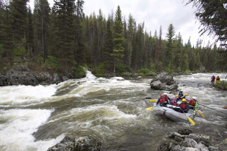

Idaho waterfalls, from the Snake River canyon to Sawtooth wilderness
Two landscapes produce most of Idaho's 249 named waterfalls. In the south, the Snake River crosses a volcanic plain and drops through a canyon the Bonneville Flood cut into rhyolite roughly 14,500 years ago; nearly every fall on the river itself has since been dammed, diverted for irrigation or turned into a hydroelectric spillway. To the north, ancient Belt Group rock near the Canadian border holds falls in wet, roadless mountain country, and the Sawtooth Wilderness adds a remote, foot-only cluster farther south.
Where the waterfalls are
The Snake River Plain carries the best-known falls through Twin Falls County, Jerome County, Power County and Bonneville County, where dams and canals have reshaped nearly every drop. East of there, the Fremont County falls on the Henrys Fork sit on the edge of the Yellowstone Plateau.
Idaho's mountain falls are harder to reach. Custer County holds the Sawtooth Wilderness and the upper Salmon River country, mostly on foot-only trails. In the north, Idaho County — the state's largest waterfall county, with 52 listings — and Clearwater County cover most of the Nez Perce-Clearwater National Forest, while Boundary County, Bonner County, Kootenai County and Shoshone County cut falls into ancient rock near the Canadian border. Southwest Idaho is different again: Owyhee County, Boise County and Elmore County hold spring-fed drops in high-desert basalt canyons on Bureau of Land Management ground.
Waterfalls worth the trip
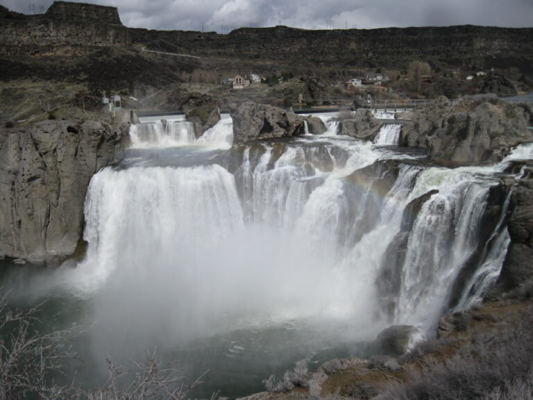
- Shoshone Falls, 212 feet over a 925-foot horseshoe rim on the Snake River, is 45 feet taller than Niagara and long called the "Niagara of the West." A drive-up city park puts the main platform about 75 feet from the nearest parking.
- Perrine Coulee Falls, about 200 feet, falls into the Snake River Canyon in the city of Twin Falls. A short walk from roadside parking passes behind the sheet of falling water.
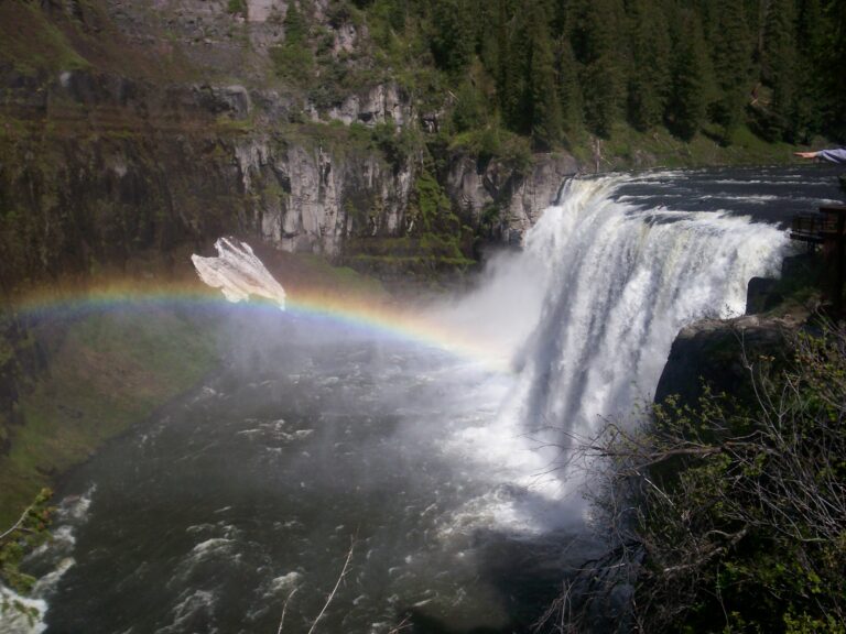
- Upper Mesa Falls, 100 feet, and Lower Mesa Falls, 60 feet, drop on the Henrys Fork and are each reached by a short walk from their own parking area.
- Goat Falls, Idaho's tallest at 615 feet, drops out of Goat Lake in the Sawtooth Wilderness on a 7.6-mile round trip with about 1,700 feet of climbing, on a free, self-issued wilderness permit.
- Copper Falls, 155 feet, is a single horsetail on Copper Creek in the Idaho Panhandle National Forests, about half a mile from the trailhead on Forest Road 2517.
- Moyie Falls, 91 feet in two tiers on the Moyie River, is a short roadside walk to a fenced overlook.
- Elk Creek Falls, 115 feet, and Lower Elk Creek Falls, 70 feet, drop through a columnar-basalt canyon reached by a day hike on Trail 740 from the trailhead near Elk River.
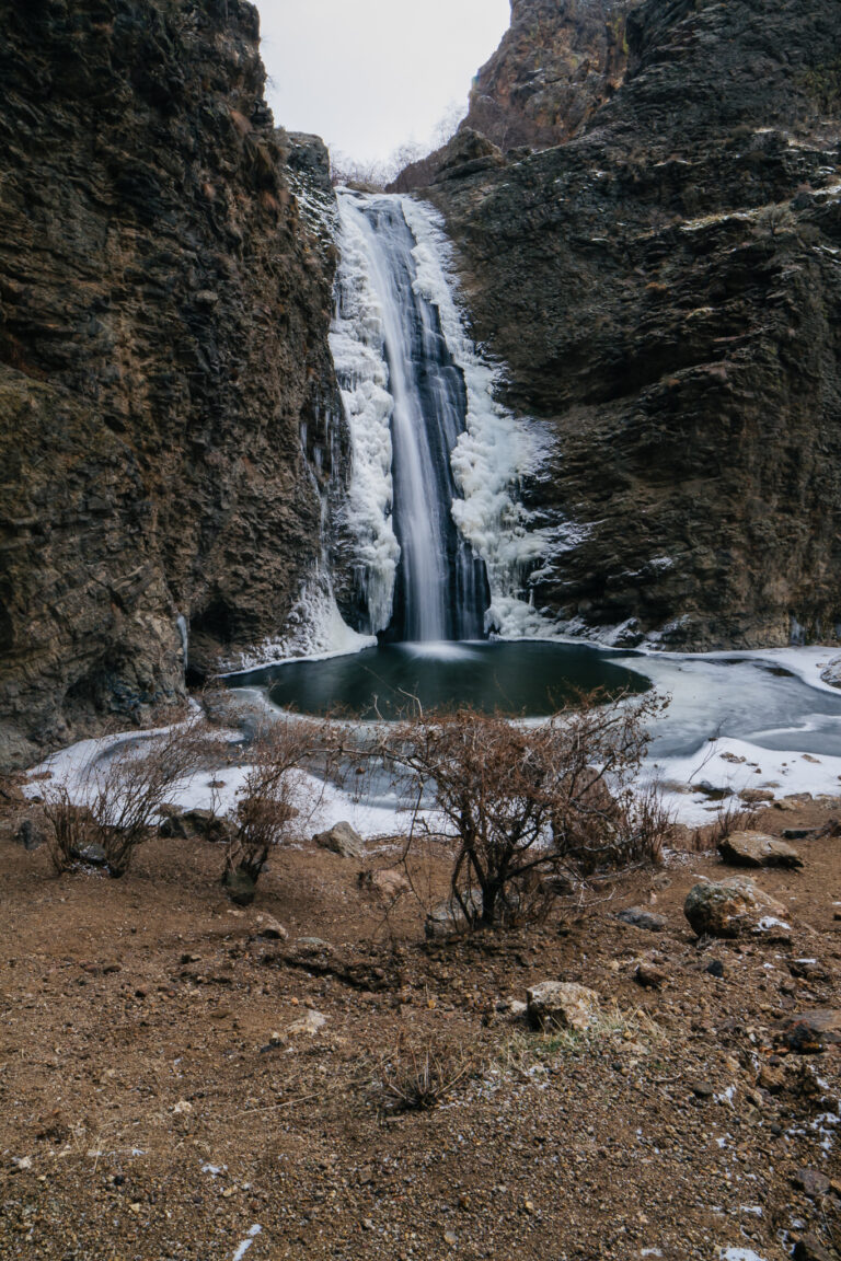
- Jump Creek Falls, 55 feet, is a spring-fed plunge with a swimming pool at the base, a short walk across Bureau of Land Management land bordered by private property.
When to go
Spring-fed desert falls and Snake River falls run on opposite clocks. Jump Creek Falls peaks between March and June, then shrinks to almost nothing by summer. On the Snake River, flow is managed rather than seasonal: Idaho Power holds Shoshone Falls to a minimum scenic flow from April through Labor Day; spring releases raise it well above that before late-summer irrigation draws it back down. Perrine Coulee runs stronger in summer, when irrigation water reaches it, but its winter icicles are a real hazard. The unplowed Mesa Falls Scenic Byway limits winter access to Upper and Lower Mesa Falls to snow travel.
Fees, permits and closures
Shoshone Falls Park charges $5 per vehicle in season, or a $25 season pass; in 2026 its ticket booth reopened April 1. The adjoining Dierkes Lake park charges $5 from March through September. Mesa Falls carries a $7 motor-vehicle entrance fee, covered by an Idaho State Parks Passport or Annual Pass; the separate Lower Mesa Falls observation site, run by the Forest Service, has no fee. Entering the Sawtooth Wilderness for Goat Falls needs a free, self-issued permit at the trailhead, and dogs must be leashed there from July 1 through Labor Day. At Jump Creek Falls, the Bureau of Land Management charges $5 for the day or $25 for an annual pass; the access road crosses private land, so stay on the signed public path.
Safety
A 16-year-old hiker died at Elk Creek Falls in September 2019 after slipping over the middle falls, and a 20-year-old man died at Jump Creek Falls in March 2017 after falling more than 70 feet near a section called Devil's Ladder. At Upper Mesa Falls, a woman survived a reported 114-foot fall while fishing in 1991. Wet basalt and granite ledges above Idaho's falls turn slick with little warning, and canyon rims are mostly unfenced outside the paved city parks; stay back from edges and out of fast current.
Waterfalls in Idaho on the map
Numbers show how many sit in that area; zoom in or click to split them, click a marker for details.
Tallest waterfalls in Idaho
- Goat Falls615 ftCuster County
- Grave Peak Falls460 ftIdaho County
- Ballinger Creek Falls415 ftIdaho County
- Lionhead Falls345 ftBoundary County
- West Rainbow Falls320 ftBonneville County
- Azure Lake Falls300 ftElmore County
- Barron Creek Falls275 ftBoise County
- Patsy Ann Falls270 ftIdaho County
- Devils Slide Falls260 ftBoundary County
- Hazard Falls260 ftIdaho County
Waterfalls by county
Idaho has named waterfalls in 25 counties. The most are in Idaho County (52), Boundary County (21), Gooding County (17), Custer County (17), Bonner County (15), Twin Falls County (15). Every county has its own page with a map and the tallest falls:
- Adams County 7
- Bannock County 5
- Blaine County 4
- Boise County 11
- Bonner County 15
- Bonneville County 5
- Boundary County 21
- Caribou County 2
- Cassia County 1
- Clearwater County 12
- Custer County 17
- Elmore County 11
- Fremont County 5
- Gooding County 17
- Idaho County 52
- Jerome County 10
- Kootenai County 1
- Lemhi County 6
- Lincoln County 2
- Owyhee County 10
- Power County 1
- Shoshone County 12
- Twin Falls County 15
- Valley County 4
- Washington County 3
Types of waterfalls in Idaho
dam (4), horsetail (4), segmented (2), plunge (2), veiling (1), historical (1). What the types mean is explained in the guide to waterfall types.
About the data
Of the 249 waterfalls in Idaho, 165 have a measured height, 71 have coordinates verified against aerial imagery and 20 have photos. Heights are the total drop as recorded by the source; falls without a measurement are listed without one. Every page has the stream, the nearest town and distance, a map with directions and a review form for photos and notes.