Waterfalls in Rhode Island
5 waterfalls in Rhode Island across 3 counties, from the USGS dataset; 1 with a measured height. The tallest is Stepstone Falls at 10 ft. All US waterfalls.
State: Rhode Island 47
- Alabama 97
- Arizona 66
- Arkansas 280
- California 1,039
- Colorado 345
- Connecticut 79
- Florida 3
- Georgia 298
- Idaho 249
- Illinois 20
- Indiana 24
- Iowa 8
- Kansas 24
- Kentucky 65
- Louisiana 6
- Maine 175
- Maryland 13
- Massachusetts 37
- Michigan 294
- Minnesota 43
- Mississippi 8
- Missouri 11
- Montana 252
- Nebraska 14
- Nevada 25
- New Hampshire 264
- New Jersey 5
- New Mexico 20
- New York 879
- North Carolina 495
- North Dakota 1
- Ohio 26
- Oklahoma 30
- Oregon 1,342
- Pennsylvania 274
- Rhode Island 5
- South Carolina 22
- South Dakota 10
- Tennessee 427
- Texas 71
- Utah 76
- Vermont 229
- Virginia 127
- Washington 2,596
- West Virginia 13
- Wisconsin 83
- Wyoming 267

- Tallest drop 5 ft
- On Wood River
- 5 mi from West Greenwich
Rhode Island's five waterfalls: mill dams on the Blackstone and two apart from it
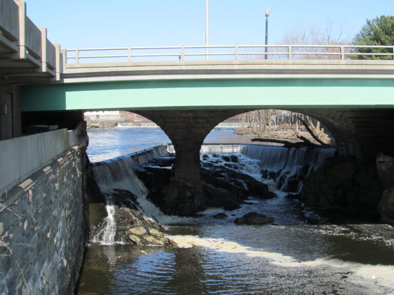
Three of Rhode Island's five listed waterfalls are mill-era drops built into dams along the Blackstone River, and the other two sit apart from that industrial river entirely, in a state forest and on Aquidneck Island.
Where the waterfalls are
Providence County holds three of the five, all on the Blackstone River's old mill-power fall line: Pawtucket Falls, where fresh water meets the tidal Seekonk River in Pawtucket; Albion Falls, in Cumberland; and Woonsocket Falls, in the mill village founded there in the 1820s.
Kent County holds Stepstone Falls, apart from the Blackstone valley in the more than 14,000-acre Arcadia Management Area, the state's largest. Newport County holds Lawton Valley Falls, on Aquidneck Island.
Waterfalls worth the trip
- Pawtucket Falls marks the spot the Narragansett name translates as "place of the falls"; Joseph Jenckes Jr. built a water-powered forge here in 1671, and Samuel Slater's spinning mill followed in 1793. The National Park Service's Old Slater Mill site nearby is free and open dawn to dusk year-round, with parking and a viewing spot for the falls.
- Stepstone Falls, 10 feet on the Wood River, is reached by the roughly one-mile Ben Utter Trail through Arcadia Management Area.
Access
Old Slater Mill charges no admission; building tours run Thursday through Sunday from May 17 through October 31, 2026, on the hour and half-hour from 10:30 a.m. to 2:30 p.m.
Safety
Pawtucket Falls sits beside the Main Street Dam, a masonry structure built in 1896 to power a mill; dams like it are not built for public access, and visitors should keep to the designated viewing areas rather than the spillway itself.
Waterfalls in Rhode Island on the map
Numbers show how many sit in that area; zoom in or click to split them, click a marker for details.
Tallest waterfalls in Rhode Island
- Stepstone Falls10 ftKent County
Waterfalls by county
Rhode Island has named waterfalls in 3 counties. The most are in Providence County (3), Newport County (1), Kent County (1). Every county has its own page with a map and the tallest falls:
Types of waterfalls in Rhode Island
cascade (1), tiered (1), dam (1). What the types mean is explained in the guide to waterfall types.
About the data
Of the 5 waterfalls in Rhode Island, 1 have a measured height, 4 have coordinates verified against aerial imagery and 1 have photos. Heights are the total drop as recorded by the source; falls without a measurement are listed without one. Every page has the stream, the nearest town and distance, a map with directions and a review form for photos and notes.