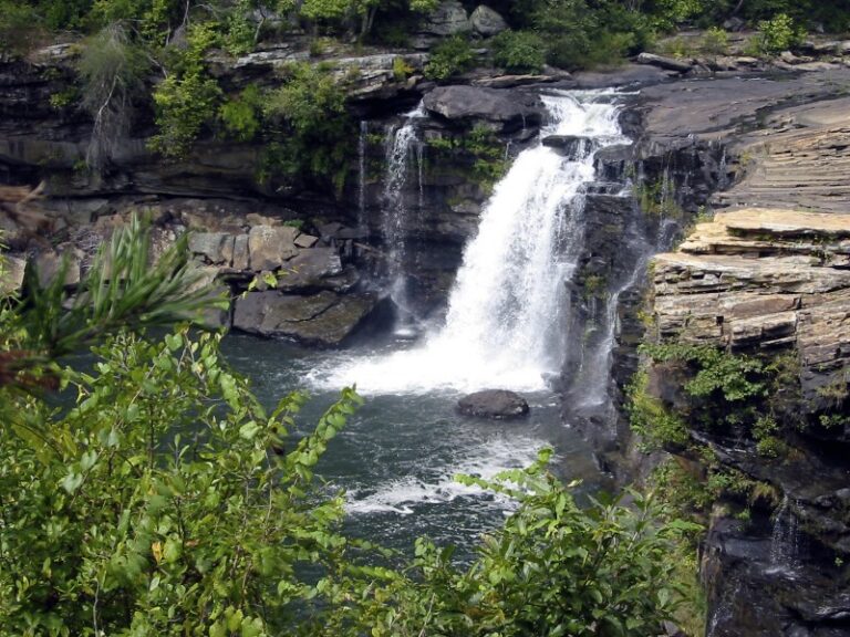
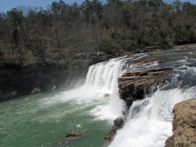
At the head of Little River Canyon National Preserve in northeast Alabama, Little River Falls drops 30 feet across sandstone bedrock on the Cherokee–DeKalb county line. A short walk from a free parking lot on Alabama Highway 35 provides access to the overlook.
The falls
The river spills in a single broad drop over sandstone bedrock. The drop measures 30 feet, though older surveys showed 45 feet, a figure still used on the preserve's planning pages. The falls are rain-fed: winter and spring storms bring them to full force, while in summer and early fall the flow drops and exposes sandstone ledges and pools.
Getting there
Park in the paved lot on the west side of the Alabama Highway 35 bridge. It holds about 100 cars plus spaces for RVs and larger vehicles, with restrooms, picnic tables and grills. Entry is free, and the area closes after dark. From a gazebo, a boardwalk splits into a step-free, accessible route and a shorter route over rock steps; either reaches the viewing platform in a few minutes. On late spring and summer weekends the lot is often full by 11 a.m., and rangers close it until spaces open; overflow parking is at the Little River Canyon Center, which is closed on Mondays. A separate gravel pullout, the Little River Falls Overlook, has a 100-foot accessible boardwalk with a distant view. More details are on the National Park Service page.
When to go
Winter and spring give the strongest flow. Summer brings low water, wading pools above the falls and a swimming hole below. Morning sun often produces a rainbow in the mist in autumn.
On site
Visitors must stay at least 50 feet from the edge of the falls and may not climb railings or fences. Rescues and deaths have occurred here. In June 2020 an 18-year-old floating above the falls was carried over and drowned; visitors should stay out of the water when it is high or swift, and keep well away from the lip. Dogs are allowed on a leash no longer than six feet, including in the water.
History and name
Native Americans and early settlers were drawn to the falls, and the Hill family once ran a mill here. In 1838 a portion of the Trail of Tears crossed the Little River just above the falls.
Nearby
From the same lot, a three-quarter-mile trail with 137 stone steps leads down to Little Falls, formerly called Martha's Falls. Brooks Branch Falls is about 0.9 mile away, Gregg's Two Falls about 2.8 miles, and Graces High Falls and Falls Branch Falls about 4 miles.
Distances are straight-line.