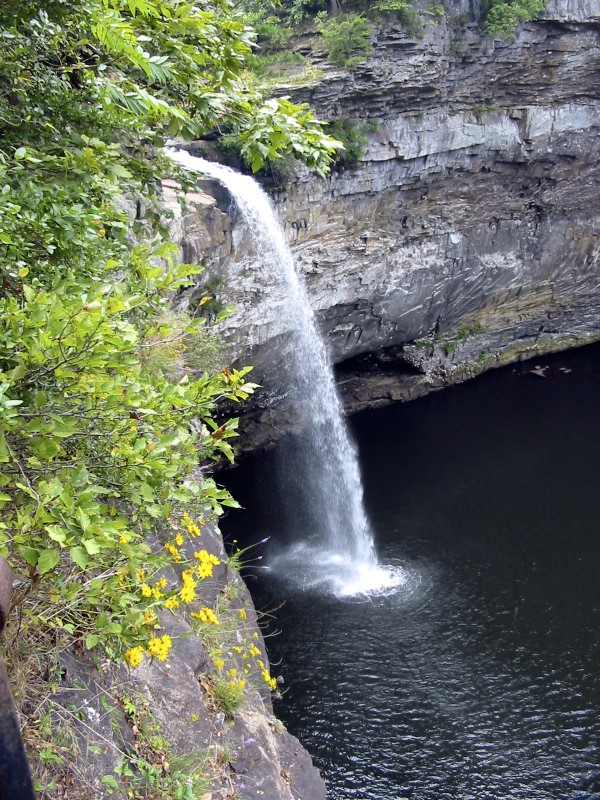
De Soto Falls is a two-tier waterfall on the West Fork Little River near Mentone in DeKalb County, Alabama, dropping about 88 feet below an old hydroelectric dam. It sits in a separate day-use area of DeSoto State Park on Lookout Mountain, about 10.3 miles northeast of Fort Payne.
The falls
Below A. A. Miller Dam the river falls in two drops, the taller about 71 feet. Lidar puts the total at about 88 feet; the park's own trail map gives 107 feet, and Wikipedia gives 104 feet. The higher figure probably includes the dam, and the dam regulates the flow.
Getting there
The falls area lies off Lookout Mountain Parkway, about seven miles from the main DeSoto State Park. Parking is $5 per vehicle, and a $50 annual pass covers this area only. The area is open in daylight and closes at dusk. A paved path with about 50 concrete steps leads down to an overlook with a side view of the falls; the upper falls and the dam can be seen without taking the steps. The park map also shows the Overlook Trail (0.45 mile one way), the River Trail (0.70 mile) and the Bluff Trail (0.32 mile), on terrain it rates moderate to strenuous. The lot often fills on weekends, roadside overflow parking isn't allowed, and there is no room for RVs or trailers.
When to go
Water is highest in winter and early spring. In summer and fall the flow drops, and the falls sometimes run dry.
On site
Swimming is allowed in the river above A. A. Miller Dam, with no lifeguard on duty. On Memorial Day 2019 a 40-year-old man drowned after jumping at the falls, in an area officials said was marked with barriers and warning signs. The park asks visitors to stay on the trails and off neighboring private property; camping isn't allowed.
History and name
The falls are named for the Spanish explorer Hernando De Soto.
Nearby
Little Falls on Seymour Branch is about 2.3 miles away. Indian Falls and Azalea Cascade, both on Laurel Fork, are about 3.8 and 3.9 miles away, and Lodge Falls is about 3.8 miles off.
Distances are straight-line.