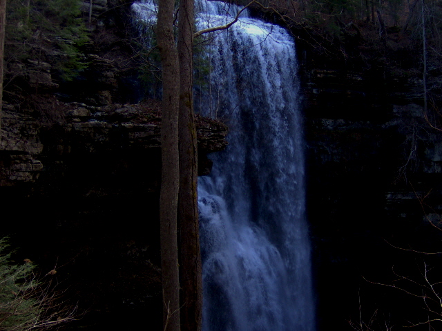
Virgin Falls is a 120-foot plunge waterfall in White County, Tennessee, where a stream flows out of a cave, drops off a cliff and disappears underground again. It is the centerpiece of Virgin Falls State Natural Area, a 1,157-acre tract on the edge of the Cumberland Plateau, reached only by a strenuous hike.
The falls
The water comes out of Virgin Falls Cave about 150 feet upstream, runs roughly 10 feet across the rock and then plunges over the cliff on the south slope of Little Chestnut Mountain into Virgin Falls Pit, a sink that feeds cave passages draining to a spring at the foot of the escarpment. The World Waterfall Database puts the single drop at about 120 feet from lidar; earlier surveys listed 110 feet. Behind the falls, the cave runs about 3,000 feet southwest, its main passage some 30 feet wide and 40 feet high.
Getting there
The trailhead and parking are at 2080 Scotts Gulf Road near Sparta. Virgin Falls is 4 miles one way, making the full outing around 9 miles. The trail descends about 900 feet over steep, rocky, uneven ground, all of which has to be climbed on the way out; allowing 5 to 9 hours and starting early is advised for the very strenuous terrain. At 1.5 miles a cable crossing spans Big Laurel Creek; don't cross it in flood. The area is managed by Scott's Gulf Wilderness State Park and is open to the public. Tennessee state parks charge no entrance or parking fee.
When to go
Flow depends on rain. In late winter and early spring the falls become a torrent, while in late summer and early fall they can shrink to a trickle.
On site
Leashed dogs are allowed, and fishing is permitted. The caves are closed to recreation because of white-nose syndrome in bats. Backcountry camping is allowed only at designated sites booked online, and never above the falls. The footing is rough: in August 2025 rescuers carried out a visitor injured in a fall in the natural area.
History and name
Bowater Pulp and Paper set the land aside as a Pocket Wilderness in 1973, and the state bought it in 2012, partly with a U.S. Fish and Wildlife Service grant. Geologist Nicholas C. Crawford used dye tracing to show that the water comes from Lost Creek Cove, a closed karst basin nearly three miles north whose sinking creeks also feed Lost Creek Falls.
Nearby
The same trail passes Big Laurel Falls, about 1.3 miles away, and Big Branch Falls, about 2 miles. Sheep Falls, also known as Sheep Cave Falls, is about 0.4 mile from Virgin Falls, and Lost Creek Falls, fed by the same underground system, is about 1.8 miles.
Distances are straight-line.