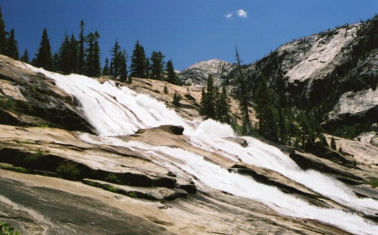
Waterwheel Falls is a 380-foot cascade on the Tuolumne River in the Grand Canyon of the Tuolumne, Yosemite National Park, California, about 9 miles below Tuolumne Meadows. At high water, ledges in the granite fling the river up and back on itself in great turning wheels of spray, the effect that gave the falls its name.
The falls
The Tuolumne slides and leaps down at least four steps over about 1,200 feet of granite, averaging some 75 feet wide. A lidar measurement puts the total at 380 feet; earlier surveys listed 360 feet. The "waterwheels" form at the first and largest ledge in early summer, when snowmelt is high and wind lifts the spray back up into the falling water.
Getting there
The trail starts at the Lembert Dome parking area on Tioga Road at the east end of Tuolumne Meadows and follows the gated road west, then the trail down the river to Glen Aulin, about 6.5 miles. Below Glen Aulin the trail drops steeply past California Falls and LeConte Falls to reach Waterwheel Falls about 3 miles farther. The round trip is roughly 18 miles with about 2,700 feet to climb back on the return, so many hikers camp at Glen Aulin. Day hikes need no permit; overnight trips require a wilderness permit, most of them allocated by lottery 24 weeks ahead. The Glen Aulin High Sierra Camp offers tent cabins in summer.
Yosemite admission is $35 per vehicle for seven days, plus $100 per person for non-US residents aged 16 and older unless they hold an Annual or America the Beautiful Pass. No timed-entry reservation is required in 2026.
When to go
Tioga Road opens once the snow is cleared; in 2026 it opened on May 15, the earliest in 16 years. The waterwheels are at their best in June and early July, when the Tuolumne is running high with snowmelt. The river keeps the falls flowing all summer, though with far less spray.
On site
Stay back from the edge of the river, which is fast and cold at high water. This is bear country: use the food lockers at the trailhead and carry a bear canister if camping.
History and name
An 1874 guidebook called it Rocket Cascade, and an 1895 map labeled it Le Conte Cascade before that name moved to the falls upstream. By 1911 Waterwheel Falls was in common use.
Nearby
Lower Waterwheel Falls is about 0.3 mile away, Le Conte Falls about 0.5 mile and California Falls about 1.3 miles, all on the same trail.
Distances are straight-line.