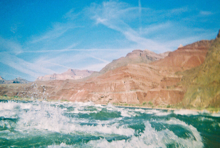
Hance Rapids is a Class IV+ rapid on the Colorado River in Grand Canyon National Park, Arizona, at about river mile 77 in Coconino County. It is rated an 8 on the Grand Canyon scale and is reached by river trip or on foot from the South Rim, at the foot of the New Hance Trail.
The falls
Hance is a boulder rapid where the river enters the Inner Gorge, running through a long, boulder-choked section with several drops and little room to recover between them. Flow is read on the Colorado River at Lees Ferry gauge, with a recommended range of 2,000 to 48,000 cfs, split into low (2,000 to 11,000), medium (11,000 to 21,000) and high (21,000 to 48,000) flows.
Getting there
River trips launch at Lees Ferry and pass Hance on the way through the canyon; there is no road to the rapid. Private (noncommercial) trips go through the park's weighted river permit lottery: a $25 lottery application, a $90 permit per participant and a $20 entrance fee per participant aged 16 and older, with a $200 or $400 deposit depending on trip size.
On foot, the New Hance Trail runs 6.5 miles one way from Highway 64 at 6,982 feet to Hance Rapids at 2,560 feet. The trailhead is about 16 miles east of the junction of Desert View Drive and the South Entrance Road; park at Moran Point or at the first pullout east of the Buggeln picnic area, then walk the road to a quarter-mile access path. The trail is unmaintained, requires route finding and scrambling, and is recommended only for highly experienced canyon hikers; the Park Service calls it possibly the most difficult established trail on the South Rim.
When to go
The Colorado River is the only reliable year-round water on the trail. Spring water often collects in pools in Red Canyon from late fall through April.
On site
Boaters scout from river right, where a difficult portage is also possible. On February 19, 2026, a 30-year-old boater on a noncommercial trip entered the river at the top of Hance Rapid and died despite CPR by his group. Hikers camp at a sandy beach just upriver, which boaters also use, or at camps below the dune downstream of Red Canyon. When the river runs red or brown, settle the silt before treating the water. The Tonto Trail and Escalante Route junctions near the river are unmarked.
History and name
The rapid takes its name from John Hance, who in 1883 became the first European American to settle at the Grand Canyon and later worked as a guide and storyteller. He built the New Hance Trail down Red Canyon after rockslides closed his earlier trail, and today's route closely follows its 1894 alignment. Hakatai and Cardenas rocks are exposed at the rapid.
Nearby
Nevills Rapids is about 1.1 miles away and Sockdolager Rapids about 1.9 miles. Unkar Creek Rapids is about 3.6 miles away and Grapevine Rapids about 4.7 miles. Moran Point, where the hike starts, is on Desert View Drive.
Distances are straight-line.