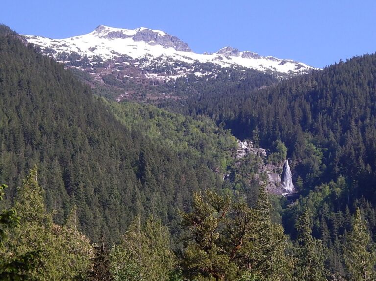
Big Devil Falls is a 350-foot tiered waterfall on the flank of Big Devil Peak in Skagit County, Washington, high above the Skagit River in the North Cascades. Its main 200-foot plunge can be seen from a pullout on Highway 20.
The falls
An unnamed glacier-fed stream drops in four tiered plunges, with the main drop measuring about 200 feet. The stream is about 15 feet wide and averages around 40 cubic feet per second at high flow, falling to nothing at low flow. The creek descends nearly 2,600 feet in its last mile, so more falling water may lie hidden above and below the measured series.
Getting there
The falls are viewed from Highway 20 along the Skagit River, about 4 miles west of Newhalem or 10 miles east of Marblemount. A roadside pullout beside a cliff on the opposite side of the road offers a viewing vantage. No trail to the base is documented.
When to go
April to July provides the best viewing months; flow drops off through summer and can run dry. On clear days the glaciers that feed the stream show up above the falls.
On site
From the highway only the uppermost section, the 200-foot main plunge, is in view; the terrain in between hides most of the lower tiers.
History and name
Big Devil Falls is an unofficial name, derived from Big Devil Peak, the mountain the stream drains.
Nearby
Lower Big Devil Falls is about 0.4 mile away, Lower Swayel Falls on Sky Creek about 1.2 miles, and Purgatory Falls on Damnation Creek about 1.5 miles.
Distances are straight-line.