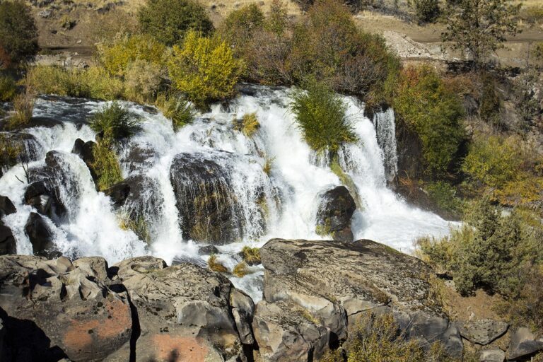
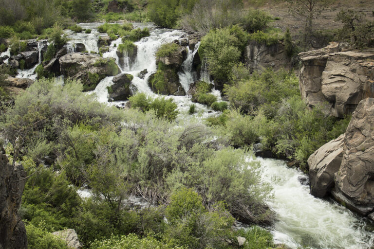
Cline Falls is a 20-foot segmented cascade on the Deschutes River in Deschutes County, Oregon, about 4 miles west of Redmond, just north of where Oregon Route 126 crosses the river. The World Waterfall Database, which surveyed it in person, calls it one of the taller waterfalls along the Deschutes.
The falls
The river splits into several channels cut into a broad ledge of basalt and drops about 20 feet across a front roughly 50 feet wide. Flow is regulated by irrigation diversions upstream: around 200 cubic feet per second at high water and near zero at low water, and the falls can run dry in dry years. The canyon walls are basalt rimrock with western juniper, sagebrush and bitterbrush above, and willow, alder and cattails along the water.
Getting there
Cline Falls State Scenic Viewpoint, a 9-acre day-use park run by Oregon Parks and Recreation Department, sits on the east bank about a quarter mile upstream of the falls. From the parking area a riverside path leads downstream to the falls. A day-use parking permit is required and can be bought on site: $10 a day for Oregon residents and $12 for nonresidents; visitors arriving on foot or by bike are exempt. A long pullout by a fence along Highway 126 also offers a view of the falls.
When to go
May to July are the best months.
On site
The park has picnic tables, shade, restrooms and fishing access to the river. Unsupervised swimming is allowed, and a popular summer swimming hole lies between the park and the falls. The park warns of swift currents and hidden obstructions and requires a life jacket to swim, float, paddle or boat. Several people have died going over the falls; swimmers, tubers and paddlers should stay well upstream of the lip. Climbers use the basalt face on the east side.
History and name
The falls are named for Dr. Cass A. Cline, a pioneer dentist who owned the surrounding land and founded the Falls Irrigation Company in 1892. A small town called Cline Falls grew on the west bank, with a post office from 1904; it faded after the railroad went elsewhere in 1911, and the post office closed in 1919. In 1901 Cline sold land to F.T. Hurlburt, who financed a power plant supplying Redmond and Prineville; Pacific Power and Light later bought it. After the power lease expired in 2010, the plant was demolished in 2015 and the dam and canal were removed in 2017, returning the river to its natural channel. The Highway Commission acquired the park land in 1936 as a gravel pit and handed it to the Parks Division in 1956.
Nearby
Also on the Deschutes, Awbry Falls is about 5.9 miles away and Big Falls about 6.7 miles. Steelhead Falls, a third Deschutes fall, is about 9.7 miles away.
Distances are straight-line.