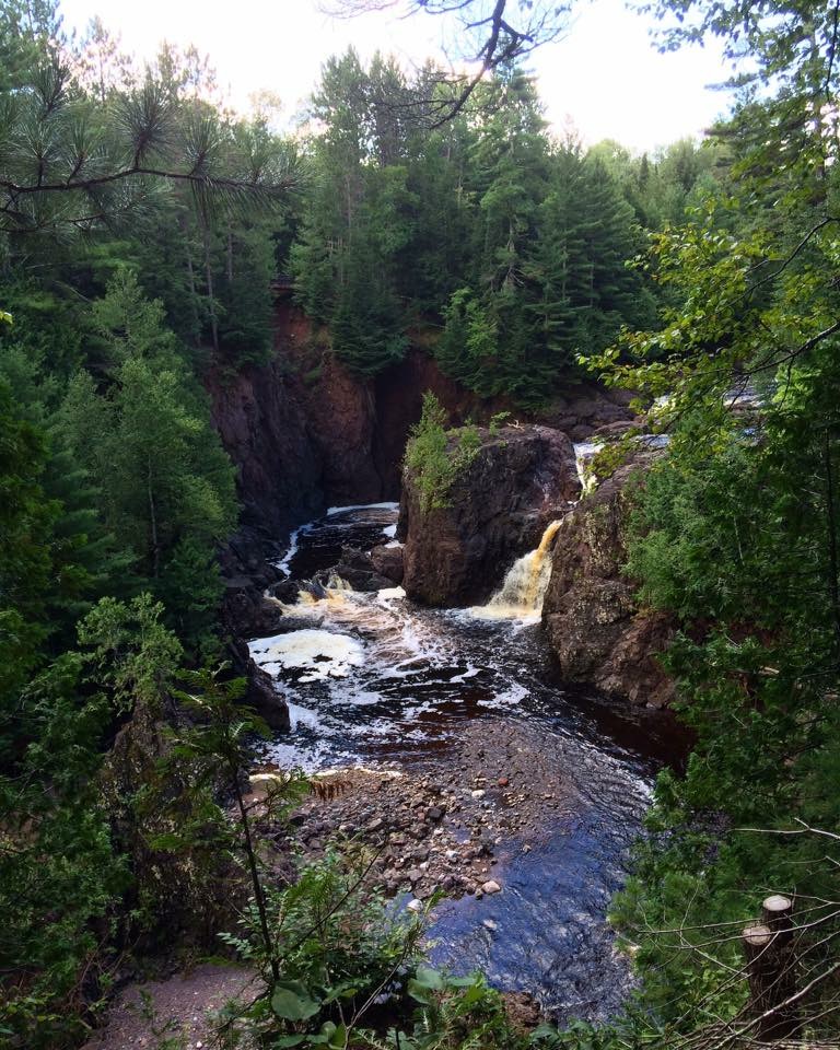
Copper Falls is a 28-foot segmented waterfall on the Bad River in Copper Falls State Park, Ashland County, Wisconsin, where the river pours over black lava into a steep-walled canyon. It can be seen from the park's Doughboys Nature Trail, which also passes Brownstone Falls.
The falls
Copper Falls marks the Bad River's first drop in about two miles of canyon, with gorge walls rising 60 to 100 feet on either side. The river runs over dark lava rock here and splits as it falls in a segmented steep cascade with a single drop of 28 feet, supported by lidar measurements. Earlier surveys listed 29 feet.
Getting there
The falls are inside Copper Falls State Park near Mellen. The park is open year-round from 6 a.m. to 11 p.m., and every vehicle needs a Wisconsin state park admission pass: $13 a day for Wisconsin plates ($3 for residents 65 and older) and $16 for out-of-state vehicles, or $28 and $50 for 12 months.
The Doughboys Nature Trail, a 1.7-mile loop, starts near the concession building and follows the Bad River and the Tyler Forks around the heart of the park, with views of Copper Falls and Brownstone Falls. A half-mile universal-access section with a crushed-granite surface has its own trailhead on the access road and leads to an overlook of Copper Falls and a historic CCC bridge.
When to go
The park is open all year, but part of the Doughboys trail closes in winter because ice and snow make the rock stairs slippery.
On site
The falls are seen from established overlooks. About half a mile of the river gorge is closed to public access because of its erosion risk and scenic value. Pets are not allowed on the Doughboys Nature Trail, which is the trail to Copper and Brownstone Falls. The park's designated swimming spot is Loon Lake.
History and name
Prospectors dug exploratory copper workings in the canyon near the falls by the early 1860s, and in the late 1800s and early 1900s Wells M. Ruggles' crew sank a shaft at the site of the present Bad River footbridge but found little copper. Veterans returning from the First World War built the first trails and bridges in 1920 and 1921; the state park was created in 1929, and CCC and WPA crews developed it in the late 1930s.
Nearby
Brownstone Falls, where the Tyler Forks drops into the Bad River canyon, is about 0.2 mile away and shares the same loop trail. Granite Falls, farther along the Bad River, is about 1.9 miles away, and Wren Falls, on the Tyler Forks, about 6.6 miles. The park's CCC 692 trail climbs to a 65-foot observation tower.
Distances are straight-line.