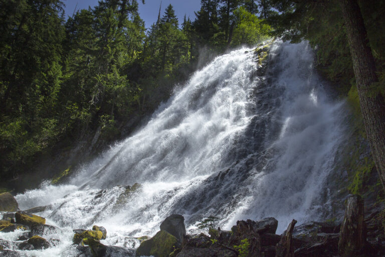
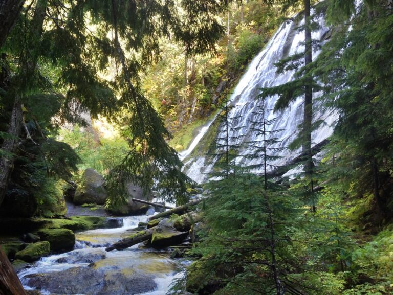
Diamond Creek Falls is a 134-foot veiling horsetail waterfall on Diamond Creek in the Willamette National Forest of Lane County, Oregon, a short way from Salt Creek Falls off Highway 58. The creek spreads into a wide, lacy fan over grooved basalt, and a loop trail from the Salt Creek Falls day use area reaches both a viewpoint and the base.
The falls
Diamond Creek widens to about 85 feet as it slides down channeled basalt at a steep angle in a single drop. A July 2023 field survey measured it at 134 feet, a figure that lidar from the State of Oregon generally agrees with; many guides still say 90, and Wikipedia gives 120. The falls look wide from below and tall from above. Downstream, the creek drops again at Lower Diamond Creek Falls before joining Salt Creek.
Getting there
The trail starts at the Salt Creek Falls Observation Site, about 5 miles west of Willamette Pass; from Highway 58, turn onto Forest Road 5893 and follow the signs. The Diamond Creek Falls Trail crosses Salt Creek on a footbridge and follows the rims of the Salt Creek and Diamond Creek canyons. The full loop is 3.4 miles; one trail guide measures 3.5 miles with about 550 feet of gain. At about 1.25 miles a spur on the right descends a quarter mile to the base.
From May 1 to October 31 parking takes a $5 day pass or a Northwest Forest Pass. In winter a snow gate closes the main lot and visitors park at the adjoining Salt Creek Sno-Park, which requires an Oregon Sno-Park permit.
When to go
April through July are the best months; flow can drop to almost nothing late in the season. Rhododendrons bloom along the trail in early to mid-June, and mosquitoes can be thick early in the season. In winter the loop is a snowshoe route, and the steep side trail to the base is rugged under snow.
On site
An upper viewpoint looks across at the falls. The spur to the base drops steeply down a log stairway and crosses a large cedar log footbridge, then ends in a misty grotto among boulders and loose rock; hikers report the rocks and log steps are slippery when wet. Dogs are allowed on leash, and the trailhead has a pit toilet. A short side path near the start leads to Too Much Bear Lake.
History and name
The Northwest Waterfall Survey suggests the creek may be named for John Diamond of Coburg, who helped open a road along the Middle Fork Willamette River for emigrants. Nearby Diamond Peak carries his name after he climbed it in July 1852 with a road-viewing party.
Nearby
Lower Diamond Creek Falls is about 0.4 mile away and visible from the loop's rim viewpoints. Salt Creek Falls, about 0.8 mile away, has a railed overlook near the trailhead, and Fall Creek Falls is about 1.1 miles away.
Distances are straight-line.