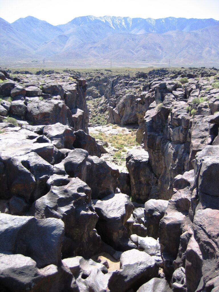
Fossil Falls is a dry waterfall in Inyo County, California: a gorge of water-polished basalt where the Owens River once poured over a lava flow at the foot of the Sierra Nevada. Usually no water runs here at all. The attraction is the sculpted rock, and the Bureau of Land Management protects the site as an Area of Critical Environmental Concern.
The falls
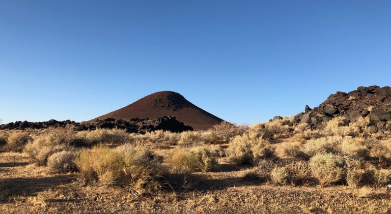
During the last ice age, meltwater from the Sierra Nevada filled large lakes and fed the Owens River, which ran south toward Indian Wells Valley. Lava from the Coso volcanic field and the Red Hill cinder cone repeatedly pushed the river off course, and where it spilled across basalt it smoothed the rock into curving chutes and drilled deep round potholes, some over 5 feet wide and 20 feet deep. The main dry drop measures about 70 feet. The site remains perennially dry, flowing for a few hours at most after thunderstorms.
Getting there
From US 395 about 25 miles north of Ridgecrest, just past Little Lake, turn east on Cinder Road toward the red cone of Red Hill. The rocky gravel road leads 1 mile to the Fossil Falls junction, then another mile past the BLM campground to a small lot for about 15 cars with a pit toilet. A flat, rocky quarter-mile path leads from the lot to the rim, about 0.6 mile round trip with 50 feet of gain. Day use is free. The campground has 11 first-come sites at $6 a night, with drinking water and a 14-day limit.
When to go
Summer highs reach 100 to 120 degrees and winter temperatures can drop below freezing. Since the channel is dry, season does not change the view.
On site
The rim is an easy walk, but getting down into the gorge means scrambling on smooth basalt that is slippery; visitors should not descend anything they cannot climb back up. The walls are also used for rock climbing and rappelling. Rattlesnakes and flash floods from upstream storms pose hazards in the area. Cell service is unreliable, and the nearest supplies are in Ridgecrest or Lone Pine.
History and name
The Coso people and later the Little Lake Shoshone lived here, chipping tools from Coso obsidian; flakes still litter the ground, and a petroglyph of an antelope or bighorn has been reported on the canyon wall. The site was listed on the National Register of Historic Places in 1980, the same year the BLM designated the protected area.
Nearby
Manter Creek Falls is about 19 miles away, Lower Taylor Creek Falls about 19.6 miles and Taylor Creek Falls about 21.1 miles.
Distances are straight-line.