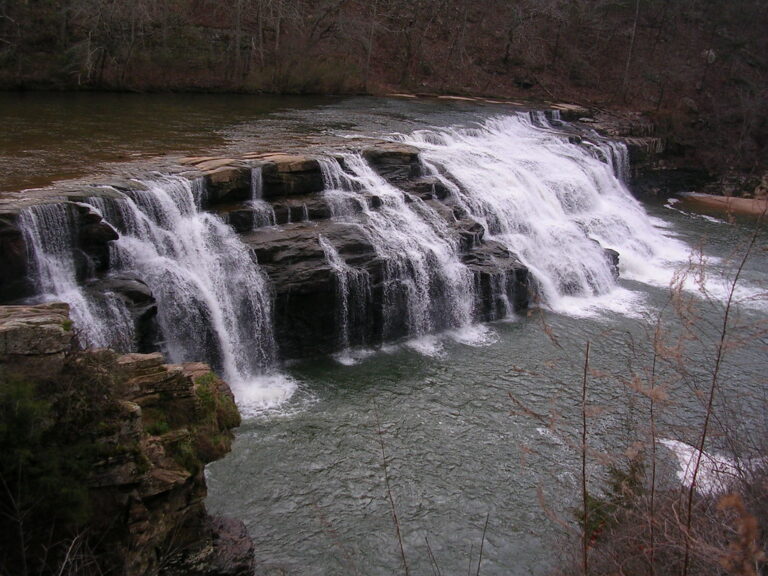
On High Fall Branch in Talladega National Forest, Clay County, Alabama, High Falls drops about 50 feet in tiered plunges outside Cheaha State Park.
The falls
A lidar survey confirms the total at about 50 feet, falling in two main steps of roughly 20 and 25 feet. Hikers on the route instead count three visible segments, including upper cascades of 10 and 15 feet; the two counts have not been reconciled.
Getting there
High Falls is identified as a Talladega National Forest destination outside Cheaha State Park. One 2022 account reaches it from the High Falls Trailhead on High Falls Drive near Lineville, a 0.5-mile out-and-back hike rated moderate to difficult, with steep climbs, wood-and-steel stairs, and a stream crossing. An earlier route instead runs 0.5 mile one way from the Lower Odum Scout Trail parking area, via a 0.3-mile spur off County Road 12. Current road conditions, fees, and permit requirements are not documented.
When to go
Winter and early spring are the recommended season; summer flow is described as much reduced.
On site
The stream crossing on the 2022 route can become too swift to cross safely after heavy rain. Rock at the falls is slippery, and the approach follows a steep ravine.
Nearby
Cheaha Falls is about 5.5 miles away, Devils Den Falls about 6.1 miles, and Shinbone Falls, on Fall Branch, about 6.8 miles.
Distances are straight-line.