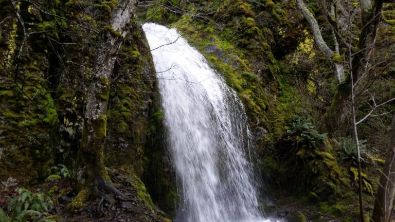
Lancaster Falls is a 410-foot tiered waterfall on Wonder Creek in Hood River County, Oregon, on the cliffs just west of Starvation Creek State Park in the Columbia River Gorge. Its lowest tier spills right beside the paved Historic Columbia River Highway State Trail, while the tall upper plunge stays mostly out of sight behind the trees.
The falls
Wonder Creek rises from a mountain spring, so the flow is small but steady. A survey in person describes a 255-foot plunge over a mossy cliff, a cascade of about 120 feet through a narrow slot and a final 35-foot drop next to the trail, 410 feet in all. Earlier surveys listed 303 feet. From the trail only the lower part is visible.
Getting there
Park at Starvation Creek State Park, off I-84 midway between Cascade Locks and Hood River. The lot is reachable only from the eastbound lanes at exit 55; from the east, use exit 51 (Wyeth) and double back. Oregon State Parks requires a day-use parking permit: $10 a day for Oregon residents, $12 for nonresidents, or $60 and $75 for 12 months. Federal recreation passes are not accepted.
From the lot, head west on the paved state trail. Friends of the Columbia Gorge lists the walk as easy, 1.6 miles out and back with 100 feet of gain, passing Starvation Creek Falls, Cabin Creek Falls and the Hole-in-the-Wall overlook before reaching Lancaster Falls at 0.8 mile. The trailhead has restrooms. The Starvation Ridge Cut-Off has been closed by a washout since August 7, 2023; the state trail and the Mount Defiance Trail remain the ways west.
When to go
The spring source keeps the falls running all year. From late autumn to early spring, with the leaves down, more of the upper drop shows through the trees.
On site
The viewpoint is on the paved trail at the foot of the lowest tier. Reaching the upper falls means a steep, unstable scramble, with poison oak growing thickly; wear long pants. Dogs must stay on a leash no longer than 6 feet.
History and name
The Oregon Board of Geographic Names named the falls in 1970 for Samuel C. Lancaster, the engineer who designed the Columbia River Highway.
Nearby
Hole-In-The-Wall Falls is about 0.2 mile away, Cabin Creek Falls about 0.5 mile and Starvation Creek Falls, beside the parking lot, about 0.9 mile. The state trail continues west to Wyeth.
Distances are straight-line.