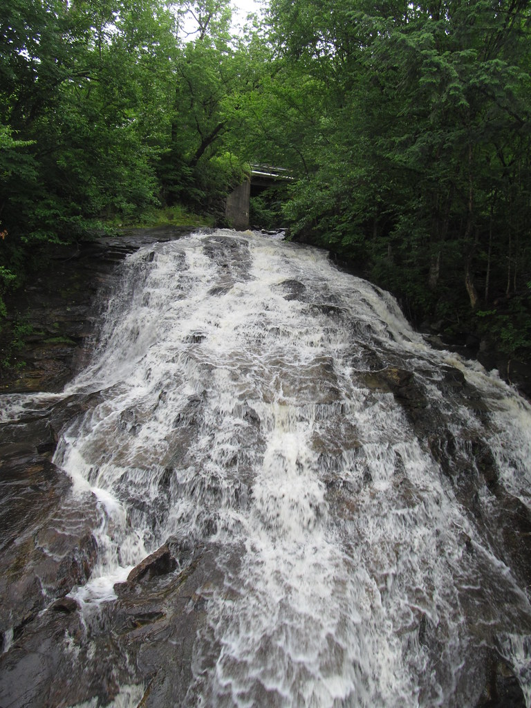
Marshfield Falls is a 115-foot series of sliding cascades on Marshfield Brook in Washington County, Vermont, just outside Marshfield village. Two concrete road bridges cross the falls, and the view from them is the only public one.
The falls
The World Waterfall Database, which surveyed the falls in person, measures 115 feet of steep sliding cascade over a run of about 500 feet, split into sections by the bridges. Its standout is a broad veil that slides down a convex ledge and fans out to nearly three times its width at the top. A lower falls of about 40 feet divides into a plunge on the left and a staircase of cascades on the right; the upper section is taller, narrower and in deep shade. Earlier measurements put the height at 140 feet. Lidar shows further cascades above and below the viewed sections.
Getting there
Both sections are seen from the Upper and Lower Depot Road bridges near Marshfield village. The land on either side of the brook is private, so stay on the road. There are no parking pull-offs at the upper section.
When to go
Spring snowmelt brings the best flow, when water covers the whole width of the bedrock; in drought the brook thins considerably. April through November is the suggested season.
On site
This is a roadside stop with no hike. Dogs are allowed, and there is no swimming. The upper cascade is heavily shaded; a wide-angle or standard lens is recommended.
History and name
The town was chartered in 1790 by the independent Republic of Vermont and named for Isaac Marsh. When the Montpelier and Wells River Railroad arrived in 1873, a station was built on Depot Road near the village. In late May 2011, floodwater overtopped the Lower Depot Road bridge and washed out the road.
Nearby
Mollys Falls on Mollys Brook is about 1.3 miles away, Power Plant Falls on the Winooski River about 1.4 miles, and East Calais Cascades on the Kingsbury Branch about 4 miles. Hardwick is about 11 miles north.
Distances are straight-line.