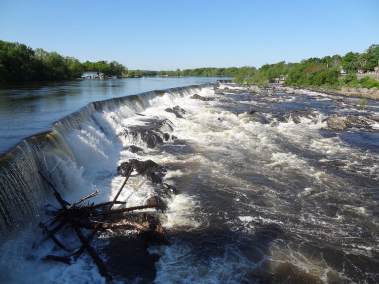
Pawtucket Falls is a set of bedrock rapids on the Merrimack River in Lowell, Middlesex County, Massachusetts, dropping about 15 feet. The fall of the river here drew the investors who built Lowell in the 1820s, America's first planned factory town, and a dam now controls the flow.
The falls
The database describes a long series of rapids over exposed bedrock stretching about two-thirds of a mile, and does not count it as a waterfall under its criteria. The Lowell National Historical Park measures the river's descent differently, at 32 feet over about a mile, the drop that powered the mills. The Pawtucket Dam, a stone structure built in the 1820s and enlarged through the 1840s, carries five-foot wooden flashboards and can send the whole Merrimack into Lowell's canals.
Getting there
The documented public viewpoint is Spalding House Park at 383 Pawtucket Street, with parking behind the house; the Lowell Parks & Conservation Trust describes a view of the falls from the grounds. Stairs at the back of the park lead down to state and national park land along the river.
The National Park Service has also offered ranger-led riverboat tours past the Pawtucket Falls Dam from the UMass Lowell Bellegarde Boathouse at 500 Pawtucket Boulevard. Fees apply and registration is through Recreation.gov; parking at the Vandenberg Esplanade lot and along Pawtucket Boulevard is free.
When to go
Because the dam can divert the entire river into the canal system, the rapids are dry under normal conditions.
On site
The trails in Spalding House Park are wheelchair accessible; for step-free access to the riverside below, use the Mammoth Street entrance. The house itself was once the Moses Davis Inn, built to lodge travelers who had to carry their boats around the falls.
History and name
Each spring the Pennacook met at the falls to fish by day and trade by night, and salmon, shad and alewives were once abundant here. Pawtucket is an Algonkian word meaning "at the falls in the river"; the falls were formerly called Pantukket Great Falls. A canal around them was built in 1796, and the falls served as the reference point for the Massachusetts–New Hampshire border, settled in 1740 as a line three miles from the river. Work on Lowell's power canals began in 1822, and by 1823 the first canals and mills were running.
Nearby
Wildcat Falls, across the state line in New Hampshire, is about 16.8 miles away, Danforth Falls about 21.3 miles and Trap Falls about 22.9 miles. The canals and mills of Lowell National Historical Park are in the city itself.
Distances are straight-line.