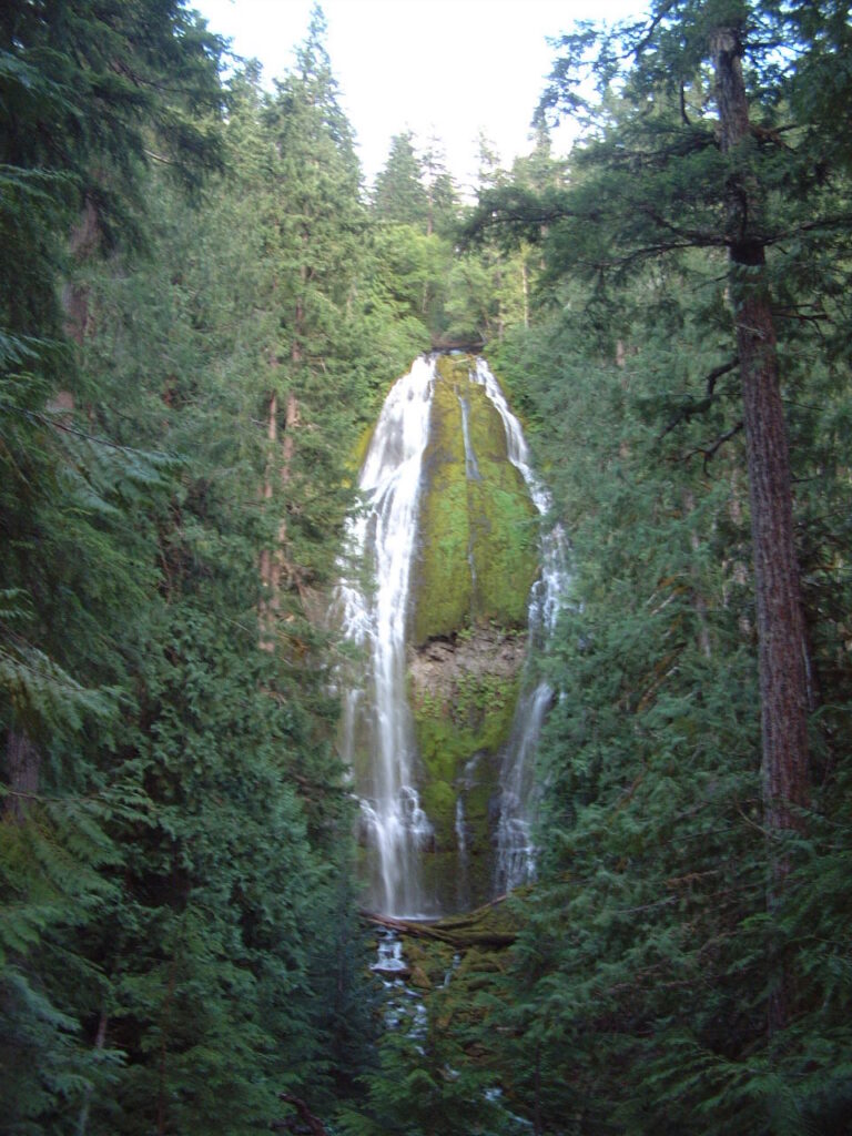
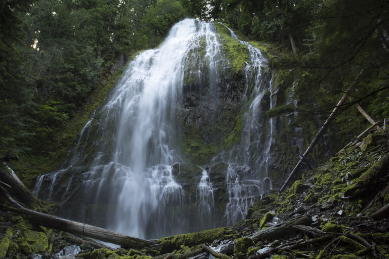

Proxy Falls is a 226-foot segmented horsetail waterfall on Proxy Creek in the Three Sisters Wilderness of Lane County, Oregon, where spring-fed water spills in two veils down a moss-covered basalt wall. An easy 1.6-mile loop from the McKenzie Pass Highway reaches it, and the World Waterfall Database calls it one of the most photographed waterfalls in Oregon.
The falls
Proxy Creek, fed by springs on the shoulder of North Sister, breaks over a cliff of columnar basalt and divides into two main streams, about 60 feet wide on average, in a single 226-foot drop. The falls sit at the end of a hanging valley carved by glaciers. The creek has no surface outlet below the plunge pool: the water sinks into porous ground.
Getting there
The Proxy Falls Trailhead is on OR 242, the McKenzie Pass Highway, east of its junction with OR 126 near McKenzie Bridge. Trail 3532 enters the Three Sisters Wilderness right away, crosses an old lava flow on rocky footing, then continues through conifer forest. The loop is about 1.6 miles with roughly 164 feet of gain; hiked clockwise, it reaches Upper Proxy Falls first and Proxy Falls after about two-thirds of a mile.
The Forest Service charges a $5 day-use fee per vehicle, or $30 for an annual pass; a valid recreation pass also covers it. A free self-issue wilderness permit is required from June 15 to October 15. There are restrooms and picnic tables across the road, but parking is limited to 15 to 20 spaces and cars fill the roadside pullouts. Vehicles over 35 feet are banned from OR 242, which has no cell service.
When to go
OR 242 closes to cars from November to mid-June; in 2026 it opened on June 15. Because the creek is spring-fed, the falls run all year, with the strongest flow in late spring and early summer. Vine maples along the trail turn color from late September to mid-October. In September 2024 the Linton Creek Fire closure briefly shut the trail; it reopened on October 1, 2024.
On site
A developed viewpoint looks at the falls from the trail. Scramble paths drop from it to the base, and the descent is steep and slippery; the final approach to the lower falls is hazardous for young children. Reaching the base also means crossing the creek. The trail isn't wheelchair accessible. Dogs are allowed on a leash.
Nearby
Upper Proxy Falls is about 0.2 mile away on the same loop; its water sinks into the lava and resurfaces in the springs of Lost Creek. Shadow Creek Falls is about 1 mile away, White Branch Falls about 1.7 miles and Linton Falls about 2.2 miles.
Distances are straight-line.