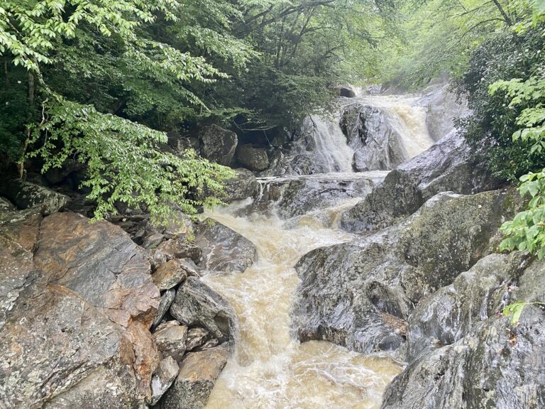
Sunburst Falls is a tiered waterfall on the West Fork Pigeon River in Haywood County, North Carolina, dropping about 55 feet in a chain of falls and cascades that passes directly beneath NC 215. A 1937 arched stone bridge spans the middle of the falls, and the upper section can be seen from the roadside without a hike.
The falls
Lidar measurements indicate a cumulative drop of about 55 feet. The largest single step is a 20-foot fall just upstream of the bridge; directly below the bridge the river funnels through a 15-foot sluice-like cascade, with pothole cascades making up the rest.
Getting there
The falls sit on a curve of NC 215 in Pisgah National Forest, about 4.2 to 4.3 miles north of the Blue Ridge Parkway junction at Beech Gap (Milepost 423), where the highway crosses the river on a high bridge. Sunburst Campground is nearby on the same route. A small gravel pullout on the left just past the bridge holds four or five cars, with more roadside spots on either side of the bridge or about 0.25 mile up or down the road. The walk to the viewpoint is 0.2 mile out and back, easy.
When to go
The fall months stand out, when the drive along NC 215 is at its most colorful.
On site
The upper falls are visible from the road and the bridge. The lower falls are reached by steep scramble paths across from the bridge that require rock hopping to reach the pool. The curve is sharp with limited sight distance; watch for motorcyclists on blind turns, park fully off the road and don't stand in the road. The rocks are very slippery in fog and rain; stay off them when wet. Swimming or wading is not advised.
History and name
The falls take their name from the nearby Sunburst community in Haywood County.
Nearby
Lower Sam Branch Falls and Wash Hollow Falls are each about 0.4 mile away, and Upper Sam Branch Falls is about 0.7 mile. Flat Laurel Creek Cascades lies about 0.9 mile away.
Distances are straight-line.