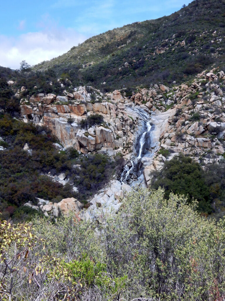
Tenaja Falls is a 130-foot waterfall on San Mateo Creek in Riverside County, California, dropping in five tiers inside the San Mateo Canyon Wilderness of the Cleveland National Forest. A short, easy trail reaches it from the Tenaja Truck Trail in the Santa Ana Mountains near Murrieta.
The falls
San Mateo Creek drops over water-polished bedrock in five tiers, the tallest about 50 feet. The World Waterfall Database gives the total as about 130 feet, based on lidar data. Earlier surveys listed 150 feet. The top tier is a near-vertical drop of more than fifteen feet into clear pools. San Mateo Creek is the southernmost stream in California supporting endangered southern steelhead.
Getting there
The Tenaja Falls trailhead is a turnout on the Tenaja Truck Trail, reached from the Clinton Keith Road exit of I-15 by way of Tenaja Road and a narrow forest road that passes the separate Tenaja Trailhead first. The hike is 1.5 miles round trip with 275 feet of elevation change, about 45 minutes, rated easy. Parking is free and no Adventure Pass is needed. Day hikers need no permit, and a self-registration station at the trailhead is optional; overnight trips in the wilderness require a wilderness permit. The trail is managed by the Trabuco Ranger District.
The current Airport Fire closure order, in force from May 27, 2026 to May 26, 2027, covers an area north of Highway 74 and does not list the Tenaja Falls Trail among its closed trails.
When to go
The falls roar in winter and spring and slow to a trickle in summer and fall; winter or spring is the recommended season, especially after rain. The wilderness sees few visitors except on this trail in spring.
On site
The trail crosses San Mateo Creek; avoid crossing at high flows. In March 1995 Riverside Mountain Rescue Unit went out for a group of Boy Scouts trapped by high water at the falls. The water-polished bedrock around the tiers is very slippery, so take care scrambling off the trail. Poison oak grows along the route. Dogs are allowed on a leash, and bikes are prohibited.
History and name
A tenaja is a natural basin in bedrock that holds water.
Nearby
Ortega Falls, on San Juan Creek, is about 5.2 miles away. Falls Canyon Falls is about 11.6 miles away and Holy Jim Falls about 11.7 miles.
Distances are straight-line.