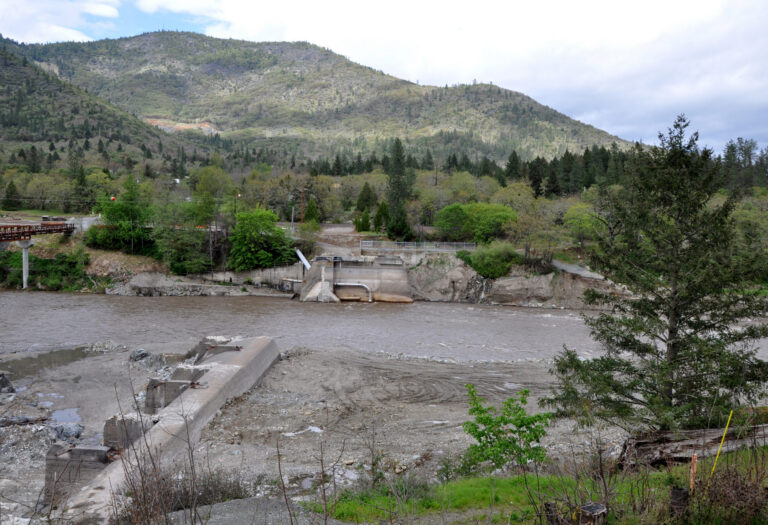
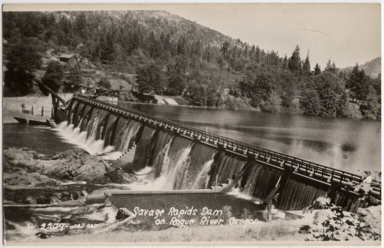
Savage Rapids is a rapid on the Rogue River in Jackson County, Oregon, between Gold Hill and Grants Pass, about 3.1 miles from the town of Rogue River. For almost ninety years the river here was held back by Savage Rapids Dam; since the dam came out in 2009, the Rogue again runs through its natural channel at the site.
The falls
The dam, 39 feet high and 500 feet long at river mile 107, is gone, and the rapid now runs through the restored channel. The former dam site sits at mile 12.83 of the Gold Hill to Grants Pass run, which is rated Class II. Savage Rapids is one of three main-stem dams removed from the Rogue, with Gold Hill and Gold Ray, leaving 157 miles of free-flowing river.
Getting there
Savage Rapids is run on the 18.4-mile float from the Gold Hill Boat Ramp to Baker Park in Grants Pass.
When to go
The runnable range for the reach is 1,000 to 3,000 cfs, read on the Rogue River at Grants Pass gauge (USGS 14361500).
On site
Bank access, scouting and portage details for the rapid aren't documented.
History and name
The name comes from the local Savage family. The irrigation dam was built in 1921 and blocked salmon and steelhead from about 500 miles of upstream spawning habitat. Removal was agreed in 2001 and authorized by Congress in 2004. On October 9, 2009, the Bureau of Reclamation closed the dam's radial gates and returned the river to its historic channel, a project estimated at $39.3 million. The removal cleared a major barrier to fish passage and to boating.
Nearby
Winterbottom Riffle is about 1.7 miles away, with Hardy Riffle about 11.7 miles and Whitehorse Riffle about 12.4 miles.
Distances are straight-line.