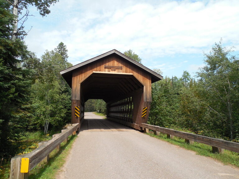
Smith Rapids is a rapid on the South Fork of the Flambeau River in Price County, Wisconsin, inside Chequamegon-Nicolet National Forest. A covered bridge crosses the river at the rapid, and a small campground overlooks it.
The falls
The South Fork runs 66 miles from its source at Round Lake to its meeting with the North Fork, and its first 25 miles lie in the national forest. The upper river is wide, often shallow and mostly slow and marshy, broken by minor rapids and boulder gardens, with numerous rapids of Class I-II on the South Fork. A grade for Smith Rapids itself isn't published.
Getting there
From Fifield, head east on State Highway 70 for a little more than 12 miles, then north on Forest Service Road 148 for 2 miles to the campground. The campground has a carry-down boat ramp. The bridge is reached on a 12-mile paddle from the Round Lake landing to Cedar Rapids at the Forest Road 149 bridge. Admission to the bridge and picnic area is free.
When to go
The South Fork is often too low for comfortable paddling, with an estimated nine canoeable days in July and again in August. Water levels are ideal in early June, and in low water the upper section means walking and dragging through shallow reaches.
On site
The campground has eight sites, tables, fire rings, vault toilets and drinking water. Off-road vehicles are not allowed in the campground. The site is pet-friendly with no garbage service. There is walleye and bass fishing on the river, with the 70-mile Flambeau Trail System nearby.
History and name
The bridge was built in 1991 in a glue-laminated Town lattice design, and Recreation.gov calls it the only covered bridge of that type in Wisconsin.
Nearby
Cedar Rapids is about 2.5 miles away, Little Cedar Rapids about 3 miles, Forest Rapids about 9 miles and Divine Rapids about 10.5 miles. Park Falls is the nearest town.
Distances are straight-line.