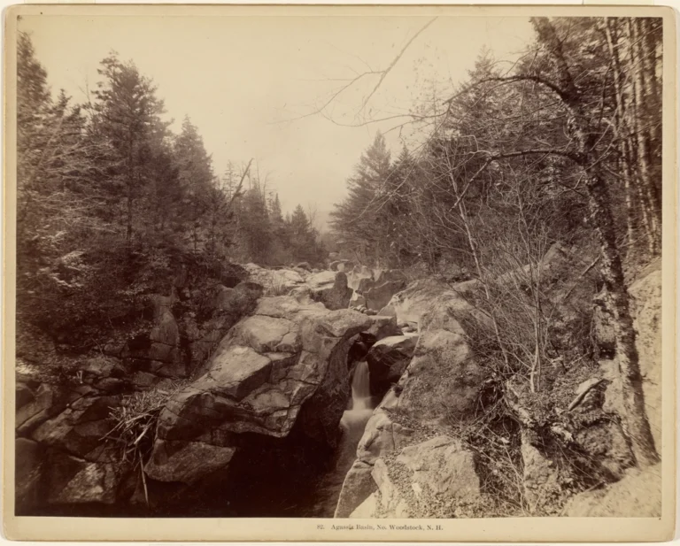
Agassiz Basin is a 20-foot punchbowl waterfall on Moosilauke Brook in Grafton County, New Hampshire, where the brook drops through a narrow granite gorge beside NH 112 just west of North Woodstock. The site is on private land, and as of 2026 it is listed as posted and closed to general public access. There is no wheelchair access.
The falls
Moosilauke Brook is the continuation of the Lost River below its meeting with Jackman Brook, and NH 112 follows it for its whole course to the Pemigewasset River in North Woodstock. At Agassiz Basin the brook passes through a granite gorge of deep, circular potholes and dark pools. Lidar data confirms the 20-foot height; the falls form segmented plunges, which an older guidebook splits into two drops of 12 and 7 feet. The curved gorge narrows to a gap about six feet wide known as Indian Leap.
Getting there
The basin lies behind a white building on NH 112, formerly Govoni's restaurant and later an antique shop, 1.7 miles west of the junction with US 3 near exit 32 of I-93. The land is privately owned and posted. Access needs the owner's permission. A footbridge described in older guidebook editions has been removed, but the falls can be seen in full from near the parking area.
When to go
May to October is the listed season.
On site
The rock around the pools is slippery, and reaching the base means a difficult scramble. Swimming was once prohibited here; a guidebook saw no signs in 2016 but warns that many people have died jumping from ledges at New England waterfalls.
History and name
The basin is named for Louis Agassiz, the Swiss-born scientist credited with the discovery of the Ice Age. Legend holds that Native Americans leapt the gap at Indian Leap as a test of courage.
Nearby
Indian Leap is the gorge at the basin itself. Bells Cascade is about 1.1 miles away, Russell Falls about 1.6 miles and Jackman Falls, on the brook that forms Moosilauke Brook, about 1.7 miles.
Distances are straight-line.