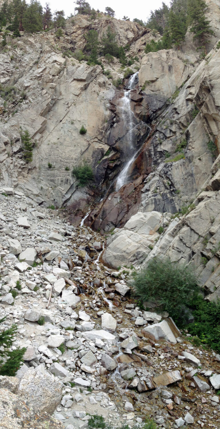
On the south side of Mount Princeton in Chaffee County, Colorado, Agnes Vaille Falls—also spelled Agnes Vail Falls—drops 180 feet as a tiered horsetail waterfall on a tributary of Chalk Creek. The path to its base has been closed since September 30, 2013, when a rockslide below the falls killed five members of one family and injured a sixth; visitors now view the falls from a short loop trail in San Isabel National Forest.
The falls
The World Waterfall Database, under the name Agnes Veil Falls, measured the drop from lidar at about 180 feet in three distinct steps, the largest about 95 feet. Earlier surveys showed 75 feet. The stream is fed mostly by snowmelt. The falls sit at about 9,267 feet and appear on the Mount Antero topographic map.
Getting there
From Nathrop, drive 8.7 miles west on Chalk Creek Drive (CO-162) to the Cascade Creek Trailhead, where parking holds about 12 vehicles. The Agnes Vaille Falls Loop Trail #1433 runs 1 mile with 200 feet of gain; another description measures the loop at about 1 mile with roughly 500 feet and rates it easy to moderate. The old spur up to the falls remains closed: the Forest Service's Salida Ranger District plans a reroute because of rockslide danger, and no reopening date has been posted.
When to go
Flow is strongest during snowmelt, making May and June the best months to visit. The small parking lot fills quickly on summer weekends.
On site
The loop gives views of the falls, Mount Princeton and the Chalk Cliffs, where hikers report mountain goats and bighorn sheep. Rockfall here is active: visitors must stay on the designated path, avoid climbing beyond the viewing platform, and not scramble onto the slide area. Dogs are allowed on a leash.
History and name
The falls honor Agnes Wolcott Vaille, a Colorado mountaineer who died in 1925 after a winter climb of Longs Peak; her friend Jo Witchey named them. The 2013 slide was likely triggered in part by that year's Colorado floods.
Nearby
Little Browns Falls is about 4.8 miles away, Browns Falls about 5.3 miles and North Fork South Arkansas Falls about 8.8 miles. The loop can be paired with the Narrow Gauge Trail #1432 for a 3.5-mile outing.
Distances are straight-line.