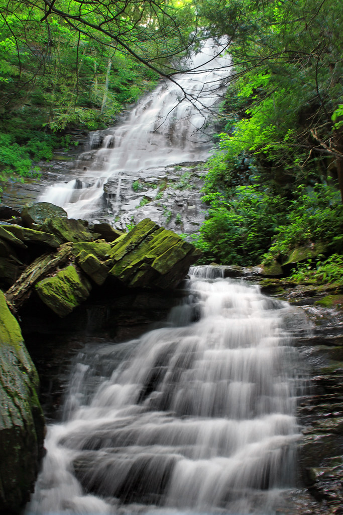
Angel Falls is a 75-foot horsetail waterfall on Falls Run in Loyalsock State Forest, Sullivan County, Pennsylvania. A spur off the Loyalsock Trail leads to its crest.
The falls
Falls Run pours over a single horsetail drop into the Falls Run gorge, one of the stream-cut ravines of the forested North Central Appalachian plateau. The World Waterfall Database puts the drop at about 75 feet from lidar data; earlier surveys listed 70 feet, while other accounts give 80 feet. From the crest there is a view down the Falls Run valley. Gipson Falls sits just below it on the same stream.
Getting there
Parking is at the Loyalsock Trail lot on Brunnerdale Road, a dirt forest road. Following a 2025 trail reroute, the hike runs about 1 mile each way: mostly flat along Ogdonia Creek, a wet crossing of Falls Run, then an uphill final stretch along the stream. Blue spur markers point to Gipson Falls and Angel Falls. An older route description measured 2.9 miles out and back with 771 feet of gain, rated moderate. The falls are located in Loyalsock State Forest and reached by a short hike.
When to go
The falls are at their best during the spring thaw or after a hard summer rain; the stream is very seasonal. Many state forest roads get no winter maintenance. Fitting the whole drop into one photo typically requires a wide-angle lens.
On site
The blue-blazed side trail reaches the top of the falls. A steep path on the right side, looking downstream, descends to the base, which gives the best angle for photos; the rocks there are slippery, so descend with care.
Nearby
Gipson Falls is just downstream on Falls Run, making it easy to see both on the same hike. Dry Run Falls and Dutters Run Falls are each about 2.5 miles away. Hughesville is the nearest town, about 10.8 miles away.
Distances are straight-line.