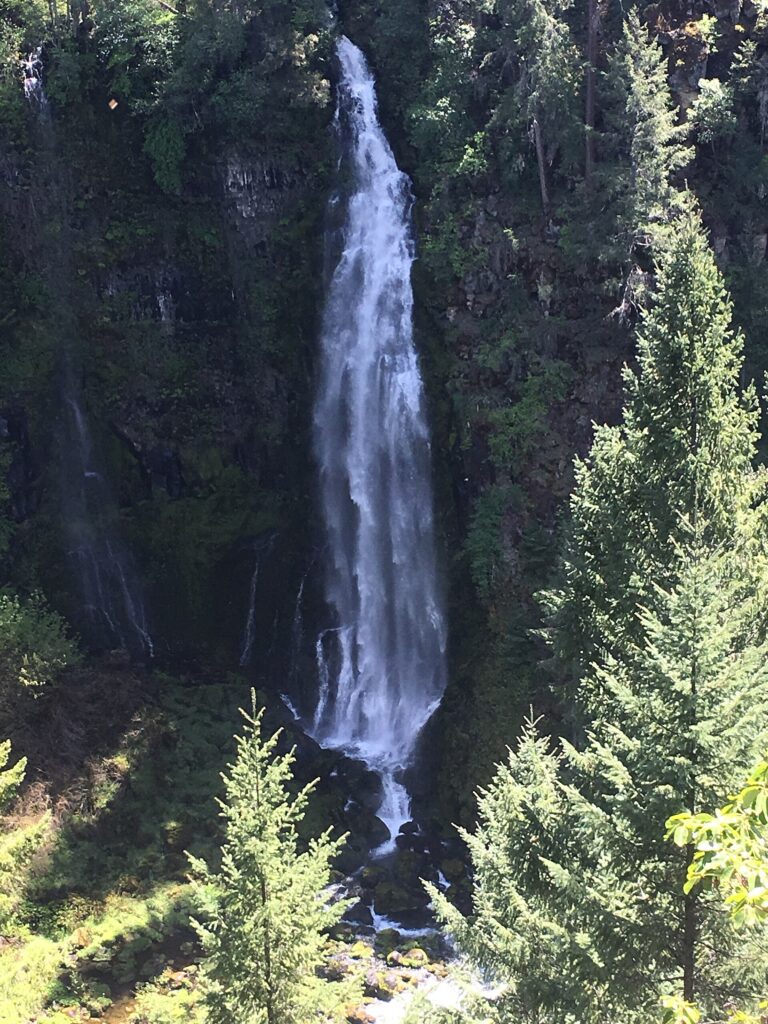

Barr Creek Falls is a 240-foot tiered waterfall in Jackson County, Oregon, where Barr Creek leaps off the rim of the Rogue River canyon just south of Prospect. It shares a cliff with neighboring Mill Creek Falls, and both are seen from overlooks on the same short trail through Prospect State Scenic Viewpoint.
The falls
Three tiers follow one another down the cliff. After crossing the southern end of the Prospect Airfield, the creek drops 60 feet in a fall mostly hidden by trees, then 30 feet in a tier that is half visible at high water, and finally 150 feet to the canyon floor. The average width is about 20 feet and the average flow about 50 cubic feet per second. According to Wikipedia, the cliff is petrified volcanic ash from the eruption of Mount Mazama.
Getting there
From Medford, take Highway 62 for 42.5 miles, turn right on Prospect Access Road for about a third of a mile, then right on Mill Creek Drive for about 1 mile to the trailhead on the right. Parking is free and no permit is needed. A picnic area and restrooms sit a little farther up Mill Creek Drive; there is no drinking water. The walk is easy at 1.4 miles round trip. Just past the trailhead, a junction splits the trail: right to the falls, left to the Avenue of the Boulders. The falls trail runs downhill to its end at the Barr Creek overlook, so the climb comes on the way back. Jackson County Parks manages the site.
When to go
Barr Creek carries little water, so the falls change a lot through the year: the Northwest Waterfall Survey describes a torrent in spring and a thin veil by late summer.
On site
The overlook is unguarded. The Outbound warns that the steep cliffs along the trail have caused fatal falls. Keep children and dogs well back from the rim.
History and name
The creek was named "Barr" for a barrier that kept cattle from straying off the Red Blanket Ranch; the falls have also been called Bear Creek Falls. The trail began as the Mill Creek Falls Scenic Area, a private hiking area built by Willamette Industries, before it became a public park.
Nearby
Mill Creek Falls is about 0.2 mile away, on the same trail. Prospect Falls on the Rogue River is 0.5 mile away, and Pearsoney Falls on Mill Creek 0.6 mile. The left fork at the trailhead leads to the Avenue of the Boulders, a riverbed of huge rocks exposed when a hydroelectric dam built in the 1920s drained the river channel.
Distances are straight-line.