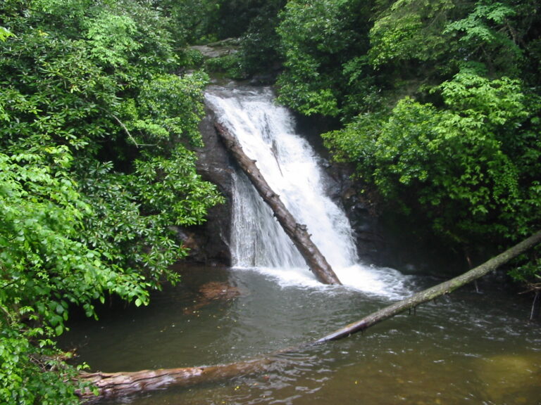
Blue Hole Falls is a 30-foot waterfall on High Shoals Creek in Towns County, Georgia, dropping in two steps into a deep pool known as the Blue Hole. It is the first of the two main falls on the High Shoals Trail in the Chattahoochee National Forest, about a mile below the trailhead and just upstream of High Shoals Falls.
The falls
Lidar data measures about 30 feet in two tiered plunges, with the lower, main drop accounting for about 20 feet. Other descriptions report a single 20-foot sheer drop or a 25-foot cascade, listing it as the second waterfall downstream on High Shoals Creek. The land is part of the Swallow Creek Wildlife Management Area.
Getting there
The trailhead is on Forest Service Road 283, Indian Grave Gap Road, which leaves GA 75 about 11.4 miles north of Helen. The gravel road runs 1.5 miles to the trailhead and fords a shallow creek about 100 yards from the highway, where four-wheel drive usually is not needed.
The High Shoals Trail descends about 1 mile to Blue Hole Falls, so the climb comes on the way back. High Shoals Falls is another 0.2 mile down the trail.
When to go
Seasonal flow for this fall is not documented.
On site
A small observation deck overlooks the falls and the pool, which measures more than ten feet deep. Visitors are asked to stay on the trail and the observation decks. Swimming at Blue Hole is sometimes posted as restricted and the water is cold; obey any signs at the trailhead and deck. Primitive campsites with fire rings sit along the trail.
Nearby
High Shoals Falls is at the end of the same trail, about 0.1 mile away. Rogers Branch Falls is about 0.9 mile away and Maple Spring Branch Falls about 1.3 miles. The nearest town, Young Harris, is about 10.5 miles away.
Distances are straight-line.