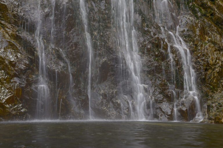
Bonita Falls is a 355-foot, four-tier waterfall in the San Bernardino National Forest, California, on an unnamed tributary that joins South Fork Lytle Creek in the eastern San Gabriel Mountains. A short scramble up a boulder wash from Lytle Creek Road reaches its lowest tier, and it ranks second in the forest only to Big Falls.
The falls
The stream drops through a narrow side canyon in a series of horsetails. Lidar analysis finds about 355 feet in four steps of roughly 15, 145, 55 and 135 feet; earlier inventories listed 370 feet, and other sources give 400 feet, or up to 495 counting two drops in the canyon above. Most visitors see only the lowest drop, which lands in a shallow pool. The falls usually flow all year.
Getting there
From Interstate 15, take the Sierra Avenue exit and follow Lytle Creek Road about 5 miles into the canyon. The Forest Service has built a Bonita Falls day-use site with a paved lot, three vault toilets, an information kiosk and an accessible paved path to the creek; the area was closed for that construction through May 2024. Parking in the national forest requires an Adventure Pass, $5 a day or $30 a year, sold at the Lytle Creek ranger station.
There is no marked trail. The route crosses Lytle Creek, heads up the rocky wash of South Fork Lytle Creek for about half a mile, then follows a side path about a quarter mile to the base; the round trip is about 1.5 miles with 374 feet of gain, most of it in the final climb into the canyon.
When to go
Flow is strongest in spring. A June 2025 visitor found enough water to wade in the pool and hot conditions in the wash. The hike is popular, and parking fills quickly on summer weekends.
On site
The canyon is heavily marked with graffiti, and trash collects at the falls. The pool is only a foot or two deep. Hikers report poison oak along the side canyon. Leashed dogs are allowed.
Rockfall is the main hazard. In June 2026 a 52-year-old hiker from Redlands was killed near the falls; the sheriff's department said a boulder fell and struck her, while a witness said a branch she grabbed broke and she fell onto a rock. Rescuers had to hike in, and radio coverage is limited. A rockfall alert issued in July 2026 runs through December 31, 2026: stay out from under the cliffs and away from unstable slopes. Climbing to the upper tiers has led to repeated rescues; stay at the base.
History and name
Bonita is Spanish for "beautiful." The falls lie in the Front Country Ranger District.
Nearby
An unnamed waterfall is about 0.3 mile away, Etiwanda Falls about 3.2 miles, Lytle Creek Falls on Lytle Creek about 4.2 miles and Middleman Falls about 5 miles. Rancho Cucamonga lies about 9.9 miles to the southwest.
Distances are straight-line.