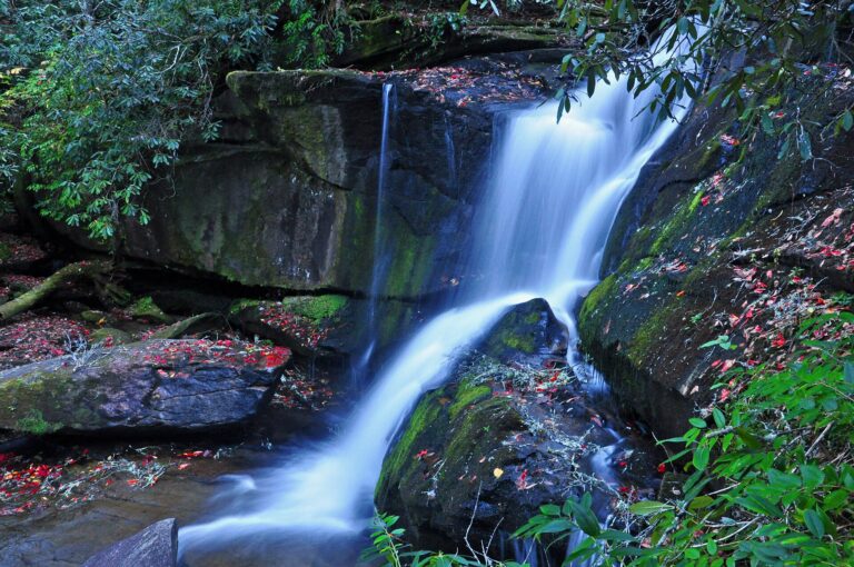
Cedar Rock Falls is a 20-foot waterfall on Cedar Rock Creek in Pisgah National Forest, Transylvania County, North Carolina. It sits a short hike from the Pisgah Center for Wildlife Education and its fish hatchery, and is counted among the area's favorite small falls.
The falls
Cedar Rock Creek forms at Picklesimer Fields, where Cedar Rock and Grogan creeks meet, and a short way downstream it drops over a mossy cliff beside a rock wall. A lidar estimate puts the single drop at about 20 feet; other measurements put it a little under that. Mist from the falls keeps a spray-cliff plant community alive on the rock, framed by hemlock and rosebay rhododendron.
Getting there
From the junction of US 276, US 64 and NC 280 in Brevard, drive 5.2 miles north on US 276, then 1.5 miles west on Forest Road 475 to the hatchery parking area. The Cat Gap Loop starts there, shared with mountain bikes at first, and the falls are just under a mile away one way, easy to moderate. The side trail to the falls is unsigned and branches off in a V from the main path. The Pisgah Conservancy's trail crew rebuilt a bridge on the loop after Tropical Storm Fred and replaced a nearby footlog in 2026; the crossings are 0.2 and 0.4 mile from the lot. NC Wildlife began rebuilding the hatchery in 2026, with full production expected in late 2028.
When to go
Seasonal flow isn't documented. The creek crossing can be difficult at high water.
On site
The last stretch to the base is an eroded scramble over roots, and the rocks are slippery when wet.
History and name
The falls are also known as Cedar Rock Creek Falls and Falls on Cedar Rock Creek.
Nearby
Grogan Creek Falls is about 0.8 mile away, Slick Rock Falls about 1 mile, and Long Branch Falls and Caney Bottom Creek Falls about 1.4 miles. Long Branch Falls can be linked to Cedar Rock Falls on foot via the Long Branch, Butter Gap and Pickelsimer Connector trails.
Distances are straight-line.