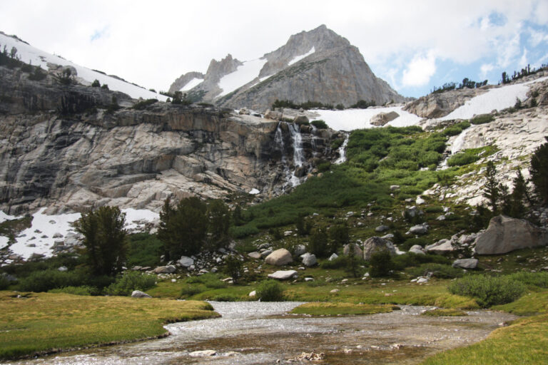
Conness Lakes Falls is a horsetail waterfall with a lidar-estimated drop of about 100 feet, on Lee Vining Creek below Mount Conness and North Peak in Mono County, California, in the Hoover Wilderness portion of Inyo National Forest.
The falls
The 100-foot figure is unconfirmed, and no tallest-drop or drop-count figure has been published. The falls drains the lower Conness Lakes at roughly 10,485 feet elevation.
Getting there
The trailhead is Saddlebag Lake, reached by 2.4 miles of partly paved, rough road that does not require high clearance. From there, a hiking report places side views of the falls about two miles in and a base approach from the northeast at about 2.25 miles; the full loop described, which continues past the falls among the lakes over exposed granite and boulder hopping, is 7.9 miles with 1,450 feet of gain and loss. Day use needs no wilderness permit; an overnight permit for the Hoover Wilderness costs $8 per person age 13 and older plus a $6 reservation fee. No closure specific to the falls was found, but a Forest Service order in effect through June 10, 2027 bans wood and charcoal fires throughout the surrounding Twenty Lakes Basin; qualifying portable stoves are still allowed.
When to go
The recommended season is mid-June to mid-October, and creek crossings are harder during snowmelt.
On site
The falls can be seen from the trail on the side of the creek, with a route to the base from the northeast; continuing among the lakes requires route-finding and off-trail Class 2 scrambling. Dogs should be kept under control to protect white-tailed ptarmigan, and motorized or mechanized travel and recreational drones are prohibited in the wilderness.
Nearby
Upper Lundy Canyon Falls is about 1.7 miles away, Lundy Canyon Falls and West Lundy Canyon Falls about 1.9 miles, and Middle Lundy Canyon Falls about 2.2 miles, all on Mill Creek.
Distances are straight-line.