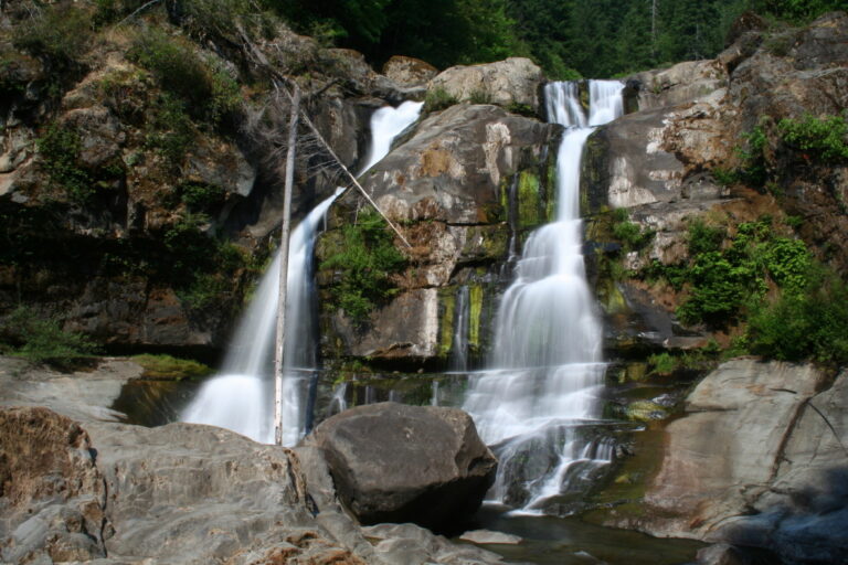
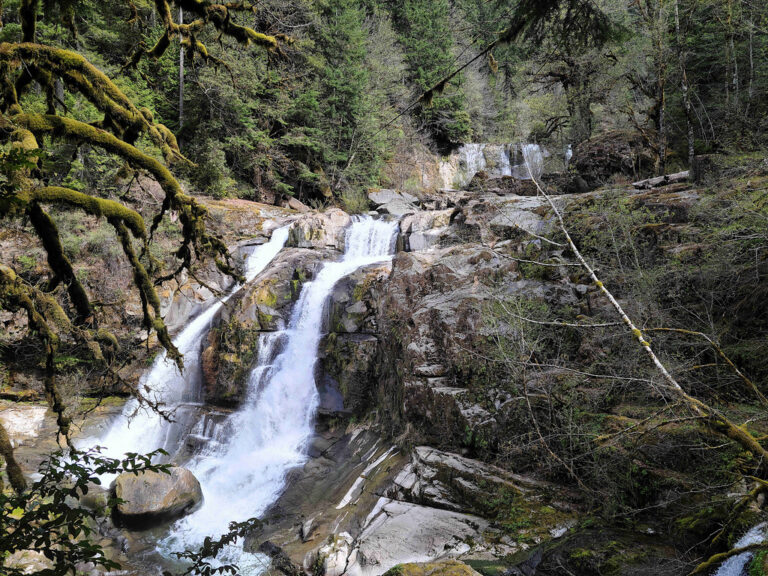
Coquille River Falls is a 115-foot, two-tiered waterfall on the South Fork Coquille River in Coos County, Oregon, in the Rogue River-Siskiyou National Forest. It sits in a forested gorge inside the Coquille River Falls Research Natural Area, set aside to protect old-growth Port Orford cedar, and a short, steep trail leads down to it.
The falls
The descent features two horsetail tiers: an upper drop of about 35 to 40 feet across a cliff some 150 feet wide, roughly 20 feet of boulder-choked cascades, and a 65-foot lower tier split by rock notches into parallel falls; other accounts place the upper tier at 50 feet. The falls form where Sru Creek and Drowned Out Creek join the river. Flow reaches approximately 330 cubic feet per second in wet months and 20 in dry periods, with the upper tier spreading much wider in winter. The bedrock is sedimentary Tyee formation from the Eocene.
Getting there
Access runs east from the coast on Highway 42 through Myrtle Point, then south on the Powers Highway for 38 miles, turning right onto Forest Road 3348 toward Eden Valley for about 1.5 miles to the trailhead just past the Sru Creek bridge. The trail involves a half-mile descent that is steep and wet, covering 1.1 miles round trip with 450 feet of elevation gain. Guides from April 2025 note that no permit is needed and there is no toilet.
When to go
November to June offers the most reliable flow. The falls are strongest in winter, when high water also makes crossing to the upper tier more difficult.
On site
The lower tier is best seen from the end of the trail. Reaching the upper tier means crossing Drowned Out Creek and scrambling up a cliff, which is hazardous in winter. The surrounding old-growth forest mixes Port Orford cedar and Douglas fir with western hemlock, grand fir, sugar pine and Pacific yew.
History and name
Coquille likely comes from "Scoquel," a Chinook Jargon word for the lamprey found in local rivers; fur traders applied the name to the river and its people in the mid-1800s. The research natural area was established in 1945.
Nearby
Drowned Out Creek Falls is on the side creek at the same spot, Lower Sru Creek Falls about 0.3 mile away, Upper Sru Creek Falls about 0.4 mile and Upper Coquille River Falls about 0.6 mile.
Distances are straight-line.