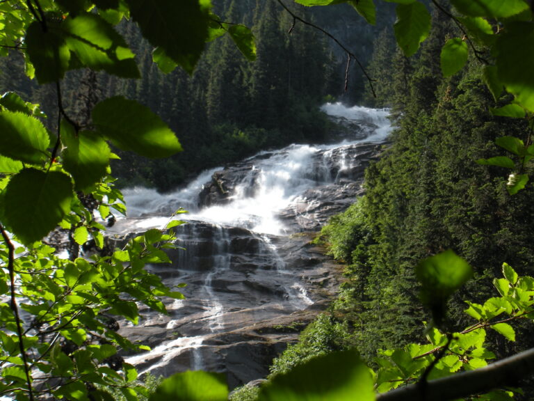
Depot Creek Falls is a 948-foot sliding waterfall on Depot Creek in the far north of North Cascades National Park, Whatcom County, Washington, a few miles south of the Canadian border. Meltwater from Mount Redoubt's glaciers pours out of Depot Valley and down a broad cliff, scored among the best waterfalls in the state, yet very few people ever see it.
The falls
The creek plunges about 248 feet into a narrow, shaded slot, turns sharply and then slides some 626 feet down steep bedrock, throwing up rooster tails, before a final 72-foot plunge — a total of 948 feet in a single drop, averaging 125 feet wide. Because of its angle and length, no single spot on the ground shows the whole fall. Glacier melt keeps it running strongly from May through September.
Getting there
No trail reaches Depot Creek Falls from the US side, and the Northwest Waterfall Survey no longer publishes directions because there is no sanctioned route. Climbers heading for Mount Redoubt approach from Canada: Chilliwack Lake Road and rough logging roads lead to the Depot Creek spur, then a short bushwhack reaches the border at Monument 65, where there is a park registration box. From there a climbers' path runs about 3 miles up the valley to the base of the falls; one 2018 party took nearly five hours and 1,600 feet of climbing from the car. Anyone considering this route needs to check current US and Canadian border-crossing rules first. Overnight stays in the park require a North Cascades backcountry permit.
When to go
July and August are the usual months, once snow has melted off the approach. Early-season snowmelt makes the rock near the falls even more slippery.
On site
The route is a faint path through a long boulder field and slide alder, with fixed handlines on wet Class 3 rock at the base of the falls. Spray soaks everything nearby, so rain gear is useful even on a clear day. There is no cell coverage.
History and name
The waterfall has no official name; it takes its name from Depot Creek, which is thought to be named for an old trading post or a supply depot of the 1858–1861 boundary survey. The creek has also been called Brown Creek and Kokanee Creek.
Nearby
Depot Valley Falls is about 0.2 mile away, Lake Fork Falls about 0.7 mile and Silver Lake Falls about 2.9 miles.
Distances are straight-line.