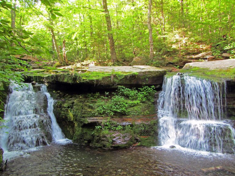
Diamond Notch Falls is a 12-foot cascade on the West Kill in the Hunter-West Kill Wilderness of the Catskills, Greene County, New York. It sits 1 mile up the Diamond Notch Trail from the end of Spruceton Road, on a trail that follows an old town road up the valley.
The falls
The West Kill spills over a ledge in two side-by-side streams into an amphitheater-like setting with a small meadow nearby. Lidar measurements place the drop at no more than 12 feet in a single steep cascade, compared to earlier listings of 14 feet and hiking records of about 25 feet. Alternate names for the feature include Westkill Falls and Buttermilk Falls.
Getting there
The trailhead begins at the parking area at the end of Spruceton Road (County Route 6), by a gate. Driving directions run west on State Route 23A to Lexington, left on State Route 42, then left onto Spruceton Road. From the parking area the blue-marked Diamond Notch Trail follows the headwaters of the West Kill and rises gently, totaling 2 miles round trip with about 300 feet of climb. The land is managed by the New York State Department of Environmental Conservation.
When to go
Seasonal flow and winter conditions at the falls are not formally documented.
On site
The Devil's Path crosses the Diamond Notch Trail near the falls. About half a mile south of the falls is the Diamond Notch lean-to, with a privy and fire pit. Past the lean-to, the trail climbs to the Diamond Notch wind gap, 2.2 miles from Spruceton Road, and continues down to Diamond Notch Road north of Lanesville.
History and name
The Diamond Notch Trail was once a town road; it was converted to a trail in the 1930s.
Nearby
Becker Hollow Falls is about 2.8 miles away, Stony Notch Falls about 3.3 miles, and Roaring Kill Falls about 6.7 miles. Woodstock is the nearest town, about 11.8 miles away.
Distances are straight-line.