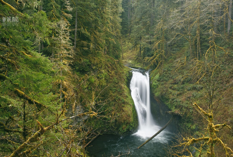
On Butte Creek in the Santiam State Forest, Clackamas County, Oregon, Lower Butte Creek Falls drops about 25 feet just below the main Butte Creek Falls.
The falls
The water comes down in segmented plunges immediately downstream of the larger falls above. A lidar-era survey lists the drop at 25 feet, though an older Oregon Department of Forestry guide gives a different figure, 70 feet, for what it labels Lower Butte Falls — possibly a different measurement of the same drop or a mislabeled feature. The lower falls is harder to see than the main plunge, and a side path to it clings to a cliff.
Getting there
An Oregon Department of Forestry trail of about 0.85 miles, with 300 feet of gain and loss, serves both Butte Creek Falls and the lower falls; it is rated moderate. The Oregon Department of Forestry currently reports that some trails in the area remain closed after fire and windstorm damage, though it does not say whether this affects the route to the lower falls, so conditions should be checked before visiting.
When to go
The trail has traditionally been used from May through October.
Nearby
Butte Creek Falls sits immediately upstream, Upper Butte Creek Falls is about 0.1 mile away, and Abiqua Falls is about 2.7 miles away.
Distances are straight-line.