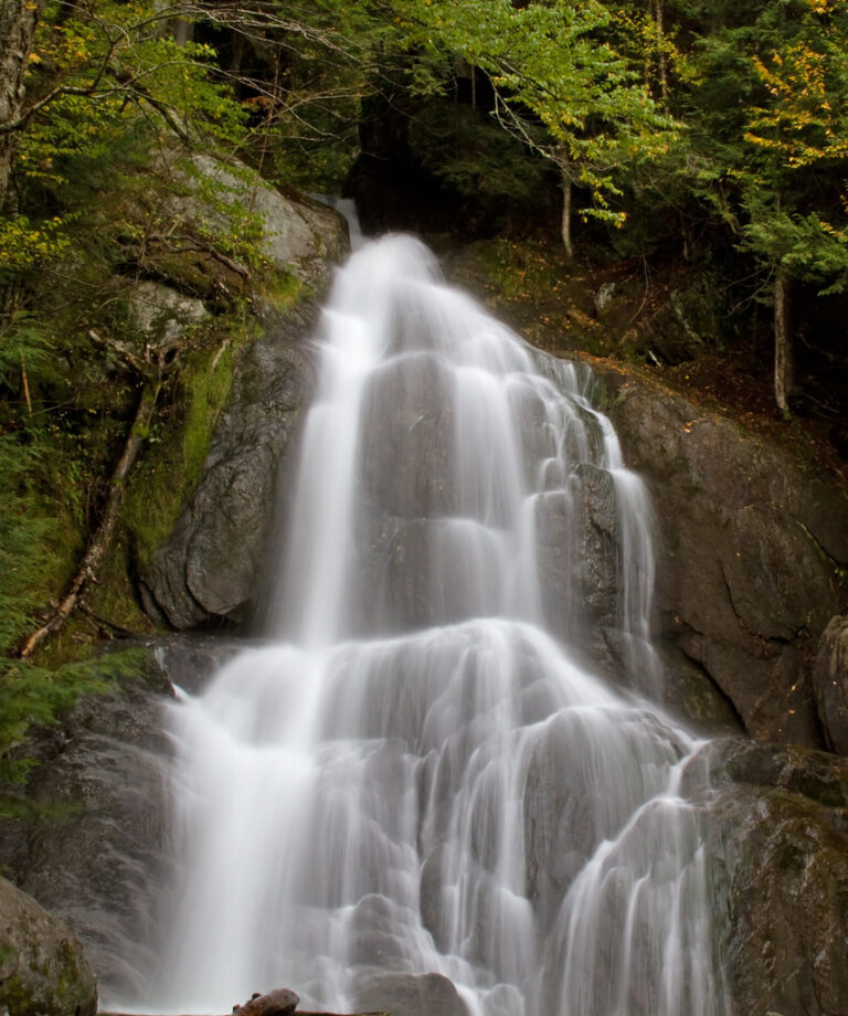
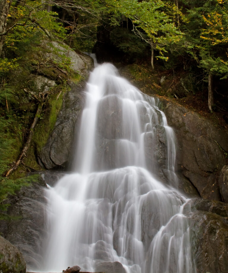
Moss Glen Falls is a 112-foot tiered waterfall on Moss Glen Brook in Lamoille County, Vermont, inside the Moss Glen Falls Natural Area of C.C. Putnam State Forest north of Stowe village. A short, easy path leads from a small roadside lot to the gorge, where the brook drops through a hemlock forest in a chain of horsetails and pools.
The falls
Moss Glen Brook leaves a grassy meadow and speeds up abruptly as it enters a narrow gorge. The World Waterfall Database, which surveyed the falls in person, gives a total of 112 feet in four drops of tiered horsetails, the tallest a 60-foot free-falling sheet. The state describes a total drop of over 100 feet and calls it one of the highest waterfalls in Vermont; another estimate gives 85 feet. The stream runs all year, though flow is much stronger for about five months than in the low-water season. The protected natural area covers 80 acres around the falls.
Getting there
From Stowe village, the route runs 3 miles north on Route 100, right onto Randolph Road, then right onto Moss Glen Falls Road for about half a mile to a small parking area on the left. The path follows the brook upstream about a quarter mile to the falls; the round trip is 0.6 mile with 150 feet of gain, about 20 minutes. At the last fork, the left branch climbs steeply over roots to the upper overlook, and the right branch stays by the water toward the base. Signage is limited, but the path is easy to follow. An old woods road continues past the falls for about 1.5 miles, over a wooden bridge, before climbing to a VAST snowmobile trail; the full route runs up to 4.2 miles.
When to go
May to October is the recommended season.
On site
The upper overlook gives the best view of the top half of the falls. Seeing the lower tiers, a wide fan and two short cascades, means wading upstream into the gorge. Vermont Forests, Parks and Recreation warns that the steep, slippery rocks are hazardous and should not be climbed; loose debris at the trail edge is also slippery, and inexperienced hikers should keep to the left branch above the falls. The trail is not wheelchair accessible. The walk is a short outing suitable for visitors with dogs.
History and name
The brook once powered a hydroelectric facility. Square holes cut into the rock wall and chiseled steps are still visible.
Nearby
Sterling Brook Cascade is about 2.8 miles away, Hancock Brook Falls about 4.6 miles and Reeds Falls about 5.5 miles. Stowe village is about 3.2 miles to the southwest.
Distances are straight-line.