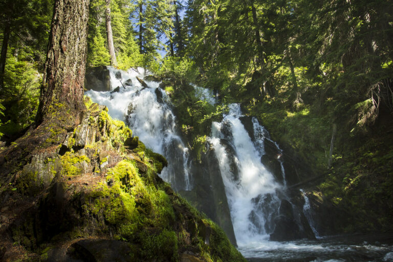
National Creek Falls is a 40-foot waterfall on spring-fed National Creek in Douglas County, Oregon, in Rogue River–Siskiyou National Forest west of Crater Lake National Park. A short, easy trail drops to the base, where the creek splits in two around a basalt outcrop.
The falls
A single 40-foot plunge drops over a jagged ledge, divided by basalt into two channels about 30 feet wide in all. Below is a mossy grotto and small meadow where Falls Creek joins National Creek. The water comes from springs on the pumice flanks of Mount Mazama.
Getting there
From OR 230, about 6 miles north of its junction with OR 62, turn onto paved Forest Road 6530, cross the Rogue River and stay left on 6530 for 3 miles. Turn right on unpaved Forest Road 6530-300, which has some large potholes, and follow it to a signed lot for 8–10 vehicles. National Creek Falls Trail #1053 descends to the falls: 0.8 mile round trip with 210 feet of gain, rated easy.
When to go
Because the creek is spring-fed, the falls run all year, even in drought. Forest Road 6530 may be blocked by snow from November to April, so the usual season is spring through fall.
On site
The trail descends through mixed conifer forest to the base of the falls and the grotto below the two channels. There is no drinking water, toilets or garbage service, so carry water and pack out trash.
History and name
The falls take their name from the creek. They sit beside an old wagon route between the Rogue Valley and the John Day goldfields; after fire destroyed it in the 1860s, the Forest Service reopened the route in 1910 as what is now Diamond Lake Road.
Nearby
Highway Falls on the Rogue River is about 1.1 miles away, Alkali Falls about 2.8 miles, Muir Creek Falls about 3 miles and Rough Rider Falls about 4.7 miles.
Distances are straight-line.