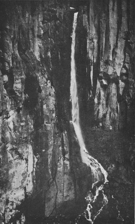
Dropping from a basalt precipice on the southwest flank of Mount Rainier, Pearl Falls plunges 310 feet along glacier-fed Pearl Creek in Pierce County, Washington. Most visitors view the falls from a distance across the valley at Ricksecker Point along the Paradise road.
The falls
Glacier-fed Pearl Creek, measuring about 10 feet wide, leaves the lip of a basalt cliff just east of Pyramid Park and drops in a single 310-foot plunge into a wide, amphitheater-like basin. The cliff consists of columnar basalt formed by volcanic activity on Mount Rainier. Below the cataract, Pearl Creek joins Pyramid Creek, then Kautz Creek and the Nisqually River.
Getting there
Reaching the falls on foot is possible but difficult, typically requiring at least two days through rugged backcountry, and no maintained trail to the base is documented. Overnight backcountry travel requires a park wilderness permit, costing $12 per person per night (free for children 15 and under) plus a $6 fee per trip.
The customary vantage point is Ricksecker Point, reached via a one-third-mile one-way scenic loop with two pullouts, located 6.5 miles from Longmire and 5 miles from Paradise. Park admission is $30 per private vehicle for seven days. No timed-entry reservation is required in 2026.
When to go
Water volume peaks from May to August during warm-weather snow and ice melt. The Ricksecker Point drive typically closes from early November to mid-May because of winter snow.
On site
Pets are prohibited on park trails and throughout the wilderness; in roadside developed areas they must remain on a leash no longer than six feet.
History and name
Tacoma photographer Albert Henry Barnes named the falls in 1912, observing that the airborne spray resembles pearls in direct sunlight.
Nearby
Middle Pearl Falls is about 0.1 mile away and Lower Pearl Falls about 0.3 mile, both on Pearl Creek. Tomlinson Falls is about 0.4 mile away.
Distances are straight-line.