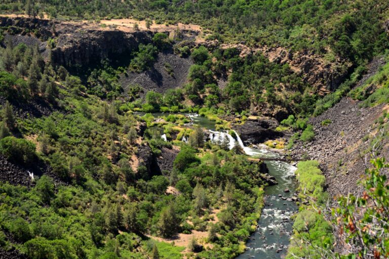
Pit River Falls is a 35-foot waterfall on the Pit River in Shasta County, California, where the river drops across the full width of its canyon about two and a half miles below Fall River Mills. A scenic vista point on State Route 299 looks down on it, and paddlers run the canyon above and below it during PG&E's October whitewater releases.
The falls
A single 35-foot drop in the form of segmented plunges spans the full width of the canyon. Earlier surveys listed 40 feet; environmental reports describe the falls as 35 to 40 feet high. The falls lie in the bypass reach of PG&E's Pit 1 hydroelectric project, where water is diverted to the Pit 1 Powerhouse, about 2.1 miles downstream, so the flow is regulated. In summer the river runs at roughly 250 to 300 cubic feet per second.
Getting there
The overlook is on Highway 299 west of Fall River Mills, about 0.4 mile from the falls. A wheelchair traveler reported that the parking lot is large enough for any RV and that the overlook is accessible. Closer access means following an old roadbed from Fall River Mills to an old bridge site below the falls, described as a bushwhack. No maintained trail to the base is documented.
When to go
Natural high flows typically come in spring; most years bring runoff events of more than 3,000 cubic feet per second lasting several days. Through the summer the flow stays fairly constant. The bypass reach carries enough water for boating only during October whitewater releases or natural high water.
On site
The view from the overlook is limited: the river runs deep in the canyon, and the same panorama takes in an old bridge, the remains of a 1920s road, and the Pit 1 Powerhouse with its large supply pipes. For paddlers the falls are a Class V drop at flows of 1,050 to 3,500 cubic feet per second; the portage bypasses about 750 feet of channel with a 30-foot climb to an abandoned toll road and a carry of about 700 feet. Most boaters take out at the Bureau of Land Management's Pit River Campground.
History and name
The falls blocked migrating salmon and were a spearing site for the Achumawi. In 1881 settlers began work, with a $2,300 appropriation, to lower the falls so salmon could pass. The Winter brothers later owned a bridge just below the falls and a toll road to Hat Creek. The canyon lies in the traditional lands of the Ajumawi band of the Pit River Tribe above the falls and the Ilmawi band below, and is considered a place of spiritual power.
Nearby
Young Falls is about 9 miles away, Burney Falls about 9.5 miles and Rock Creek Falls about 12.8 miles.
Distances are straight-line.