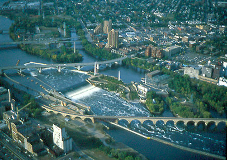
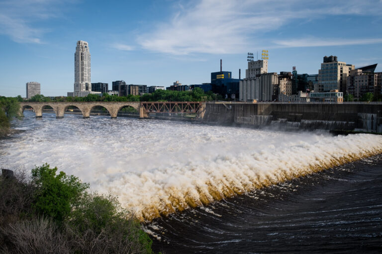
Saint Anthony Falls marks the historic cataract of the Mississippi River in downtown Minneapolis, Minnesota. What visitors see today is a dam and a concrete apron that hold the old falls in place, with the Stone Arch Bridge and riverfront parks serving as the main viewpoints.
The falls
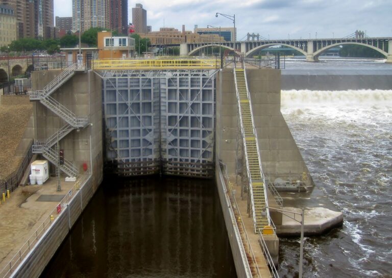
The natural falls poured over a cap of hard Platteville limestone resting on soft St. Peter sandstone. As the river undercut the sandstone, the limestone broke off and the falls crept upstream from near Fort Snelling over about 12,000 years, sitting roughly 1,500 feet downstream of the present site in 1680. Geological records measure the natural retreat at about 4 feet a year, speeding to 26 feet a year between 1857 and 1868 as milling cut into the ledge. The Upper St. Anthony Falls Lock and Dam and a concrete apron now fix the drop in place, raising the river about 35 feet where modern infrastructure replaces the natural falls.
Getting there
The falls sit on the edge of downtown, and the usual viewpoint is the Stone Arch Bridge, which the Minneapolis Park & Recreation Board fully reopened on July 21, 2025 after repairs. Mill Ruins Park has paid parking, and its developed areas are open from 6 a.m. to midnight. Guided riverfront walks depart from the bandstand in Father Hennepin Bluff Park, near SE Main Street and 6th Avenue SE; the route runs up to 1.25 miles, takes about an hour and crosses the bridge.
When to go
Guided falls walks have run through the winter, from January 30 to April 17, 2026, and again in summer, so the riverfront is visited year-round.
On site
The riverfront paths used for the walking tours are level, paved and fully accessible, with limited shade. The Upper lock no longer operates for boats, requiring paddlers to portage 1.54 miles from Flag Poll Plaza above the Hennepin Avenue bridge to Bohemian Flats. The dams here are hazardous and have caused deaths; water entry is prohibited near the apron.
History and name
The Dakota name, Owámniyomni, means turbulent waters, whirlpool or eddy. Father Louis Hennepin, the first European to see the falls, named them in 1680 after Saint Anthony of Padua. Jonathan Carver estimated the drop at about 29 feet in 1766. On October 5, 1869, the collapse of the Eastman tunnel under Hennepin Island nearly destroyed the falls, and the Army Corps of Engineers finished an 1,850-foot concrete wall in 1876 to stop the erosion. From 1880 to 1930 the mills powered by the falls made Minneapolis the flour-milling capital of the world; the Pillsbury A-Mill of 1881 also ran the first hydroelectric plant here.
Nearby
Minnehaha Falls is about 5.1 miles away. Across the state line in Wisconsin are Willow Falls, about 28.5 miles away, and Apple River Falls, about 29.2 miles away.
Distances are straight-line.