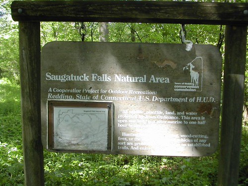
Saugatuck Falls is a 10-foot cascade waterfall on the Saugatuck River in Redding, Connecticut, inside the town's Saugatuck Falls Natural Area, about 3.8 miles north of Georgetown. It is a modest, walk-in pair of cascades, reached on a woodland trail from Route 53.
The falls
The drop consists of two gradual cascades of roughly 3 to 5 feet each, separated by a pool, for a total of about 10 feet. Coming along the river, walkers pass a large pool and a 1-foot riffle before the main falls come into view around a sharp bend in the river.
Getting there
The natural area's entrance is on Route 53 opposite John Read Middle School, and visitors park at the school. The Falls Trail runs for about 0.8 mile each way, with the waterfall just east of the trail. The walk takes about 30 minutes, rated moderate, with 50 feet of climbing and 30 feet of descent over roots and rocks.
When to go
April through November is the recommended season. Woodland flowers bloom in May and mountain laurel in June. The natural area is part of Redding's controlled bow hunt from September 15, 2026, through January 31, 2027.
On site
Swimming at Falls Hole is prohibited because the Saugatuck River supplies drinking water. Dogs are allowed, and there is no wheelchair access.
History and name
The Town of Redding acquired the natural area in March 1968; at 318 acres it is the largest open space in the town's deer management program.
Nearby
Ambler Cascade is about 4.2 miles away and Sheep Falls about 5 miles. Also on the Saugatuck River, Valley Forge Falls is about 5.4 miles away and Devils Glen about 5.6 miles. Danbury lies about 6.4 miles to the north.
Distances are straight-line.